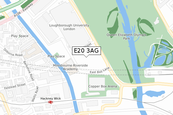
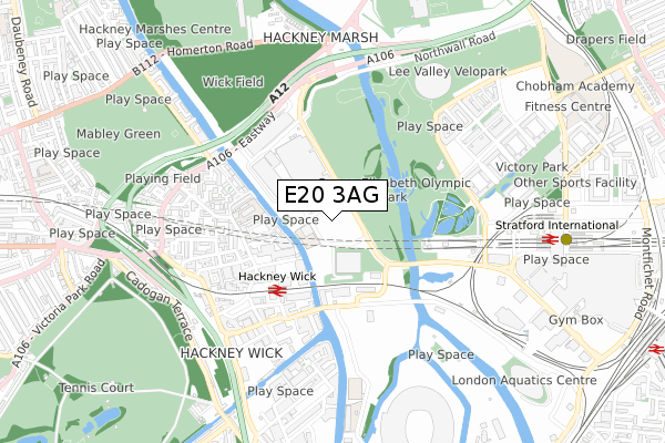
E20 3AG is located in the Hackney Wick electoral ward, within the London borough of Hackney and the English Parliamentary constituency of Hackney South and Shoreditch. The Sub Integrated Care Board (ICB) Location is NHS North East London ICB - A3A8R and the police force is Metropolitan Police. This postcode has been in use since January 2020.


GetTheData
Source: OS Open Zoomstack (Ordnance Survey)
Licence: Open Government Licence (requires attribution)
Attribution: Contains OS data © Crown copyright and database right 2024
Source: Open Postcode Geo
Licence: Open Government Licence (requires attribution)
Attribution: Contains OS data © Crown copyright and database right 2024; Contains Royal Mail data © Royal Mail copyright and database right 2024; Source: Office for National Statistics licensed under the Open Government Licence v.3.0
| Easting | 537339 |
| Northing | 184887 |
| Latitude | 51.546173 |
| Longitude | -0.020749 |
GetTheData
Source: Open Postcode Geo
Licence: Open Government Licence
| Country | England |
| Postcode District | E20 |
➜ Where is Hackney? | |
GetTheData
Source: Land Registry Price Paid Data
Licence: Open Government Licence
| Ward | Hackney Wick |
| Constituency | Hackney South And Shoreditch |
GetTheData
Source: ONS Postcode Database
Licence: Open Government Licence
| The Copper Box | Hackney Wick | 99m |
| The Copper Box | Hackney Wick | 100m |
| Hereeast | Hackney Wick | 317m |
| Hereeast | Hackney Wick | 352m |
| Berkshire Road | Hackney Wick | 356m |
| Stratford International Dlr Station | Stratford | 779m |
| Stratford Underground Station | Stratford | 1,296m |
| Stratford Dlr Station (Station Street) | Stratford | 1,309m |
| Pudding Mill Lane Dlr Station (Pudding Mill Lane) | Pudding Mill Lane | 1,433m |
| Leyton Underground Station | Leyton | 1,569m |
| Hackney Wick Station | 0.4km |
| Stratford International Station | 0.8km |
| Stratford (London) Station | 1.3km |
GetTheData
Source: NaPTAN
Licence: Open Government Licence
GetTheData
Source: ONS Postcode Database
Licence: Open Government Licence


➜ Get more ratings from the Food Standards Agency
GetTheData
Source: Food Standards Agency
Licence: FSA terms & conditions
| Last Collection | |||
|---|---|---|---|
| Location | Mon-Fri | Sat | Distance |
| Eastway | 17:00 | 11:30 | 647m |
| Cadogan Terrace | 17:00 | 11:30 | 714m |
| Monier Road | 17:30 | 11:30 | 819m |
GetTheData
Source: Dracos
Licence: Creative Commons Attribution-ShareAlike
| Risk of E20 3AG flooding from rivers and sea | Low |
| ➜ E20 3AG flood map | |
GetTheData
Source: Open Flood Risk by Postcode
Licence: Open Government Licence
The below table lists the International Territorial Level (ITL) codes (formerly Nomenclature of Territorial Units for Statistics (NUTS) codes) and Local Administrative Units (LAU) codes for E20 3AG:
| ITL 1 Code | Name |
|---|---|
| TLI | London |
| ITL 2 Code | Name |
| TLI4 | Inner London - East |
| ITL 3 Code | Name |
| TLI41 | Hackney and Newham |
| LAU 1 Code | Name |
| E09000012 | Hackney |
GetTheData
Source: ONS Postcode Directory
Licence: Open Government Licence
The below table lists the Census Output Area (OA), Lower Layer Super Output Area (LSOA), and Middle Layer Super Output Area (MSOA) for E20 3AG:
| Code | Name | |
|---|---|---|
| OA | E00009197 | |
| LSOA | E01001849 | Hackney 018D |
| MSOA | E02000362 | Hackney 018 |
GetTheData
Source: ONS Postcode Directory
Licence: Open Government Licence
| E9 5LR | Leabank Square | 290m |
| E9 5LN | Wallis Road | 293m |
| E9 5LP | Leabank Square | 297m |
| E9 5NX | Silkmills Square | 355m |
| E9 5NN | Prince Edward Road | 378m |
| E9 5NY | Windsor Wharf | 383m |
| E9 5LU | Berkshire Road | 388m |
| E9 5EN | White Post Lane | 393m |
| E9 5JL | Mallard Close | 426m |
| E9 5LX | Prince Edward Road | 429m |
GetTheData
Source: Open Postcode Geo; Land Registry Price Paid Data
Licence: Open Government Licence