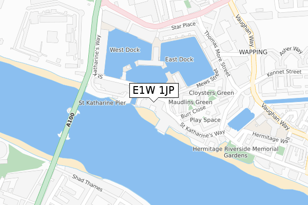
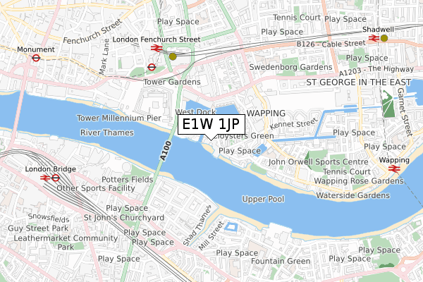
E1W 1JP is located in the St Katharine's & Wapping electoral ward, within the London borough of Tower Hamlets and the English Parliamentary constituency of Poplar and Limehouse. The Sub Integrated Care Board (ICB) Location is NHS North East London ICB - A3A8R and the police force is Metropolitan Police. This postcode has been in use since January 2020.


GetTheData
Source: OS Open Zoomstack (Ordnance Survey)
Licence: Open Government Licence (requires attribution)
Attribution: Contains OS data © Crown copyright and database right 2024
Source: Open Postcode Geo
Licence: Open Government Licence (requires attribution)
Attribution: Contains OS data © Crown copyright and database right 2024; Contains Royal Mail data © Royal Mail copyright and database right 2024; Source: Office for National Statistics licensed under the Open Government Licence v.3.0
| Easting | 533948 |
| Northing | 180334 |
| Latitude | 51.506073 |
| Longitude | -0.071352 |
GetTheData
Source: Open Postcode Geo
Licence: Open Government Licence
| Country | England |
| Postcode District | E1W |
➜ See where E1W is on a map ➜ Where is London? | |
GetTheData
Source: Land Registry Price Paid Data
Licence: Open Government Licence
Elevation or altitude of E1W 1JP as distance above sea level:
| Metres | Feet | |
|---|---|---|
| Elevation | 10m | 33ft |
Elevation is measured from the approximate centre of the postcode, to the nearest point on an OS contour line from OS Terrain 50, which has contour spacing of ten vertical metres.
➜ How high above sea level am I? Find the elevation of your current position using your device's GPS.
GetTheData
Source: Open Postcode Elevation
Licence: Open Government Licence
| Ward | St Katharine's & Wapping |
| Constituency | Poplar And Limehouse |
GetTheData
Source: ONS Postcode Database
Licence: Open Government Licence
| St Katherine Dock (East Smithfield) | Wapping | 252m |
| St Katherine Dock (East Smithfield) | Wapping | 264m |
| The Tower Of London (Tower Bridge Approach) | Tower Hill | 301m |
| The Tower Of London (Tower Bridge Approach) | Tower Hill | 306m |
| Stockholm Way (Vaughan Way) | Wapping | 330m |
| Tower Gateway Dlr Station (Minories) | Tower Gateway | 559m |
| Tower Hill Underground Station | Tower Hill | 563m |
| Aldgate Underground Station | Aldgate | 957m |
| Aldgate East Underground Station | Aldgate East | 1,000m |
| Bermondsey Underground Station | Bermondsey | 1,046m |
| London Fenchurch Street Station | 0.8km |
| London Bridge Station | 1km |
| Wapping Station | 1.1km |
GetTheData
Source: NaPTAN
Licence: Open Government Licence
GetTheData
Source: ONS Postcode Database
Licence: Open Government Licence


➜ Get more ratings from the Food Standards Agency
GetTheData
Source: Food Standards Agency
Licence: FSA terms & conditions
| Last Collection | |||
|---|---|---|---|
| Location | Mon-Fri | Sat | Distance |
| St Katherines Dock | 18:30 | 11:30 | 56m |
| Thomas More Square | 18:30 | 12:00 | 284m |
| Thomas More Square | 18:30 | 11:30 | 284m |
GetTheData
Source: Dracos
Licence: Creative Commons Attribution-ShareAlike
The below table lists the International Territorial Level (ITL) codes (formerly Nomenclature of Territorial Units for Statistics (NUTS) codes) and Local Administrative Units (LAU) codes for E1W 1JP:
| ITL 1 Code | Name |
|---|---|
| TLI | London |
| ITL 2 Code | Name |
| TLI4 | Inner London - East |
| ITL 3 Code | Name |
| TLI42 | Tower Hamlets |
| LAU 1 Code | Name |
| E09000030 | Tower Hamlets |
GetTheData
Source: ONS Postcode Directory
Licence: Open Government Licence
The below table lists the Census Output Area (OA), Lower Layer Super Output Area (LSOA), and Middle Layer Super Output Area (MSOA) for E1W 1JP:
| Code | Name | |
|---|---|---|
| OA | E00021628 | |
| LSOA | E01004293 | Tower Hamlets 027B |
| MSOA | E02000890 | Tower Hamlets 027 |
GetTheData
Source: ONS Postcode Directory
Licence: Open Government Licence
| E1W 1LA | St Katharines Way | 52m |
| E1W 1LP | St Katharines Way | 58m |
| E1W 1UF | St Katharines Way | 78m |
| E1W 1NB | Burr Close | 87m |
| E1W 1LZ | Maudlins Green | 101m |
| E1W 1UE | St Katharines Way | 127m |
| E1W 1AA | St Katharines Way | 128m |
| E1W 1AT | East Smithfield | 135m |
| E1W 1BE | St Katharines Way | 139m |
| E1W 1UG | Mews Street | 142m |
GetTheData
Source: Open Postcode Geo; Land Registry Price Paid Data
Licence: Open Government Licence