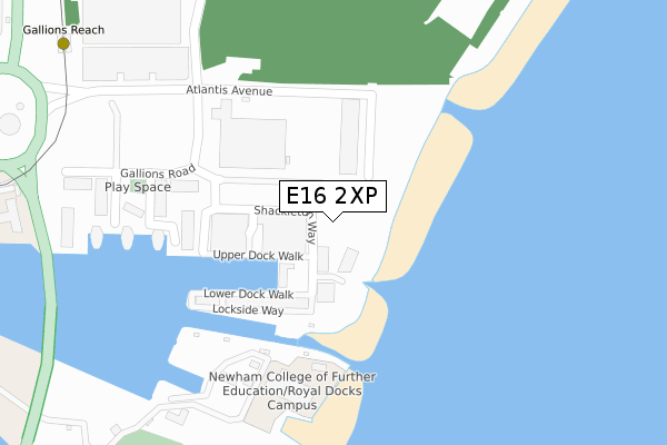
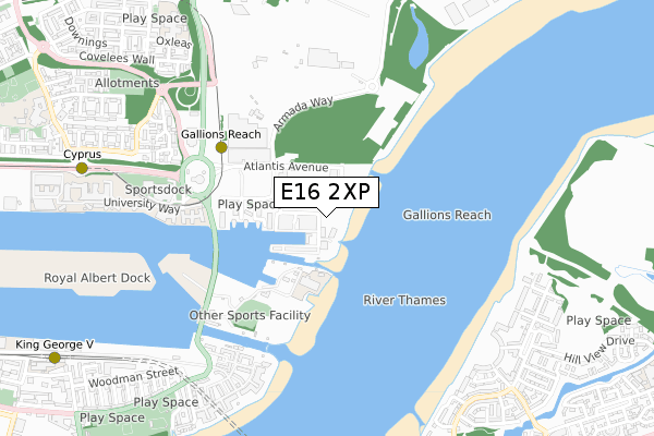
E16 2XP is located in the Royal Albert electoral ward, within the London borough of Newham and the English Parliamentary constituency of East Ham. The Sub Integrated Care Board (ICB) Location is NHS North East London ICB - A3A8R and the police force is Metropolitan Police. This postcode has been in use since June 2019.


GetTheData
Source: OS Open Zoomstack (Ordnance Survey)
Licence: Open Government Licence (requires attribution)
Attribution: Contains OS data © Crown copyright and database right 2025
Source: Open Postcode Geo
Licence: Open Government Licence (requires attribution)
Attribution: Contains OS data © Crown copyright and database right 2025; Contains Royal Mail data © Royal Mail copyright and database right 2025; Source: Office for National Statistics licensed under the Open Government Licence v.3.0
| Easting | 544277 |
| Northing | 180667 |
| Latitude | 51.506524 |
| Longitude | 0.077510 |
GetTheData
Source: Open Postcode Geo
Licence: Open Government Licence
| Country | England |
| Postcode District | E16 |
➜ See where E16 is on a map ➜ Where is London? | |
GetTheData
Source: Land Registry Price Paid Data
Licence: Open Government Licence
| Ward | Royal Albert |
| Constituency | East Ham |
GetTheData
Source: ONS Postcode Database
Licence: Open Government Licence
| Gallions Reach | Gallions Reach | 368m |
| Armada Point | Gallions Reach | 378m |
| Armada Point | Gallions Reach | 407m |
| Gallions Reach | Gallions Reach | 434m |
| Uel Docklands Campus | Gallions Reach | 453m |
| Gallions Reach Dlr Station (Royal Docks Road) | Gallions Reach | 492m |
| Cyprus Dlr Station (Royal Albert Way) | Cyprus | 966m |
| King George V Dlr Station (Rymill Street) | Silvertown | 1,148m |
| Beckton Dlr Station (Woolwich Manor Road) | Beckton | 1,414m |
| Plumstead Station | 1.9km |
| Woolwich Arsenal Station | 1.9km |
| Woolwich Dockyard Station | 2.3km |
GetTheData
Source: NaPTAN
Licence: Open Government Licence
GetTheData
Source: ONS Postcode Database
Licence: Open Government Licence


➜ Get more ratings from the Food Standards Agency
GetTheData
Source: Food Standards Agency
Licence: FSA terms & conditions
| Last Collection | |||
|---|---|---|---|
| Location | Mon-Fri | Sat | Distance |
| Fishguard Way | 17:30 | 11:30 | 702m |
| University Of East London | 17:00 | 11:30 | 821m |
| Warepoint Drive | 17:30 | 12:00 | 947m |
GetTheData
Source: Dracos
Licence: Creative Commons Attribution-ShareAlike
| Risk of E16 2XP flooding from rivers and sea | Very Low |
| ➜ E16 2XP flood map | |
GetTheData
Source: Open Flood Risk by Postcode
Licence: Open Government Licence
The below table lists the International Territorial Level (ITL) codes (formerly Nomenclature of Territorial Units for Statistics (NUTS) codes) and Local Administrative Units (LAU) codes for E16 2XP:
| ITL 1 Code | Name |
|---|---|
| TLI | London |
| ITL 2 Code | Name |
| TLI4 | Inner London - East |
| ITL 3 Code | Name |
| TLI41 | Hackney and Newham |
| LAU 1 Code | Name |
| E09000025 | Newham |
GetTheData
Source: ONS Postcode Directory
Licence: Open Government Licence
The below table lists the Census Output Area (OA), Lower Layer Super Output Area (LSOA), and Middle Layer Super Output Area (MSOA) for E16 2XP:
| Code | Name | |
|---|---|---|
| OA | E00174974 | |
| LSOA | E01003482 | Newham 033B |
| MSOA | E02000746 | Newham 033 |
GetTheData
Source: ONS Postcode Directory
Licence: Open Government Licence
| E16 2QJ | Albert Basin | 163m |
| E16 2QP | Albert Basin Way | 219m |
| E16 2QL | Gallions Road | 229m |
| E16 2QN | Albert Basin Way | 261m |
| E16 2QZ | Albert Basin Way | 265m |
| E16 2QX | Basin Approach | 311m |
| E16 2FE | Basin Approach | 351m |
| E16 2QW | Basin Approach | 357m |
| E16 2FD | Gallions Road | 389m |
| E16 2FF | Basin Approach | 400m |
GetTheData
Source: Open Postcode Geo; Land Registry Price Paid Data
Licence: Open Government Licence