E16 2TP maps, stats, and open data
- Home
- Postcode
- E
- E16
- E16 2
E16 2TP is located in the Royal Victoria electoral ward, within the London borough of Newham and the English Parliamentary constituency of East Ham. The Sub Integrated Care Board (ICB) Location is NHS North East London ICB - A3A8R and the police force is Metropolitan Police. This postcode has been in use since January 2018.
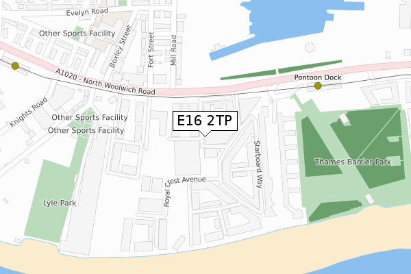
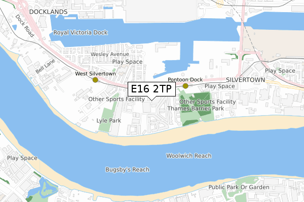
E16 2TP maps


Source: OS Open Zoomstack (Ordnance Survey)
Licence: Open Government Licence (requires attribution)
Attribution: Contains OS data © Crown copyright and database right 2025
Source: Open Postcode GeoLicence: Open Government Licence (requires attribution)
Attribution: Contains OS data © Crown copyright and database right 2025; Contains Royal Mail data © Royal Mail copyright and database right 2025; Source: Office for National Statistics licensed under the Open Government Licence v.3.0
E16 2TP geodata
| Easting | 540924 |
| Northing | 179981 |
| Latitude | 51.501205 |
| Longitude | 0.028956 |
Where is E16 2TP?
| Country | England |
| Postcode District | E16 |
Politics
| Ward | Royal Victoria |
|---|
| Constituency | East Ham |
|---|
Transport
Nearest bus stops to E16 2TP
| Mill Road (North Woolwich Road) | Silvertown | 112m |
| Boxley Street (North Woolwich Road) | Silvertown | 219m |
| Boxley Street | Silvertown | 274m |
| Pontoon Dock (North Woolwich Road) | Silvertown | 300m |
| Pontoon Dock (North Woolwich Road) | Silvertown | 369m |
Nearest underground/metro/tram to E16 2TP
| Pontoon Dock Dlr Station (North Woolwich Road) | Silvertown | 248m |
| West Silvertown Dlr Station (Wesley Avenue) | Silvertown | 484m |
| Custom House (For Excel) Dlr Station (Victoria Dock Road) | Custom House | 959m |
| Prince Regent Dlr Station (Victoria Dock Road) | Prince Regent | 967m |
| Emirates Royal Docks (Western Gateway) | Royal Victoria | 1,071m |
Nearest railway stations to E16 2TP
| Charlton Station | 1.6km |
| Westcombe Park Station | 2km |
| Woolwich Dockyard Station | 2.1km |
Broadband
Broadband access in E16 2TP (2020 data)
| Percentage of properties with Next Generation Access | 100.0% |
| Percentage of properties with Superfast Broadband | 100.0% |
| Percentage of properties with Ultrafast Broadband | 100.0% |
| Percentage of properties with Full Fibre Broadband | 100.0% |
Superfast Broadband is between 30Mbps and 300Mbps
Ultrafast Broadband is > 300Mbps
Broadband speed in E16 2TP (2019 data)
Download
| Median download speed | 100.0Mbps |
| Average download speed | 183.3Mbps |
| Maximum download speed | 350.00Mbps |
Upload
Ofcom does not currently provide upload speed data for E16 2TP. This is because there are less than four broadband connections in this postcode.
Broadband limitations in E16 2TP (2020 data)
| Percentage of properties unable to receive 2Mbps | 0.0% |
| Percentage of properties unable to receive 5Mbps | 0.0% |
| Percentage of properties unable to receive 10Mbps | 0.0% |
| Percentage of properties unable to receive 30Mbps | 0.0% |
Deprivation
53.4% of English postcodes are less deprived than
E16 2TP:
Food Standards Agency
Three nearest food hygiene ratings to E16 2TP (metres)
Keonbae Ltd
20A Royal Crest Avenue
45m
Smore Taste Of Asia
Azuolas
➜ Get more ratings from the Food Standards Agency
Nearest post box to E16 2TP
| | Last Collection | |
|---|
| Location | Mon-Fri | Sat | Distance |
|---|
| Kierbeck Business Centre | | | 268m |
| Pontoon Dock Dlr Station | 18:30 | 11:30 | 320m |
| 2c Royal Victoria Place E16 | 17:30 | 11:30 | 483m |
Environment
| Risk of E16 2TP flooding from rivers and sea | Very Low |
E16 2TP ITL and E16 2TP LAU
The below table lists the International Territorial Level (ITL) codes (formerly Nomenclature of Territorial Units for Statistics (NUTS) codes) and Local Administrative Units (LAU) codes for E16 2TP:
| ITL 1 Code | Name |
|---|
| TLI | London |
| ITL 2 Code | Name |
|---|
| TLI4 | Inner London - East |
| ITL 3 Code | Name |
|---|
| TLI41 | Hackney and Newham |
| LAU 1 Code | Name |
|---|
| E09000025 | Newham |
E16 2TP census areas
The below table lists the Census Output Area (OA), Lower Layer Super Output Area (LSOA), and Middle Layer Super Output Area (MSOA) for E16 2TP:
| Code | Name |
|---|
| OA | E00018199 | |
|---|
| LSOA | E01033577 | Newham 037E |
|---|
| MSOA | E02000750 | Newham 037 |
|---|
Nearest postcodes to E16 2TP


