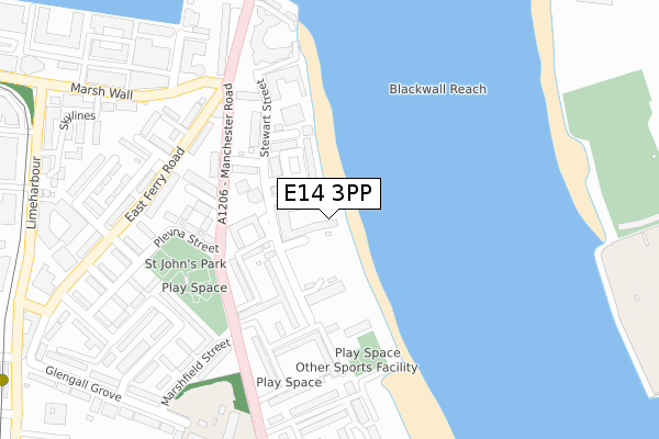
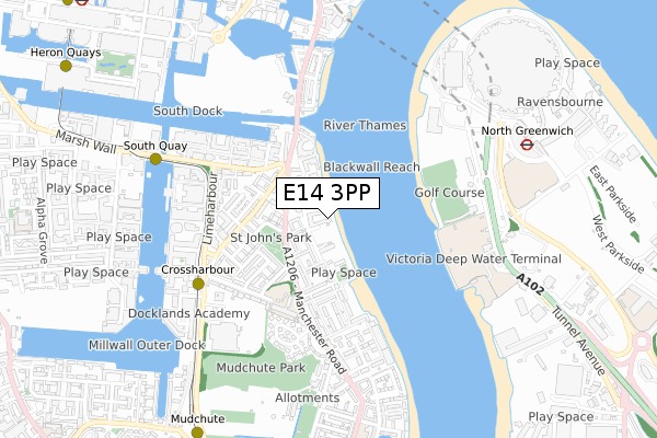
E14 3PP is located in the Blackwall & Cubitt Town electoral ward, within the London borough of Tower Hamlets and the English Parliamentary constituency of Poplar and Limehouse. The Sub Integrated Care Board (ICB) Location is NHS North East London ICB - A3A8R and the police force is Metropolitan Police. This postcode has been in use since January 2019.


GetTheData
Source: OS Open Zoomstack (Ordnance Survey)
Licence: Open Government Licence (requires attribution)
Attribution: Contains OS data © Crown copyright and database right 2025
Source: Open Postcode Geo
Licence: Open Government Licence (requires attribution)
Attribution: Contains OS data © Crown copyright and database right 2025; Contains Royal Mail data © Royal Mail copyright and database right 2025; Source: Office for National Statistics licensed under the Open Government Licence v.3.0
| Easting | 538425 |
| Northing | 179541 |
| Latitude | 51.497868 |
| Longitude | -0.007196 |
GetTheData
Source: Open Postcode Geo
Licence: Open Government Licence
| Country | England |
| Postcode District | E14 |
➜ See where E14 is on a map ➜ Where is London? | |
GetTheData
Source: Land Registry Price Paid Data
Licence: Open Government Licence
| Ward | Blackwall & Cubitt Town |
| Constituency | Poplar And Limehouse |
GetTheData
Source: ONS Postcode Database
Licence: Open Government Licence
| St John's Park (Manchester Road) | Crossharbour | 172m |
| St John's Park (Manchester Road) | Crossharbour | 180m |
| Stewart Street (Manchester Road) | Crossharbour | 211m |
| Stewart Street (Manchester Road) | Crossharbour | 219m |
| Jack Dash House | Crossharbour | 283m |
| Crossharbour Dlr Station (Limeharbour) | Crossharbour | 565m |
| South Quay Dlr Station (Marsh Wall) | South Quay | 665m |
| North Greenwich Underground Station | North Greenwich | 850m |
| Mudchute Dlr Station (East Ferry Road) | Mudchute | 953m |
| Canary Wharf Underground Station | Canary Wharf | 988m |
| Maze Hill Station | 1.8km |
| Greenwich Station | 2.2km |
| Westcombe Park Station | 2.3km |
GetTheData
Source: NaPTAN
Licence: Open Government Licence
| Percentage of properties with Next Generation Access | 100.0% |
| Percentage of properties with Superfast Broadband | 100.0% |
| Percentage of properties with Ultrafast Broadband | 100.0% |
| Percentage of properties with Full Fibre Broadband | 100.0% |
Superfast Broadband is between 30Mbps and 300Mbps
Ultrafast Broadband is > 300Mbps
| Percentage of properties unable to receive 2Mbps | 0.0% |
| Percentage of properties unable to receive 5Mbps | 0.0% |
| Percentage of properties unable to receive 10Mbps | 0.0% |
| Percentage of properties unable to receive 30Mbps | 0.0% |
GetTheData
Source: Ofcom
Licence: Ofcom Terms of Use (requires attribution)
GetTheData
Source: ONS Postcode Database
Licence: Open Government Licence


➜ Get more ratings from the Food Standards Agency
GetTheData
Source: Food Standards Agency
Licence: FSA terms & conditions
| Last Collection | |||
|---|---|---|---|
| Location | Mon-Fri | Sat | Distance |
| Manchester Road | 17:30 | 11:30 | 214m |
| Wood Wharf Business Park | 19:00 | 462m | |
| Skylines | 464m | ||
GetTheData
Source: Dracos
Licence: Creative Commons Attribution-ShareAlike
| Risk of E14 3PP flooding from rivers and sea | Very Low |
| ➜ E14 3PP flood map | |
GetTheData
Source: Open Flood Risk by Postcode
Licence: Open Government Licence
The below table lists the International Territorial Level (ITL) codes (formerly Nomenclature of Territorial Units for Statistics (NUTS) codes) and Local Administrative Units (LAU) codes for E14 3PP:
| ITL 1 Code | Name |
|---|---|
| TLI | London |
| ITL 2 Code | Name |
| TLI4 | Inner London - East |
| ITL 3 Code | Name |
| TLI42 | Tower Hamlets |
| LAU 1 Code | Name |
| E09000030 | Tower Hamlets |
GetTheData
Source: ONS Postcode Directory
Licence: Open Government Licence
The below table lists the Census Output Area (OA), Lower Layer Super Output Area (LSOA), and Middle Layer Super Output Area (MSOA) for E14 3PP:
| Code | Name | |
|---|---|---|
| OA | E00021249 | |
| LSOA | E01004214 | Tower Hamlets 030A |
| MSOA | E02000893 | Tower Hamlets 030 |
GetTheData
Source: ONS Postcode Directory
Licence: Open Government Licence
| E14 3EU | Capstan Square | 86m |
| E14 3JP | Stewart Street | 111m |
| E14 3JR | Stewart Street | 113m |
| E14 3JE | Stewart Street | 137m |
| E14 3YH | Folly Wall | 141m |
| E14 3HA | Stewart Street | 149m |
| E14 3JW | Manchester Road | 163m |
| E14 3JL | Stewart Street | 170m |
| E14 3JN | Stewart Street | 170m |
| E14 3JQ | Stewart Street | 170m |
GetTheData
Source: Open Postcode Geo; Land Registry Price Paid Data
Licence: Open Government Licence