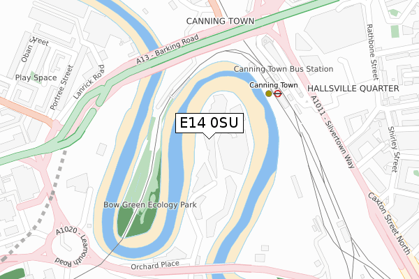
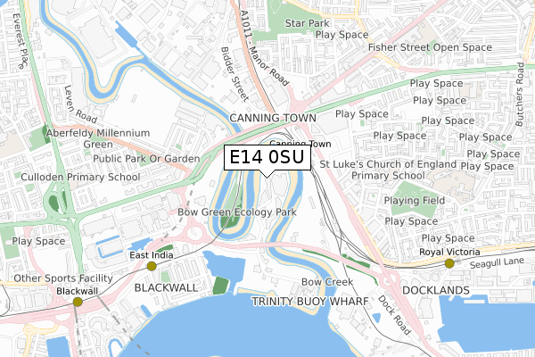
E14 0SU is located in the Blackwall & Cubitt Town electoral ward, within the London borough of Tower Hamlets and the English Parliamentary constituency of Poplar and Limehouse. The Sub Integrated Care Board (ICB) Location is NHS North East London ICB - A3A8R and the police force is Metropolitan Police. This postcode has been in use since September 2018.


GetTheData
Source: OS Open Zoomstack (Ordnance Survey)
Licence: Open Government Licence (requires attribution)
Attribution: Contains OS data © Crown copyright and database right 2025
Source: Open Postcode Geo
Licence: Open Government Licence (requires attribution)
Attribution: Contains OS data © Crown copyright and database right 2025; Contains Royal Mail data © Royal Mail copyright and database right 2025; Source: Office for National Statistics licensed under the Open Government Licence v.3.0
| Easting | 539283 |
| Northing | 181240 |
| Latitude | 51.512925 |
| Longitude | 0.005827 |
GetTheData
Source: Open Postcode Geo
Licence: Open Government Licence
| Country | England |
| Postcode District | E14 |
➜ See where E14 is on a map ➜ Where is London? | |
GetTheData
Source: Land Registry Price Paid Data
Licence: Open Government Licence
| Ward | Blackwall & Cubitt Town |
| Constituency | Poplar And Limehouse |
GetTheData
Source: ONS Postcode Database
Licence: Open Government Licence
| Canning Town (Canning Town Bus Station) | Canning Town | 232m |
| Canning Town (Canning Town Bus Station) | Canning Town | 233m |
| Canning Town (Canning Town Bus Station) | Canning Town | 235m |
| Canning Town (Canning Town Bus Station) | Canning Town | 240m |
| Canning Town (Canning Town Bus Station) | Canning Town | 242m |
| Canning Town Underground Station | Canning Town | 190m |
| Canning Town Dlr Station (Silvertown Way) | Canning Town | 208m |
| East India Dlr Station (Aspen Way) | East India | 690m |
| Star Lane Dlr Station | Canning Town | 882m |
| Royal Victoria Dlr Station (Victoria Dock Road) | Royal Victoria | 968m |
| West Ham Station | 1.7km |
| Limehouse Station | 3.2km |
| Stratford (London) Station | 3.3km |
GetTheData
Source: NaPTAN
Licence: Open Government Licence
| Percentage of properties with Next Generation Access | 100.0% |
| Percentage of properties with Superfast Broadband | 100.0% |
| Percentage of properties with Ultrafast Broadband | 100.0% |
| Percentage of properties with Full Fibre Broadband | 100.0% |
Superfast Broadband is between 30Mbps and 300Mbps
Ultrafast Broadband is > 300Mbps
Ofcom does not currently provide download speed data for E14 0SU. This is because there are less than four broadband connections in this postcode.
Ofcom does not currently provide upload speed data for E14 0SU. This is because there are less than four broadband connections in this postcode.
| Percentage of properties unable to receive 2Mbps | 0.0% |
| Percentage of properties unable to receive 5Mbps | 0.0% |
| Percentage of properties unable to receive 10Mbps | 0.0% |
| Percentage of properties unable to receive 30Mbps | 0.0% |
GetTheData
Source: Ofcom
Licence: Ofcom Terms of Use (requires attribution)
GetTheData
Source: ONS Postcode Database
Licence: Open Government Licence


➜ Get more ratings from the Food Standards Agency
GetTheData
Source: Food Standards Agency
Licence: FSA terms & conditions
| Last Collection | |||
|---|---|---|---|
| Location | Mon-Fri | Sat | Distance |
| 22 Barking Road E16 | 17:30 | 12:00 | 400m |
| Oban Street | 17:30 | 11:30 | 478m |
| Goodway Gardens | 17:30 | 11:30 | 644m |
GetTheData
Source: Dracos
Licence: Creative Commons Attribution-ShareAlike
| Risk of E14 0SU flooding from rivers and sea | Very Low |
| ➜ E14 0SU flood map | |
GetTheData
Source: Open Flood Risk by Postcode
Licence: Open Government Licence
The below table lists the International Territorial Level (ITL) codes (formerly Nomenclature of Territorial Units for Statistics (NUTS) codes) and Local Administrative Units (LAU) codes for E14 0SU:
| ITL 1 Code | Name |
|---|---|
| TLI | London |
| ITL 2 Code | Name |
| TLI4 | Inner London - East |
| ITL 3 Code | Name |
| TLI42 | Tower Hamlets |
| LAU 1 Code | Name |
| E09000030 | Tower Hamlets |
GetTheData
Source: ONS Postcode Directory
Licence: Open Government Licence
The below table lists the Census Output Area (OA), Lower Layer Super Output Area (LSOA), and Middle Layer Super Output Area (MSOA) for E14 0SU:
| Code | Name | |
|---|---|---|
| OA | E00167127 | |
| LSOA | E01032778 | Tower Hamlets 028G |
| MSOA | E02000891 | Tower Hamlets 028 |
GetTheData
Source: ONS Postcode Directory
Licence: Open Government Licence
| E16 1EA | Silvertown Way | 356m |
| E14 0HT | Portree Street | 363m |
| E16 1BE | Hallsville Road | 373m |
| E16 1BF | Hallsville Road | 373m |
| E14 0JU | Orchard Place | 384m |
| E14 0HU | Portree Street | 397m |
| E14 0LR | Abbott Road | 406m |
| E16 1GW | Silvertown Square | 408m |
| E16 1JH | Rathbone Street | 411m |
| E16 1HU | Shirley Street | 416m |
GetTheData
Source: Open Postcode Geo; Land Registry Price Paid Data
Licence: Open Government Licence