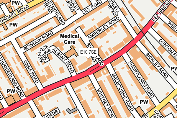
E10 7SE is located in the Lea Bridge electoral ward, within the London borough of Waltham Forest and the English Parliamentary constituency of Walthamstow. The Sub Integrated Care Board (ICB) Location is NHS North East London ICB - A3A8R and the police force is Metropolitan Police. This postcode has been in use since July 2017.


GetTheData
Source: OS OpenMap – Local (Ordnance Survey)
Source: OS VectorMap District (Ordnance Survey)
Licence: Open Government Licence (requires attribution)
| Easting | 537474 |
| Northing | 187884 |
| Latitude | 51.573072 |
| Longitude | -0.017632 |
GetTheData
Source: Open Postcode Geo
Licence: Open Government Licence
| Country | England |
| Postcode District | E10 |
➜ See where E10 is on a map ➜ Where is Leyton? | |
GetTheData
Source: Land Registry Price Paid Data
Licence: Open Government Licence
| Ward | Lea Bridge |
| Constituency | Walthamstow |
GetTheData
Source: ONS Postcode Database
Licence: Open Government Licence
| Shortlands Road | Walthamstow Central | 92m |
| Shortlands Road | Walthamstow Central | 95m |
| Manor Road (E10) | Walthamstow | 185m |
| Rochdale Road | Walthamstow Central | 280m |
| High Road Leyton Bakers Arms (Lea Bridge Road) | Whipps Cross | 313m |
| Walthamstow Central Underground Station | Walthamstow Central | 1,111m |
| Leyton Midland Road Station | 0.8km |
| Walthamstow Queens Road Station | 1km |
| Walthamstow Central Station | 1.1km |
GetTheData
Source: NaPTAN
Licence: Open Government Licence
GetTheData
Source: ONS Postcode Database
Licence: Open Government Licence


➜ Get more ratings from the Food Standards Agency
GetTheData
Source: Food Standards Agency
Licence: FSA terms & conditions
| Last Collection | |||
|---|---|---|---|
| Location | Mon-Fri | Sat | Distance |
| 198 Capworth Street | 17:30 | 11:30 | 407m |
| Capworth Street | 17:30 | 11:30 | 413m |
| Collingwood Road | 17:30 | 11:30 | 425m |
GetTheData
Source: Dracos
Licence: Creative Commons Attribution-ShareAlike
The below table lists the International Territorial Level (ITL) codes (formerly Nomenclature of Territorial Units for Statistics (NUTS) codes) and Local Administrative Units (LAU) codes for E10 7SE:
| ITL 1 Code | Name |
|---|---|
| TLI | London |
| ITL 2 Code | Name |
| TLI5 | Outer London - East and North East |
| ITL 3 Code | Name |
| TLI53 | Redbridge and Waltham Forest |
| LAU 1 Code | Name |
| E09000031 | Waltham Forest |
GetTheData
Source: ONS Postcode Directory
Licence: Open Government Licence
The below table lists the Census Output Area (OA), Lower Layer Super Output Area (LSOA), and Middle Layer Super Output Area (MSOA) for E10 7SE:
| Code | Name | |
|---|---|---|
| OA | E00022262 | |
| LSOA | E01004420 | Waltham Forest 020C |
| MSOA | E02000914 | Waltham Forest 020 |
GetTheData
Source: ONS Postcode Directory
Licence: Open Government Licence
| E10 7EB | Lea Bridge Road | 50m |
| E10 7DT | Lea Bridge Road | 51m |
| E10 7EW | Albany Road | 52m |
| E10 7EP | Shrubland Road | 70m |
| E10 7EH | Albany Road | 99m |
| E10 7ER | Amberley Road | 121m |
| E10 7EJ | Albany Road | 131m |
| E17 8JB | Bowdon Road | 152m |
| E10 7HF | Melbourne Road | 154m |
| E17 8HY | Lily Road | 162m |
GetTheData
Source: Open Postcode Geo; Land Registry Price Paid Data
Licence: Open Government Licence