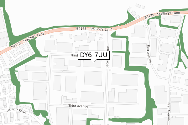
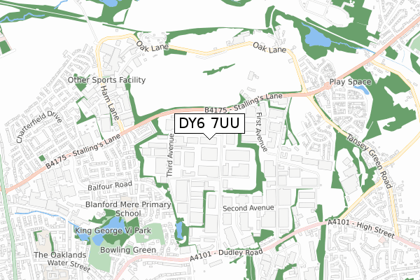
DY6 7UU is located in the Brockmoor and Pensnett electoral ward, within the metropolitan district of Dudley and the English Parliamentary constituency of Dudley South. The Sub Integrated Care Board (ICB) Location is NHS Black Country ICB - D2P2L and the police force is West Midlands. This postcode has been in use since December 1999.


GetTheData
Source: OS Open Zoomstack (Ordnance Survey)
Licence: Open Government Licence (requires attribution)
Attribution: Contains OS data © Crown copyright and database right 2025
Source: Open Postcode Geo
Licence: Open Government Licence (requires attribution)
Attribution: Contains OS data © Crown copyright and database right 2025; Contains Royal Mail data © Royal Mail copyright and database right 2025; Source: Office for National Statistics licensed under the Open Government Licence v.3.0
| Easting | 389746 |
| Northing | 289881 |
| Latitude | 52.506726 |
| Longitude | -2.152502 |
GetTheData
Source: Open Postcode Geo
Licence: Open Government Licence
| Country | England |
| Postcode District | DY6 |
➜ See where DY6 is on a map ➜ Where is Kingswinford? | |
GetTheData
Source: Land Registry Price Paid Data
Licence: Open Government Licence
Elevation or altitude of DY6 7UU as distance above sea level:
| Metres | Feet | |
|---|---|---|
| Elevation | 90m | 295ft |
Elevation is measured from the approximate centre of the postcode, to the nearest point on an OS contour line from OS Terrain 50, which has contour spacing of ten vertical metres.
➜ How high above sea level am I? Find the elevation of your current position using your device's GPS.
GetTheData
Source: Open Postcode Elevation
Licence: Open Government Licence
| Ward | Brockmoor And Pensnett |
| Constituency | Dudley South |
GetTheData
Source: ONS Postcode Database
Licence: Open Government Licence
| Stallings Lane (Second Avenue) | Tansey Green | 130m |
| Stallings Lane (Second Avenue) | Tansey Green | 134m |
| Elf Garage (Stallings Lane) | Tansey Green | 197m |
| Elf Garage (Stallings Lane) | Tansey Green | 197m |
| Pensnett Trading Estate (Second Avenue) | Tansey Green | 225m |
| Cradley Heath Station | 5.9km |
| Coseley Station | 6.2km |
GetTheData
Source: NaPTAN
Licence: Open Government Licence
GetTheData
Source: ONS Postcode Database
Licence: Open Government Licence


➜ Get more ratings from the Food Standards Agency
GetTheData
Source: Food Standards Agency
Licence: FSA terms & conditions
| Last Collection | |||
|---|---|---|---|
| Location | Mon-Fri | Sat | Distance |
| Standhills Road | 17:30 | 11:30 | 1,013m |
| Rangeways Road | 17:30 | 11:30 | 1,091m |
| New Dudley Road | 17:30 | 11:00 | 1,239m |
GetTheData
Source: Dracos
Licence: Creative Commons Attribution-ShareAlike
The below table lists the International Territorial Level (ITL) codes (formerly Nomenclature of Territorial Units for Statistics (NUTS) codes) and Local Administrative Units (LAU) codes for DY6 7UU:
| ITL 1 Code | Name |
|---|---|
| TLG | West Midlands (England) |
| ITL 2 Code | Name |
| TLG3 | West Midlands |
| ITL 3 Code | Name |
| TLG36 | Dudley |
| LAU 1 Code | Name |
| E08000027 | Dudley |
GetTheData
Source: ONS Postcode Directory
Licence: Open Government Licence
The below table lists the Census Output Area (OA), Lower Layer Super Output Area (LSOA), and Middle Layer Super Output Area (MSOA) for DY6 7UU:
| Code | Name | |
|---|---|---|
| OA | E00049666 | |
| LSOA | E01009816 | Dudley 012A |
| MSOA | E02002011 | Dudley 012 |
GetTheData
Source: ONS Postcode Directory
Licence: Open Government Licence
| DY6 7LF | Hinsford Close | 403m |
| DY6 7EQ | Balfour Road | 425m |
| DY6 7EB | Balfour Road | 467m |
| DY6 7ER | Heathlands Close | 473m |
| DY6 7HH | Birchwood Walk | 480m |
| DY6 7EF | Greenland Close | 486m |
| DY6 7HL | Courtland Road | 505m |
| DY6 7ED | Honeysuckle Avenue | 520m |
| DY6 7EP | Dovedale Road | 523m |
| DY6 7ES | Leacroft Road | 532m |
GetTheData
Source: Open Postcode Geo; Land Registry Price Paid Data
Licence: Open Government Licence