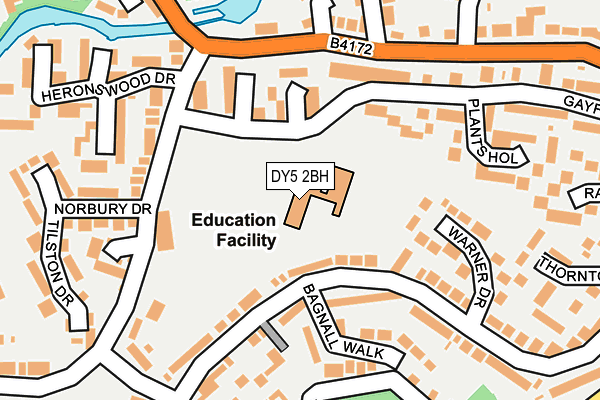
DY5 2BH is located in the Amblecote electoral ward, within the metropolitan district of Dudley and the English Parliamentary constituency of Stourbridge. The Sub Integrated Care Board (ICB) Location is NHS Black Country ICB - D2P2L and the police force is West Midlands. This postcode has been in use since March 1982.


GetTheData
Source: OS OpenMap – Local (Ordnance Survey)
Source: OS VectorMap District (Ordnance Survey)
Licence: Open Government Licence (requires attribution)
| Easting | 391813 |
| Northing | 286208 |
| Latitude | 52.473741 |
| Longitude | -2.121957 |
GetTheData
Source: Open Postcode Geo
Licence: Open Government Licence
| Country | England |
| Postcode District | DY5 |
➜ See where DY5 is on a map ➜ Where is Brierley Hill? | |
GetTheData
Source: Land Registry Price Paid Data
Licence: Open Government Licence
Elevation or altitude of DY5 2BH as distance above sea level:
| Metres | Feet | |
|---|---|---|
| Elevation | 110m | 361ft |
Elevation is measured from the approximate centre of the postcode, to the nearest point on an OS contour line from OS Terrain 50, which has contour spacing of ten vertical metres.
➜ How high above sea level am I? Find the elevation of your current position using your device's GPS.
GetTheData
Source: Open Postcode Elevation
Licence: Open Government Licence
| Ward | Amblecote |
| Constituency | Stourbridge |
GetTheData
Source: ONS Postcode Database
Licence: Open Government Licence
| Gayfield Avenue (Turners Lane) | Silver End | 142m |
| Gayfield Avenue (Turners Lane) | Silver End | 152m |
| The Goss (Delph Rd) | Brierley Hill | 181m |
| The Goss (Delph Rd) | Brierley Hill | 183m |
| Norbury Drive (Turners Lane) | Silver End | 199m |
| Lye (West Midlands) Station | 1.6km |
| Cradley Heath Station | 2.2km |
| Stourbridge Town Station | 2.4km |
GetTheData
Source: NaPTAN
Licence: Open Government Licence
GetTheData
Source: ONS Postcode Database
Licence: Open Government Licence


➜ Get more ratings from the Food Standards Agency
GetTheData
Source: Food Standards Agency
Licence: FSA terms & conditions
| Last Collection | |||
|---|---|---|---|
| Location | Mon-Fri | Sat | Distance |
| Little Potter Street | 17:30 | 11:30 | 383m |
| Church Street | 17:30 | 12:00 | 588m |
| Silver End Post Office | 17:30 | 12:00 | 797m |
GetTheData
Source: Dracos
Licence: Creative Commons Attribution-ShareAlike
The below table lists the International Territorial Level (ITL) codes (formerly Nomenclature of Territorial Units for Statistics (NUTS) codes) and Local Administrative Units (LAU) codes for DY5 2BH:
| ITL 1 Code | Name |
|---|---|
| TLG | West Midlands (England) |
| ITL 2 Code | Name |
| TLG3 | West Midlands |
| ITL 3 Code | Name |
| TLG36 | Dudley |
| LAU 1 Code | Name |
| E08000027 | Dudley |
GetTheData
Source: ONS Postcode Directory
Licence: Open Government Licence
The below table lists the Census Output Area (OA), Lower Layer Super Output Area (LSOA), and Middle Layer Super Output Area (MSOA) for DY5 2BH:
| Code | Name | |
|---|---|---|
| OA | E00049202 | |
| LSOA | E01009727 | Dudley 027C |
| MSOA | E02002026 | Dudley 027 |
GetTheData
Source: ONS Postcode Directory
Licence: Open Government Licence
| DY5 2BN | Monkswell Close | 101m |
| DY5 2BL | Walthamstow Court | 129m |
| DY5 2SS | Bagnall Walk | 146m |
| DY5 2PG | Turners Lane | 147m |
| DY5 2BW | Warner Drive | 160m |
| DY5 2BT | Gayfield Avenue | 161m |
| DY5 2PQ | Turners Lane | 166m |
| DY5 2BP | Gayfield Avenue | 174m |
| DY5 2TY | Delph Road | 182m |
| DY5 2SU | Gayfield Avenue | 191m |
GetTheData
Source: Open Postcode Geo; Land Registry Price Paid Data
Licence: Open Government Licence