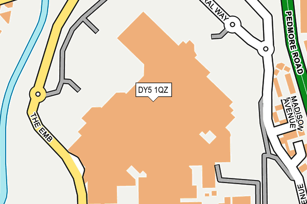
DY5 1QZ is located in the Brierley Hill electoral ward, within the metropolitan district of Dudley and the English Parliamentary constituency of Dudley South. The Sub Integrated Care Board (ICB) Location is NHS Black Country ICB - D2P2L and the police force is West Midlands. This postcode has been in use since June 1998.


GetTheData
Source: OS OpenMap – Local (Ordnance Survey)
Source: OS VectorMap District (Ordnance Survey)
Licence: Open Government Licence (requires attribution)
| Easting | 392541 |
| Northing | 287180 |
| Latitude | 52.482490 |
| Longitude | -2.111262 |
GetTheData
Source: Open Postcode Geo
Licence: Open Government Licence
| Country | England |
| Postcode District | DY5 |
➜ See where DY5 is on a map ➜ Where is Brierley Hill? | |
GetTheData
Source: Land Registry Price Paid Data
Licence: Open Government Licence
Elevation or altitude of DY5 1QZ as distance above sea level:
| Metres | Feet | |
|---|---|---|
| Elevation | 120m | 394ft |
Elevation is measured from the approximate centre of the postcode, to the nearest point on an OS contour line from OS Terrain 50, which has contour spacing of ten vertical metres.
➜ How high above sea level am I? Find the elevation of your current position using your device's GPS.
GetTheData
Source: Open Postcode Elevation
Licence: Open Government Licence
| Ward | Brierley Hill |
| Constituency | Dudley South |
GetTheData
Source: ONS Postcode Database
Licence: Open Government Licence
| Merry Hill Centre (Embankment) | Merry Hill | 191m |
| Merry Hill Centre (Embankment) | Merry Hill | 209m |
| Engine Lane (Level St) | Merry Hill | 257m |
| Engine Lane (Level St) | Merry Hill | 275m |
| Hurst Lane (Pedmore Rd) | Merry Hill | 290m |
| Cradley Heath Station | 2km |
| Lye (West Midlands) Station | 2.5km |
| Stourbridge Town Station | 3.6km |
GetTheData
Source: NaPTAN
Licence: Open Government Licence
GetTheData
Source: ONS Postcode Database
Licence: Open Government Licence

➜ Get more ratings from the Food Standards Agency
GetTheData
Source: Food Standards Agency
Licence: FSA terms & conditions
| Last Collection | |||
|---|---|---|---|
| Location | Mon-Fri | Sat | Distance |
| Merry Hill 3 | 17:30 | 12:00 | 185m |
| Merry Hill 1 | 18:30 | 12:30 | 362m |
| Waterfront | 19:00 | 11:00 | 523m |
GetTheData
Source: Dracos
Licence: Creative Commons Attribution-ShareAlike
The below table lists the International Territorial Level (ITL) codes (formerly Nomenclature of Territorial Units for Statistics (NUTS) codes) and Local Administrative Units (LAU) codes for DY5 1QZ:
| ITL 1 Code | Name |
|---|---|
| TLG | West Midlands (England) |
| ITL 2 Code | Name |
| TLG3 | West Midlands |
| ITL 3 Code | Name |
| TLG36 | Dudley |
| LAU 1 Code | Name |
| E08000027 | Dudley |
GetTheData
Source: ONS Postcode Directory
Licence: Open Government Licence
The below table lists the Census Output Area (OA), Lower Layer Super Output Area (LSOA), and Middle Layer Super Output Area (MSOA) for DY5 1QZ:
| Code | Name | |
|---|---|---|
| OA | E00171358 | |
| LSOA | E01009741 | Dudley 022A |
| MSOA | E02002021 | Dudley 022 |
GetTheData
Source: ONS Postcode Directory
Licence: Open Government Licence
| DY5 1TZ | Madison Avenue | 248m |
| DY5 1TW | Columbus Avenue | 290m |
| DY5 1SZ | The Embankment | 327m |
| DY5 1SX | Times Square Avenue | 357m |
| DY5 1UA | Level Street | 402m |
| DY5 1SY | The Merry Hill Centre | 488m |
| DY5 1UG | Tyne Place | 551m |
| DY5 1UQ | Sheriff Drive | 571m |
| DY5 1UU | Two Locks | 584m |
| DY5 1RG | Little Cottage Street | 612m |
GetTheData
Source: Open Postcode Geo; Land Registry Price Paid Data
Licence: Open Government Licence