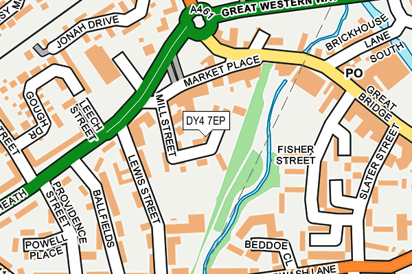
DY4 7EP is located in the Great Bridge electoral ward, within the metropolitan district of Sandwell and the English Parliamentary constituency of West Bromwich West. The Sub Integrated Care Board (ICB) Location is NHS Black Country ICB - D2P2L and the police force is West Midlands. This postcode has been in use since March 2017.


GetTheData
Source: OS OpenMap – Local (Ordnance Survey)
Source: OS VectorMap District (Ordnance Survey)
Licence: Open Government Licence (requires attribution)
| Easting | 397669 |
| Northing | 292399 |
| Latitude | 52.529471 |
| Longitude | -2.035785 |
GetTheData
Source: Open Postcode Geo
Licence: Open Government Licence
| Country | England |
| Postcode District | DY4 |
➜ See where DY4 is on a map ➜ Where is West Bromwich? | |
GetTheData
Source: Land Registry Price Paid Data
Licence: Open Government Licence
| Ward | Great Bridge |
| Constituency | West Bromwich West |
GetTheData
Source: ONS Postcode Database
Licence: Open Government Licence
24, THOMAS COX WHARF, TIPTON, DY4 7EP 2018 3 AUG £172,995 |
21, THOMAS COX WHARF, TIPTON, DY4 7EP 2018 27 APR £171,995 |
14, THOMAS COX WHARF, TIPTON, DY4 7EP 2017 21 DEC £169,995 |
9, THOMAS COX WHARF, TIPTON, DY4 7EP 2017 15 DEC £168,995 |
8, THOMAS COX WHARF, TIPTON, DY4 7EP 2017 30 NOV £169,995 |
2, THOMAS COX WHARF, TIPTON, DY4 7EP 2017 10 AUG £167,995 |
1, THOMAS COX WHARF, TIPTON, DY4 7EP 2017 28 JUL £169,995 |
GetTheData
Source: HM Land Registry Price Paid Data
Licence: Contains HM Land Registry data © Crown copyright and database right 2024. This data is licensed under the Open Government Licence v3.0.
| Great Bridge Interchange (Great Bridge Bus Station) | Great Bridge | 94m |
| Great Bridge Interchange (Great Bridge Bus Station) | Great Bridge | 101m |
| Great Bridge Interchange (Great Bridge Bus Station) | Great Bridge | 103m |
| Market Place (Market Pl) | Great Bridge | 186m |
| Slater Street (Great Bridge St) | Great Bridge | 240m |
| Dudley Port Station | 1.1km |
| Tipton Station | 2km |
| Sandwell & Dudley Station | 2.8km |
GetTheData
Source: NaPTAN
Licence: Open Government Licence
| Percentage of properties with Next Generation Access | 100.0% |
| Percentage of properties with Superfast Broadband | 100.0% |
| Percentage of properties with Ultrafast Broadband | 0.0% |
| Percentage of properties with Full Fibre Broadband | 0.0% |
Superfast Broadband is between 30Mbps and 300Mbps
Ultrafast Broadband is > 300Mbps
| Median download speed | 40.0Mbps |
| Average download speed | 49.8Mbps |
| Maximum download speed | 79.85Mbps |
| Median upload speed | 10.0Mbps |
| Average upload speed | 10.7Mbps |
| Maximum upload speed | 20.00Mbps |
| Percentage of properties unable to receive 2Mbps | 0.0% |
| Percentage of properties unable to receive 5Mbps | 0.0% |
| Percentage of properties unable to receive 10Mbps | 0.0% |
| Percentage of properties unable to receive 30Mbps | 0.0% |
GetTheData
Source: Ofcom
Licence: Ofcom Terms of Use (requires attribution)
GetTheData
Source: ONS Postcode Database
Licence: Open Government Licence


➜ Get more ratings from the Food Standards Agency
GetTheData
Source: Food Standards Agency
Licence: FSA terms & conditions
| Last Collection | |||
|---|---|---|---|
| Location | Mon-Fri | Sat | Distance |
| Great Bridge Post Office | 18:30 | 12:00 | 208m |
| Sheepwash Lane | 18:30 | 11:30 | 340m |
| Great Bridge St Opposite Charl | 17:30 | 12:00 | 598m |
GetTheData
Source: Dracos
Licence: Creative Commons Attribution-ShareAlike
| Risk of DY4 7EP flooding from rivers and sea | Medium |
| ➜ DY4 7EP flood map | |
GetTheData
Source: Open Flood Risk by Postcode
Licence: Open Government Licence
The below table lists the International Territorial Level (ITL) codes (formerly Nomenclature of Territorial Units for Statistics (NUTS) codes) and Local Administrative Units (LAU) codes for DY4 7EP:
| ITL 1 Code | Name |
|---|---|
| TLG | West Midlands (England) |
| ITL 2 Code | Name |
| TLG3 | West Midlands |
| ITL 3 Code | Name |
| TLG37 | Sandwell |
| LAU 1 Code | Name |
| E08000028 | Sandwell |
GetTheData
Source: ONS Postcode Directory
Licence: Open Government Licence
The below table lists the Census Output Area (OA), Lower Layer Super Output Area (LSOA), and Middle Layer Super Output Area (MSOA) for DY4 7EP:
| Code | Name | |
|---|---|---|
| OA | E00050495 | |
| LSOA | E01009977 | Sandwell 016B |
| MSOA | E02002058 | Sandwell 016 |
GetTheData
Source: ONS Postcode Directory
Licence: Open Government Licence
| DY4 7EJ | Market Place | 68m |
| DY4 7EG | Mill Street | 74m |
| DY4 7EH | Horseley Heath | 94m |
| DY4 7EL | Market Place | 100m |
| DY4 7EB | Lewis Street | 127m |
| DY4 7AR | Market Place | 138m |
| DY4 7HZ | Beddoe Close | 153m |
| DY4 7DY | Ballfields | 169m |
| DY4 7ER | Fisher Street | 182m |
| DY4 7AH | Horseley Heath | 187m |
GetTheData
Source: Open Postcode Geo; Land Registry Price Paid Data
Licence: Open Government Licence