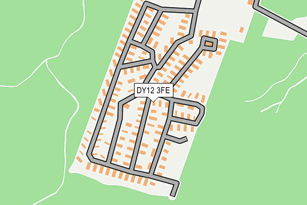
DY12 3FE is located in the Cleobury Mortimer electoral ward, within the unitary authority of Shropshire and the English Parliamentary constituency of Ludlow. The Sub Integrated Care Board (ICB) Location is NHS Shropshire, Telford and Wrekin ICB - M2L0M and the police force is West Mercia. This postcode has been in use since July 2008.


GetTheData
Source: OS OpenMap – Local (Ordnance Survey)
Source: OS VectorMap District (Ordnance Survey)
Licence: Open Government Licence (requires attribution)
| Easting | 376598 |
| Northing | 276930 |
| Latitude | 52.389890 |
| Longitude | -2.345297 |
GetTheData
Source: Open Postcode Geo
Licence: Open Government Licence
| Country | England |
| Postcode District | DY12 |
➜ See where DY12 is on a map | |
GetTheData
Source: Land Registry Price Paid Data
Licence: Open Government Licence
Elevation or altitude of DY12 3FE as distance above sea level:
| Metres | Feet | |
|---|---|---|
| Elevation | 100m | 328ft |
Elevation is measured from the approximate centre of the postcode, to the nearest point on an OS contour line from OS Terrain 50, which has contour spacing of ten vertical metres.
➜ How high above sea level am I? Find the elevation of your current position using your device's GPS.
GetTheData
Source: Open Postcode Elevation
Licence: Open Government Licence
| Ward | Cleobury Mortimer |
| Constituency | Ludlow |
GetTheData
Source: ONS Postcode Database
Licence: Open Government Licence
| Caravan Park (B4194) | Chamberline Wood | 260m |
| Caravan Park (B4194) | Chamberline Wood | 277m |
| Wyre Cottage (B4194) | Buttonoak | 1,665m |
| Wyre Cottage (B4194) | Buttonoak | 1,680m |
| Bark Hill Shops (The Lakes Road) | Bark Hill | 1,837m |
GetTheData
Source: NaPTAN
Licence: Open Government Licence
| Median download speed | 8.4Mbps |
| Average download speed | 8.3Mbps |
| Maximum download speed | 12.96Mbps |
| Median upload speed | 1.0Mbps |
| Average upload speed | 0.8Mbps |
| Maximum upload speed | 1.25Mbps |
GetTheData
Source: Ofcom
Licence: Ofcom Terms of Use (requires attribution)
Estimated total energy consumption in DY12 3FE by fuel type, 2015.
| Consumption (kWh) | 64,671 |
|---|---|
| Meter count | 24 |
| Mean (kWh/meter) | 2,695 |
| Median (kWh/meter) | 2,692 |
GetTheData
Source: Postcode level gas estimates: 2015 (experimental)
Source: Postcode level electricity estimates: 2015 (experimental)
Licence: Open Government Licence
GetTheData
Source: ONS Postcode Database
Licence: Open Government Licence


➜ Get more ratings from the Food Standards Agency
GetTheData
Source: Food Standards Agency
Licence: FSA terms & conditions
| Last Collection | |||
|---|---|---|---|
| Location | Mon-Fri | Sat | Distance |
| Northwood Halt | 12:00 | 08:45 | 1,303m |
| Sturt Common | 12:15 | 09:00 | 1,429m |
| Button Oak | 15:20 | 09:00 | 1,670m |
GetTheData
Source: Dracos
Licence: Creative Commons Attribution-ShareAlike
The below table lists the International Territorial Level (ITL) codes (formerly Nomenclature of Territorial Units for Statistics (NUTS) codes) and Local Administrative Units (LAU) codes for DY12 3FE:
| ITL 1 Code | Name |
|---|---|
| TLG | West Midlands (England) |
| ITL 2 Code | Name |
| TLG2 | Shropshire and Staffordshire |
| ITL 3 Code | Name |
| TLG22 | Shropshire |
| LAU 1 Code | Name |
| E06000051 | Shropshire |
GetTheData
Source: ONS Postcode Directory
Licence: Open Government Licence
The below table lists the Census Output Area (OA), Lower Layer Super Output Area (LSOA), and Middle Layer Super Output Area (MSOA) for DY12 3FE:
| Code | Name | |
|---|---|---|
| OA | E00174581 | |
| LSOA | E01028858 | Shropshire 035E |
| MSOA | E02006014 | Shropshire 035 |
GetTheData
Source: ONS Postcode Directory
Licence: Open Government Licence
| DY12 3AD | Dowles Road | 340m |
| DY12 3AF | Dowles Road | 419m |
| DY12 3AB | Dowles Road | 779m |
| DY12 3AA | Dowles Road | 1073m |
| DY12 2LG | Drymill Lane | 1108m |
| DY12 3NJ | Dowles Road | 1283m |
| DY12 2LF | Drymill Lane | 1329m |
| DY12 3AG | Button Oak | 1359m |
| DY12 2LE | Drymill Lane | 1383m |
| DY12 1AP | Northwood Lane | 1482m |
GetTheData
Source: Open Postcode Geo; Land Registry Price Paid Data
Licence: Open Government Licence