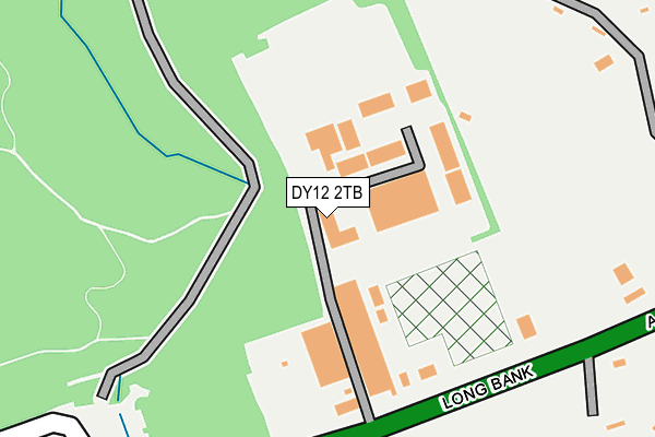
DY12 2TB is located in the Bewdley & Rock electoral ward, within the local authority district of Wyre Forest and the English Parliamentary constituency of Wyre Forest. The Sub Integrated Care Board (ICB) Location is NHS Herefordshire and Worcestershire ICB - 18C and the police force is West Mercia. This postcode has been in use since August 1992.


GetTheData
Source: OS OpenMap – Local (Ordnance Survey)
Source: OS VectorMap District (Ordnance Survey)
Licence: Open Government Licence (requires attribution)
| Easting | 375372 |
| Northing | 274322 |
| Latitude | 52.366403 |
| Longitude | -2.363116 |
GetTheData
Source: Open Postcode Geo
Licence: Open Government Licence
| Country | England |
| Postcode District | DY12 |
➜ See where DY12 is on a map | |
GetTheData
Source: Land Registry Price Paid Data
Licence: Open Government Licence
Elevation or altitude of DY12 2TB as distance above sea level:
| Metres | Feet | |
|---|---|---|
| Elevation | 150m | 492ft |
Elevation is measured from the approximate centre of the postcode, to the nearest point on an OS contour line from OS Terrain 50, which has contour spacing of ten vertical metres.
➜ How high above sea level am I? Find the elevation of your current position using your device's GPS.
GetTheData
Source: Open Postcode Elevation
Licence: Open Government Licence
| Ward | Bewdley & Rock |
| Constituency | Wyre Forest |
GetTheData
Source: ONS Postcode Database
Licence: Open Government Licence
| Wyre Forest Visitors Centre (Cleobury Road (A456)) | Callow Hill | 341m |
| Wyre Forest Visitor Centre (Cleobury Road) | Callow Hill | 534m |
| Royal Forester (A456) | Callow Hill | 1,079m |
| Royal Forrester (A456) | Callow Hill | 1,084m |
| Caravan Park Entrance (Caravan Park Road) | Lye Head | 1,317m |
GetTheData
Source: NaPTAN
Licence: Open Government Licence
GetTheData
Source: ONS Postcode Database
Licence: Open Government Licence


➜ Get more ratings from the Food Standards Agency
GetTheData
Source: Food Standards Agency
Licence: FSA terms & conditions
| Last Collection | |||
|---|---|---|---|
| Location | Mon-Fri | Sat | Distance |
| Blount Arms | 12:00 | 11:00 | 2,359m |
| Far Forest Post Office | 17:00 | 10:30 | 2,373m |
| Heightington Road | 11:30 | 09:00 | 3,183m |
GetTheData
Source: Dracos
Licence: Creative Commons Attribution-ShareAlike
The below table lists the International Territorial Level (ITL) codes (formerly Nomenclature of Territorial Units for Statistics (NUTS) codes) and Local Administrative Units (LAU) codes for DY12 2TB:
| ITL 1 Code | Name |
|---|---|
| TLG | West Midlands (England) |
| ITL 2 Code | Name |
| TLG1 | Herefordshire, Worcestershire and Warwickshire |
| ITL 3 Code | Name |
| TLG12 | Worcestershire CC |
| LAU 1 Code | Name |
| E07000239 | Wyre Forest |
GetTheData
Source: ONS Postcode Directory
Licence: Open Government Licence
The below table lists the Census Output Area (OA), Lower Layer Super Output Area (LSOA), and Middle Layer Super Output Area (MSOA) for DY12 2TB:
| Code | Name | |
|---|---|---|
| OA | E00165611 | |
| LSOA | E01032472 | Wyre Forest 011D |
| MSOA | E02006777 | Wyre Forest 011 |
GetTheData
Source: ONS Postcode Directory
Licence: Open Government Licence
| DY12 2UL | Long Bank | 234m |
| DY12 2QY | St Johns Lane | 263m |
| DY12 2UN | Longbank | 335m |
| DY12 2QZ | St Johns Lane | 425m |
| DY12 2UW | 457m | |
| DY12 2QT | Longbank | 504m |
| DY12 2QU | Longbank | 512m |
| DY14 9XH | 556m | |
| DY12 2UP | 562m | |
| DY14 9XQ | Forest Houses | 575m |
GetTheData
Source: Open Postcode Geo; Land Registry Price Paid Data
Licence: Open Government Licence