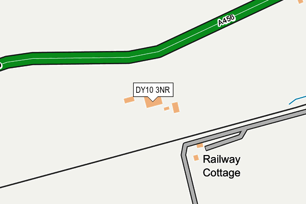
DY10 3NR is located in the Wyre Forest Rural electoral ward, within the local authority district of Wyre Forest and the English Parliamentary constituency of Wyre Forest. The Sub Integrated Care Board (ICB) Location is NHS Herefordshire and Worcestershire ICB - 18C and the police force is West Mercia. This postcode has been in use since January 1980.


GetTheData
Source: OS OpenMap – Local (Ordnance Survey)
Source: OS VectorMap District (Ordnance Survey)
Licence: Open Government Licence (requires attribution)
| Easting | 385765 |
| Northing | 277331 |
| Latitude | 52.393812 |
| Longitude | -2.210614 |
GetTheData
Source: Open Postcode Geo
Licence: Open Government Licence
| Country | England |
| Postcode District | DY10 |
➜ See where DY10 is on a map ➜ Where is Kidderminster? | |
GetTheData
Source: Land Registry Price Paid Data
Licence: Open Government Licence
Elevation or altitude of DY10 3NR as distance above sea level:
| Metres | Feet | |
|---|---|---|
| Elevation | 70m | 230ft |
Elevation is measured from the approximate centre of the postcode, to the nearest point on an OS contour line from OS Terrain 50, which has contour spacing of ten vertical metres.
➜ How high above sea level am I? Find the elevation of your current position using your device's GPS.
GetTheData
Source: Open Postcode Elevation
Licence: Open Government Licence
| Ward | Wyre Forest Rural |
| Constituency | Wyre Forest |
GetTheData
Source: ONS Postcode Database
Licence: Open Government Licence
| Hodge Hill Nurseries (Birmingham Road) | Hurcott | 79m |
| Hodge Hill Nurseries (Birmingham Road) | Hurcott | 112m |
| Hurcot Lane (Birmingham Road) | Hurcott | 535m |
| Park Hall (Birmingham Road) | Hurcott | 799m |
| Park Hall (Birmingham Road) | Hurcott | 853m |
| Kidderminster Station | 2.2km |
| Blakedown Station | 2.7km |
| Hagley Station | 5.4km |
GetTheData
Source: NaPTAN
Licence: Open Government Licence
GetTheData
Source: ONS Postcode Database
Licence: Open Government Licence


➜ Get more ratings from the Food Standards Agency
GetTheData
Source: Food Standards Agency
Licence: FSA terms & conditions
| Last Collection | |||
|---|---|---|---|
| Location | Mon-Fri | Sat | Distance |
| Wilden Lane | 18:00 | 11:30 | 822m |
| Hurcott Pool | 11:00 | 09:00 | 865m |
| Offmore Farm | 18:30 | 11:30 | 905m |
GetTheData
Source: Dracos
Licence: Creative Commons Attribution-ShareAlike
The below table lists the International Territorial Level (ITL) codes (formerly Nomenclature of Territorial Units for Statistics (NUTS) codes) and Local Administrative Units (LAU) codes for DY10 3NR:
| ITL 1 Code | Name |
|---|---|
| TLG | West Midlands (England) |
| ITL 2 Code | Name |
| TLG1 | Herefordshire, Worcestershire and Warwickshire |
| ITL 3 Code | Name |
| TLG12 | Worcestershire CC |
| LAU 1 Code | Name |
| E07000239 | Wyre Forest |
GetTheData
Source: ONS Postcode Directory
Licence: Open Government Licence
The below table lists the Census Output Area (OA), Lower Layer Super Output Area (LSOA), and Middle Layer Super Output Area (MSOA) for DY10 3NR:
| Code | Name | |
|---|---|---|
| OA | E00165412 | |
| LSOA | E01032432 | Wyre Forest 001B |
| MSOA | E02006767 | Wyre Forest 001 |
GetTheData
Source: ONS Postcode Directory
Licence: Open Government Licence
| DY10 3NP | Birmingham Road | 351m |
| DY10 3PH | 480m | |
| DY10 3NN | Deansford Lane | 520m |
| DY10 3NS | Birmingham Road | 528m |
| DY10 3QJ | Husum Way | 717m |
| DY10 3QN | Barrie Avenue | 759m |
| DY10 3PJ | Hurcott Lane | 769m |
| DY10 3XX | Munro Close | 794m |
| DY10 3NL | Birmingham Road | 794m |
| DY10 3XY | Husum Way | 808m |
GetTheData
Source: Open Postcode Geo; Land Registry Price Paid Data
Licence: Open Government Licence