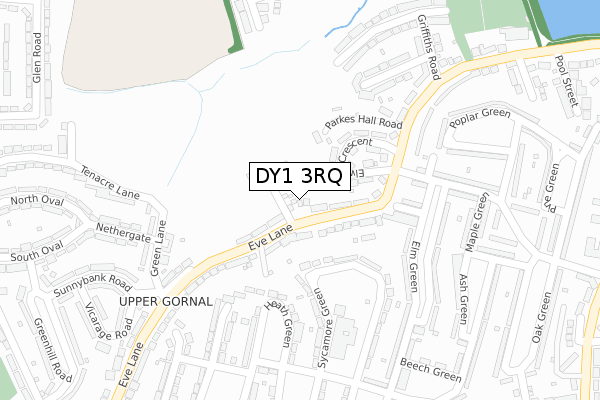
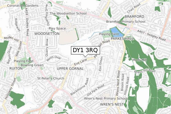
DY1 3RQ is located in the Upper Gornal and Woodsetton electoral ward, within the metropolitan district of Dudley and the English Parliamentary constituency of Dudley North. The Sub Integrated Care Board (ICB) Location is NHS Black Country ICB - D2P2L and the police force is West Midlands. This postcode has been in use since April 2020.


GetTheData
Source: OS Open Zoomstack (Ordnance Survey)
Licence: Open Government Licence (requires attribution)
Attribution: Contains OS data © Crown copyright and database right 2024
Source: Open Postcode Geo
Licence: Open Government Licence (requires attribution)
Attribution: Contains OS data © Crown copyright and database right 2024; Contains Royal Mail data © Royal Mail copyright and database right 2024; Source: Office for National Statistics licensed under the Open Government Licence v.3.0
| Easting | 392855 |
| Northing | 292478 |
| Latitude | 52.530138 |
| Longitude | -2.106748 |
GetTheData
Source: Open Postcode Geo
Licence: Open Government Licence
| Country | England |
| Postcode District | DY1 |
➜ See where DY1 is on a map ➜ Where is Coseley? | |
GetTheData
Source: Land Registry Price Paid Data
Licence: Open Government Licence
| Ward | Upper Gornal And Woodsetton |
| Constituency | Dudley North |
GetTheData
Source: ONS Postcode Database
Licence: Open Government Licence
2024 14 JUN £274,000 |
14, SHEARING CLOSE, DUDLEY, DY1 3RQ 2021 3 SEP £332,000 |
2021 16 APR £225,000 |
1, SHEARING CLOSE, DUDLEY, DY1 3RQ 2021 26 MAR £320,000 |
3, SHEARING CLOSE, DUDLEY, DY1 3RQ 2021 26 MAR £320,000 |
5, SHEARING CLOSE, DUDLEY, DY1 3RQ 2021 9 MAR £318,000 |
4, SHEARING CLOSE, DUDLEY, DY1 3RQ 2021 4 MAR £250,000 |
7, SHEARING CLOSE, DUDLEY, DY1 3RQ 2021 29 JAN £295,000 |
11, SHEARING CLOSE, DUDLEY, DY1 3RQ 2020 6 NOV £250,000 |
6, SHEARING CLOSE, DUDLEY, DY1 3RQ 2020 5 NOV £295,000 |
GetTheData
Source: HM Land Registry Price Paid Data
Licence: Contains HM Land Registry data © Crown copyright and database right 2024. This data is licensed under the Open Government Licence v3.0.
| Parkes Hall Centre (Eve Lane) | Wrens Nest Estate | 68m |
| Parkes Hall Centre (Eve Lane) | Wrens Nest Estate | 93m |
| Parkes Hall Rd (Elm Green) | Wrens Nest Estate | 202m |
| Parkes Hall Rd (Elm Green) | Wrens Nest Estate | 207m |
| Green Lane (Eve Lane) | Upper Gornal | 255m |
| Coseley Station | 2.2km |
| Tipton Station | 2.8km |
| Dudley Port Station | 3.9km |
GetTheData
Source: NaPTAN
Licence: Open Government Licence
GetTheData
Source: ONS Postcode Database
Licence: Open Government Licence

➜ Get more ratings from the Food Standards Agency
GetTheData
Source: Food Standards Agency
Licence: FSA terms & conditions
| Last Collection | |||
|---|---|---|---|
| Location | Mon-Fri | Sat | Distance |
| Brook Street | 17:30 | 11:00 | 614m |
| Duke Street | 17:30 | 11:00 | 1,035m |
| Catholic Lane | 17:30 | 11:00 | 1,277m |
GetTheData
Source: Dracos
Licence: Creative Commons Attribution-ShareAlike
The below table lists the International Territorial Level (ITL) codes (formerly Nomenclature of Territorial Units for Statistics (NUTS) codes) and Local Administrative Units (LAU) codes for DY1 3RQ:
| ITL 1 Code | Name |
|---|---|
| TLG | West Midlands (England) |
| ITL 2 Code | Name |
| TLG3 | West Midlands |
| ITL 3 Code | Name |
| TLG36 | Dudley |
| LAU 1 Code | Name |
| E08000027 | Dudley |
GetTheData
Source: ONS Postcode Directory
Licence: Open Government Licence
The below table lists the Census Output Area (OA), Lower Layer Super Output Area (LSOA), and Middle Layer Super Output Area (MSOA) for DY1 3RQ:
| Code | Name | |
|---|---|---|
| OA | E00049449 | |
| LSOA | E01009774 | Dudley 005D |
| MSOA | E02002004 | Dudley 005 |
GetTheData
Source: ONS Postcode Directory
Licence: Open Government Licence
| DY1 3RJ | Parkes Hall Road | 106m |
| DY1 3RL | Elwell Crescent | 123m |
| DY1 3TX | Eve Lane | 130m |
| DY1 3RH | Parkes Hall Road | 133m |
| DY1 3TU | Eve Lane | 171m |
| DY1 3RF | Elm Green | 235m |
| DY1 3QE | Sycamore Green | 236m |
| DY1 3RR | Stanton Avenue | 236m |
| DY1 3RW | Parkes Hall Road | 237m |
| DY3 1XG | Green Lane | 245m |
GetTheData
Source: Open Postcode Geo; Land Registry Price Paid Data
Licence: Open Government Licence