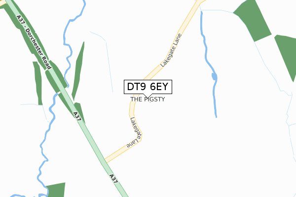
DT9 6EY is located in the Yetminster electoral ward, within the unitary authority of Dorset and the English Parliamentary constituency of West Dorset. The Sub Integrated Care Board (ICB) Location is NHS Dorset ICB - 11J and the police force is Dorset. This postcode has been in use since January 2019.


GetTheData
Source: OS Open Zoomstack (Ordnance Survey)
Licence: Open Government Licence (requires attribution)
Attribution: Contains OS data © Crown copyright and database right 2025
Source: Open Postcode Geo
Licence: Open Government Licence (requires attribution)
Attribution: Contains OS data © Crown copyright and database right 2025; Contains Royal Mail data © Royal Mail copyright and database right 2025; Source: Office for National Statistics licensed under the Open Government Licence v.3.0
| Easting | 357443 |
| Northing | 110012 |
| Latitude | 50.888009 |
| Longitude | -2.606389 |
GetTheData
Source: Open Postcode Geo
Licence: Open Government Licence
| Country | England |
| Postcode District | DT9 |
➜ See where DT9 is on a map | |
GetTheData
Source: Land Registry Price Paid Data
Licence: Open Government Licence
| Ward | Yetminster |
| Constituency | West Dorset |
GetTheData
Source: ONS Postcode Database
Licence: Open Government Licence
| The Church | Ryme Intrinseca | 1,109m |
| The Church | Ryme Intrinseca | 1,114m |
| Prowles Cross (Dorchester Road) | Closworth | 1,271m |
| Prowles Cross (Dorchester Road) | Closworth | 1,285m |
| Yetminster Station | 2.5km |
| Thornford Station | 3.2km |
| Chetnole Station | 3.4km |
GetTheData
Source: NaPTAN
Licence: Open Government Licence
GetTheData
Source: ONS Postcode Database
Licence: Open Government Licence


➜ Get more ratings from the Food Standards Agency
GetTheData
Source: Food Standards Agency
Licence: FSA terms & conditions
| Last Collection | |||
|---|---|---|---|
| Location | Mon-Fri | Sat | Distance |
| Closworth | 12:00 | 09:00 | 1,062m |
| Prowles Cross | 12:00 | 09:00 | 1,183m |
| Pimperne Melbury | 11:15 | 08:30 | 1,849m |
GetTheData
Source: Dracos
Licence: Creative Commons Attribution-ShareAlike
The below table lists the International Territorial Level (ITL) codes (formerly Nomenclature of Territorial Units for Statistics (NUTS) codes) and Local Administrative Units (LAU) codes for DT9 6EY:
| ITL 1 Code | Name |
|---|---|
| TLK | South West (England) |
| ITL 2 Code | Name |
| TLK2 | Dorset and Somerset |
| ITL 3 Code | Name |
| TLK25 | Dorset |
| LAU 1 Code | Name |
| E06000059 | Dorset |
GetTheData
Source: ONS Postcode Directory
Licence: Open Government Licence
The below table lists the Census Output Area (OA), Lower Layer Super Output Area (LSOA), and Middle Layer Super Output Area (MSOA) for DT9 6EY:
| Code | Name | |
|---|---|---|
| OA | E00104228 | |
| LSOA | E01020550 | West Dorset 002D |
| MSOA | E02004270 | West Dorset 002 |
GetTheData
Source: ONS Postcode Directory
Licence: Open Government Licence
| BA22 9RH | Dorchester Road | 735m |
| DT9 6JT | Elsford Cottages | 976m |
| DT9 6JU | Croft Corner | 1001m |
| BA22 9RN | 1033m | |
| DT9 6JR | New Buildings | 1046m |
| BA22 9RQ | Dorchester Road | 1093m |
| DT9 6JX | 1174m | |
| DT9 6JP | 1351m | |
| DT9 6JY | Ryme Road | 1728m |
| DT9 6LB | Cloverhay | 1759m |
GetTheData
Source: Open Postcode Geo; Land Registry Price Paid Data
Licence: Open Government Licence