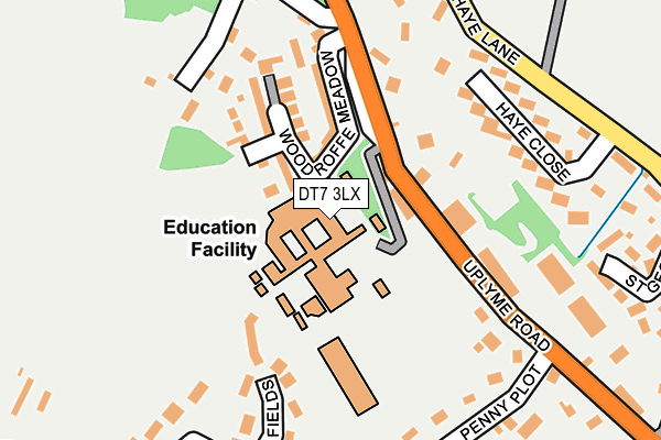
DT7 3LX is located in the Lyme & Charmouth electoral ward, within the unitary authority of Dorset and the English Parliamentary constituency of West Dorset. The Sub Integrated Care Board (ICB) Location is NHS Dorset ICB - 11J and the police force is Dorset. This postcode has been in use since January 1980.


GetTheData
Source: OS OpenMap – Local (Ordnance Survey)
Source: OS VectorMap District (Ordnance Survey)
Licence: Open Government Licence (requires attribution)
| Easting | 333129 |
| Northing | 92724 |
| Latitude | 50.730268 |
| Longitude | -2.948854 |
GetTheData
Source: Open Postcode Geo
Licence: Open Government Licence
| Country | England |
| Postcode District | DT7 |
➜ See where DT7 is on a map ➜ Where is Lyme Regis? | |
GetTheData
Source: Land Registry Price Paid Data
Licence: Open Government Licence
Elevation or altitude of DT7 3LX as distance above sea level:
| Metres | Feet | |
|---|---|---|
| Elevation | 100m | 328ft |
Elevation is measured from the approximate centre of the postcode, to the nearest point on an OS contour line from OS Terrain 50, which has contour spacing of ten vertical metres.
➜ How high above sea level am I? Find the elevation of your current position using your device's GPS.
GetTheData
Source: Open Postcode Elevation
Licence: Open Government Licence
| Ward | Lyme & Charmouth |
| Constituency | West Dorset |
GetTheData
Source: ONS Postcode Database
Licence: Open Government Licence
| Medical Centre (Uplyme Road) | Lyme Regis | 103m |
| Medical Centre (Uplyme Road) | Lyme Regis | 114m |
| Woodroffe School | Lyme Regis | 152m |
| Woodroffe School (Uplyme Road) | Lyme Regis | 163m |
| Haye Close | Lyme Regis | 252m |
GetTheData
Source: NaPTAN
Licence: Open Government Licence
GetTheData
Source: ONS Postcode Database
Licence: Open Government Licence


➜ Get more ratings from the Food Standards Agency
GetTheData
Source: Food Standards Agency
Licence: FSA terms & conditions
| Last Collection | |||
|---|---|---|---|
| Location | Mon-Fri | Sat | Distance |
| The Square | 16:15 | 12:00 | 1,265m |
| Anning Road | 16:15 | 11:45 | 1,281m |
| Wood Farm Caravan Park | 17:00 | 09:30 | 2,647m |
GetTheData
Source: Dracos
Licence: Creative Commons Attribution-ShareAlike
The below table lists the International Territorial Level (ITL) codes (formerly Nomenclature of Territorial Units for Statistics (NUTS) codes) and Local Administrative Units (LAU) codes for DT7 3LX:
| ITL 1 Code | Name |
|---|---|
| TLK | South West (England) |
| ITL 2 Code | Name |
| TLK2 | Dorset and Somerset |
| ITL 3 Code | Name |
| TLK25 | Dorset |
| LAU 1 Code | Name |
| E06000059 | Dorset |
GetTheData
Source: ONS Postcode Directory
Licence: Open Government Licence
The below table lists the Census Output Area (OA), Lower Layer Super Output Area (LSOA), and Middle Layer Super Output Area (MSOA) for DT7 3LX:
| Code | Name | |
|---|---|---|
| OA | E00104128 | |
| LSOA | E01020532 | West Dorset 005B |
| MSOA | E02004273 | West Dorset 005 |
GetTheData
Source: ONS Postcode Directory
Licence: Open Government Licence
| DT7 3QN | Woodroffe Villas | 63m |
| DT7 3NX | Woodroffe Meadow | 95m |
| DT7 3NU | Thornton Pearn Rise | 123m |
| DT7 3LS | Uplyme Road | 156m |
| DT7 3RT | Haye Barton | 163m |
| DT7 3NF | Launchycroft | 192m |
| DT7 3NE | Penny Plot | 204m |
| DT7 3NG | Haye Lane | 208m |
| DT7 3NJ | Haye Close | 214m |
| DT7 3EZ | Somer Fields | 224m |
GetTheData
Source: Open Postcode Geo; Land Registry Price Paid Data
Licence: Open Government Licence