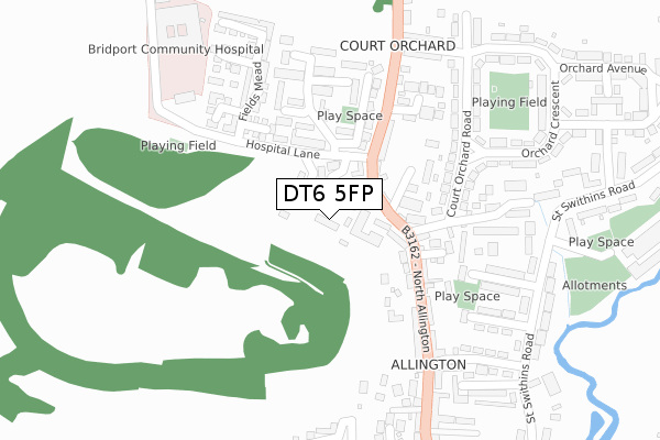
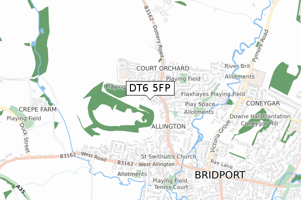
DT6 5FP is located in the Bridport electoral ward, within the unitary authority of Dorset and the English Parliamentary constituency of West Dorset. The Sub Integrated Care Board (ICB) Location is NHS Dorset ICB - 11J and the police force is Dorset. This postcode has been in use since July 2018.


GetTheData
Source: OS Open Zoomstack (Ordnance Survey)
Licence: Open Government Licence (requires attribution)
Attribution: Contains OS data © Crown copyright and database right 2025
Source: Open Postcode Geo
Licence: Open Government Licence (requires attribution)
Attribution: Contains OS data © Crown copyright and database right 2025; Contains Royal Mail data © Royal Mail copyright and database right 2025; Source: Office for National Statistics licensed under the Open Government Licence v.3.0
| Easting | 345998 |
| Northing | 93562 |
| Latitude | 50.739134 |
| Longitude | -2.766657 |
GetTheData
Source: Open Postcode Geo
Licence: Open Government Licence
| Country | England |
| Postcode District | DT6 |
➜ See where DT6 is on a map ➜ Where is Bridport? | |
GetTheData
Source: Land Registry Price Paid Data
Licence: Open Government Licence
| Ward | Bridport |
| Constituency | West Dorset |
GetTheData
Source: ONS Postcode Database
Licence: Open Government Licence
| Cherry Tree (Hospital Lane) | Court Orchard | 98m |
| Cherry Tree (Hospital Lane) | Court Orchard | 107m |
| The Boot Inn (North Allington) | Allington | 171m |
| The Boot Inn (North Allington) | Allington | 177m |
| Mead Fields (Hospital Lane) | Court Orchard | 192m |
GetTheData
Source: NaPTAN
Licence: Open Government Licence
| Percentage of properties with Next Generation Access | 100.0% |
| Percentage of properties with Superfast Broadband | 100.0% |
| Percentage of properties with Ultrafast Broadband | 0.0% |
| Percentage of properties with Full Fibre Broadband | 0.0% |
Superfast Broadband is between 30Mbps and 300Mbps
Ultrafast Broadband is > 300Mbps
| Percentage of properties unable to receive 2Mbps | 0.0% |
| Percentage of properties unable to receive 5Mbps | 0.0% |
| Percentage of properties unable to receive 10Mbps | 0.0% |
| Percentage of properties unable to receive 30Mbps | 0.0% |
GetTheData
Source: Ofcom
Licence: Ofcom Terms of Use (requires attribution)
GetTheData
Source: ONS Postcode Database
Licence: Open Government Licence


➜ Get more ratings from the Food Standards Agency
GetTheData
Source: Food Standards Agency
Licence: FSA terms & conditions
| Last Collection | |||
|---|---|---|---|
| Location | Mon-Fri | Sat | Distance |
| North Allington | 16:00 | 12:00 | 95m |
| Allington Mead | 16:00 | 12:00 | 317m |
| Victoria Grove | 16:00 | 12:00 | 699m |
GetTheData
Source: Dracos
Licence: Creative Commons Attribution-ShareAlike
The below table lists the International Territorial Level (ITL) codes (formerly Nomenclature of Territorial Units for Statistics (NUTS) codes) and Local Administrative Units (LAU) codes for DT6 5FP:
| ITL 1 Code | Name |
|---|---|
| TLK | South West (England) |
| ITL 2 Code | Name |
| TLK2 | Dorset and Somerset |
| ITL 3 Code | Name |
| TLK25 | Dorset |
| LAU 1 Code | Name |
| E06000059 | Dorset |
GetTheData
Source: ONS Postcode Directory
Licence: Open Government Licence
The below table lists the Census Output Area (OA), Lower Layer Super Output Area (LSOA), and Middle Layer Super Output Area (MSOA) for DT6 5FP:
| Code | Name | |
|---|---|---|
| OA | E00103933 | |
| LSOA | E01020499 | West Dorset 006B |
| MSOA | E02004274 | West Dorset 006 |
GetTheData
Source: ONS Postcode Directory
Licence: Open Government Licence
| DT6 5HJ | Allington Gardens | 48m |
| DT6 5ED | North Allington | 51m |
| DT6 5RA | Trustin Close | 65m |
| DT6 5EB | North Allington | 127m |
| DT6 5EE | North Allington | 128m |
| DT6 5ER | Diment Square | 130m |
| DT6 5EA | North Allington | 159m |
| DT6 5RS | Biddlecombe Orchard | 167m |
| DT6 5RD | Diment Gardens | 169m |
| DT6 5HH | Cherry Tree | 194m |
GetTheData
Source: Open Postcode Geo; Land Registry Price Paid Data
Licence: Open Government Licence