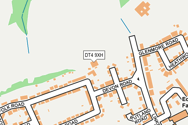
DT4 9XH is located in the Chickerell electoral ward, within the unitary authority of Dorset and the English Parliamentary constituency of West Dorset. The Sub Integrated Care Board (ICB) Location is NHS Dorset ICB - 11J and the police force is Dorset. This postcode has been in use since March 1988.


GetTheData
Source: OS OpenMap – Local (Ordnance Survey)
Source: OS VectorMap District (Ordnance Survey)
Licence: Open Government Licence (requires attribution)
| Easting | 365586 |
| Northing | 80538 |
| Latitude | 50.623512 |
| Longitude | -2.487859 |
GetTheData
Source: Open Postcode Geo
Licence: Open Government Licence
| Country | England |
| Postcode District | DT4 |
➜ See where DT4 is on a map ➜ Where is Weymouth? | |
GetTheData
Source: Land Registry Price Paid Data
Licence: Open Government Licence
Elevation or altitude of DT4 9XH as distance above sea level:
| Metres | Feet | |
|---|---|---|
| Elevation | 20m | 66ft |
Elevation is measured from the approximate centre of the postcode, to the nearest point on an OS contour line from OS Terrain 50, which has contour spacing of ten vertical metres.
➜ How high above sea level am I? Find the elevation of your current position using your device's GPS.
GetTheData
Source: Open Postcode Elevation
Licence: Open Government Licence
| Ward | Chickerell |
| Constituency | West Dorset |
GetTheData
Source: ONS Postcode Database
Licence: Open Government Licence
| Wessex Stadium | Southill | 571m |
| Police Hq (Radipole Lane) | Southill | 607m |
| Police Hq (Radipole Lane) | Southill | 620m |
| Mayfield Close (Radipole Lane) | Southill | 683m |
| Police Station (Radipole Lane) | Southill | 698m |
| Weymouth Station | 2.5km |
| Upwey Station | 3.2km |
GetTheData
Source: NaPTAN
Licence: Open Government Licence
GetTheData
Source: ONS Postcode Database
Licence: Open Government Licence

➜ Get more ratings from the Food Standards Agency
GetTheData
Source: Food Standards Agency
Licence: FSA terms & conditions
| Last Collection | |||
|---|---|---|---|
| Location | Mon-Fri | Sat | Distance |
| Chickerell P.o. | 16:45 | 11:00 | 1,025m |
| West Close | 16:45 | 09:30 | 1,511m |
| Bowleaze | 16:45 | 08:00 | 1,895m |
GetTheData
Source: Dracos
Licence: Creative Commons Attribution-ShareAlike
The below table lists the International Territorial Level (ITL) codes (formerly Nomenclature of Territorial Units for Statistics (NUTS) codes) and Local Administrative Units (LAU) codes for DT4 9XH:
| ITL 1 Code | Name |
|---|---|
| TLK | South West (England) |
| ITL 2 Code | Name |
| TLK2 | Dorset and Somerset |
| ITL 3 Code | Name |
| TLK25 | Dorset |
| LAU 1 Code | Name |
| E06000059 | Dorset |
GetTheData
Source: ONS Postcode Directory
Licence: Open Government Licence
The below table lists the Census Output Area (OA), Lower Layer Super Output Area (LSOA), and Middle Layer Super Output Area (MSOA) for DT4 9XH:
| Code | Name | |
|---|---|---|
| OA | E00104033 | |
| LSOA | E01020514 | West Dorset 012C |
| MSOA | E02004280 | West Dorset 012 |
GetTheData
Source: ONS Postcode Directory
Licence: Open Government Licence
| DT3 4PA | The Coppice | 461m |
| DT4 9XJ | Radipole Lane | 509m |
| DT3 4FQ | Elliott Way | 532m |
| DT3 4FN | Oldridge Road | 551m |
| DT3 4AN | Lower Putton Lane | 554m |
| DT3 4NX | Podington Meadows | 558m |
| DT3 4AH | Browns Crescent | 575m |
| DT3 4AL | Green Lane | 576m |
| DT3 4BY | Lower Putton Lane | 578m |
| DT4 0TF | Radipole Lane | 602m |
GetTheData
Source: Open Postcode Geo; Land Registry Price Paid Data
Licence: Open Government Licence