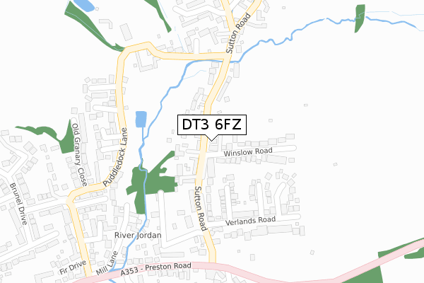
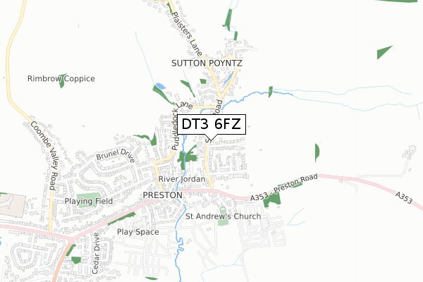
DT3 6FZ is located in the Littlemoor & Preston electoral ward, within the unitary authority of Dorset and the English Parliamentary constituency of South Dorset. The Sub Integrated Care Board (ICB) Location is NHS Dorset ICB - 11J and the police force is Dorset. This postcode has been in use since July 2019.


GetTheData
Source: OS Open Zoomstack (Ordnance Survey)
Licence: Open Government Licence (requires attribution)
Attribution: Contains OS data © Crown copyright and database right 2025
Source: Open Postcode Geo
Licence: Open Government Licence (requires attribution)
Attribution: Contains OS data © Crown copyright and database right 2025; Contains Royal Mail data © Royal Mail copyright and database right 2025; Source: Office for National Statistics licensed under the Open Government Licence v.3.0
| Easting | 368555 |
| Northing | 82548 |
| Latitude | 50.641755 |
| Longitude | -2.446060 |
GetTheData
Source: Open Postcode Geo
Licence: Open Government Licence
| Country | England |
| Postcode District | DT3 |
➜ See where DT3 is on a map ➜ Where is Weymouth? | |
GetTheData
Source: Land Registry Price Paid Data
Licence: Open Government Licence
| Ward | Littlemoor & Preston |
| Constituency | South Dorset |
GetTheData
Source: ONS Postcode Database
Licence: Open Government Licence
2025 8 JAN £415,000 |
2020 1 DEC £328,000 |
6, CRANESBILL WAY, WEYMOUTH, DT3 6FZ 2020 27 NOV £299,995 |
5, CRANESBILL WAY, WEYMOUTH, DT3 6FZ 2020 24 JUL £294,995 |
3, CRANESBILL WAY, WEYMOUTH, DT3 6FZ 2020 24 JUL £299,995 |
15, CRANESBILL WAY, WEYMOUTH, DT3 6FZ 2020 26 JUN £294,995 |
GetTheData
Source: HM Land Registry Price Paid Data
Licence: Contains HM Land Registry data © Crown copyright and database right 2025. This data is licensed under the Open Government Licence v3.0.
| Alamanda Road | Littlemoor | 132m |
| Alamanda Road (Louviers Road) | Littlemoor | 141m |
| Buddleia Close (Louviers Road) | Littlemoor | 350m |
| Buddleia Close (Louviers Road) | Littlemoor | 352m |
| Top Club (Louviers Road) | Littlemoor | 459m |
| Upwey Station | 1.6km |
| Weymouth Station | 3km |
GetTheData
Source: NaPTAN
Licence: Open Government Licence
GetTheData
Source: ONS Postcode Database
Licence: Open Government Licence


➜ Get more ratings from the Food Standards Agency
GetTheData
Source: Food Standards Agency
Licence: FSA terms & conditions
| Last Collection | |||
|---|---|---|---|
| Location | Mon-Fri | Sat | Distance |
| Buddleia Close | 17:00 | 09:00 | 270m |
| Oakbury Drive | 17:15 | 12:00 | 969m |
| Overcombe P.o. | 16:30 | 12:00 | 1,369m |
GetTheData
Source: Dracos
Licence: Creative Commons Attribution-ShareAlike
The below table lists the International Territorial Level (ITL) codes (formerly Nomenclature of Territorial Units for Statistics (NUTS) codes) and Local Administrative Units (LAU) codes for DT3 6FZ:
| ITL 1 Code | Name |
|---|---|
| TLK | South West (England) |
| ITL 2 Code | Name |
| TLK2 | Dorset and Somerset |
| ITL 3 Code | Name |
| TLK25 | Dorset |
| LAU 1 Code | Name |
| E06000059 | Dorset |
GetTheData
Source: ONS Postcode Directory
Licence: Open Government Licence
The below table lists the Census Output Area (OA), Lower Layer Super Output Area (LSOA), and Middle Layer Super Output Area (MSOA) for DT3 6FZ:
| Code | Name | |
|---|---|---|
| OA | E00104233 | |
| LSOA | E01020551 | Weymouth and Portland 001A |
| MSOA | E02004281 | Weymouth and Portland 001 |
GetTheData
Source: ONS Postcode Directory
Licence: Open Government Licence
| DT3 6SL | Primula Close | 127m |
| DT3 6SN | Freesia Close | 175m |
| DT3 6SZ | Cornflower Close | 207m |
| DT3 6SS | Alamanda Road | 231m |
| DT3 6SH | Dahlia Close | 244m |
| DT3 6SG | Buddleia Close | 264m |
| DT3 6SY | Foxglove Way | 285m |
| DT3 6AY | Louviers Road | 301m |
| DT3 6SW | Honeysuckle Close | 301m |
| DT3 6FF | Gentian Way | 324m |
GetTheData
Source: Open Postcode Geo; Land Registry Price Paid Data
Licence: Open Government Licence