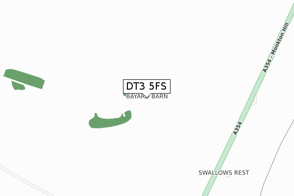
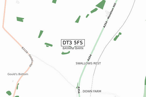
DT3 5FS is located in the Winterborne & Broadmayne electoral ward, within the unitary authority of Dorset and the English Parliamentary constituency of West Dorset. The Sub Integrated Care Board (ICB) Location is NHS Dorset ICB - 11J and the police force is Dorset. This postcode has been in use since December 2019.


GetTheData
Source: OS Open Zoomstack (Ordnance Survey)
Licence: Open Government Licence (requires attribution)
Attribution: Contains OS data © Crown copyright and database right 2025
Source: Open Postcode Geo
Licence: Open Government Licence (requires attribution)
Attribution: Contains OS data © Crown copyright and database right 2025; Contains Royal Mail data © Royal Mail copyright and database right 2025; Source: Office for National Statistics licensed under the Open Government Licence v.3.0
| Easting | 367031 |
| Northing | 86680 |
| Latitude | 50.678828 |
| Longitude | -2.467981 |
GetTheData
Source: Open Postcode Geo
Licence: Open Government Licence
| Country | England |
| Postcode District | DT3 |
➜ See where DT3 is on a map | |
GetTheData
Source: Land Registry Price Paid Data
Licence: Open Government Licence
| Ward | Winterborne & Broadmayne |
| Constituency | West Dorset |
GetTheData
Source: ONS Postcode Database
Licence: Open Government Licence
| Bayard Dairy | Upwey | 1,512m |
| Bayard Dairy | Upwey | 1,519m |
| Wishing Well (Church Street) | Upwey | 1,719m |
| Wishing Well (Church Street) | Upwey | 1,734m |
| Monkton Park | Winterborne Monkton | 1,779m |
| Upwey Station | 3.4km |
| Dorchester West Station | 4km |
| Dorchester South Station | 4km |
GetTheData
Source: NaPTAN
Licence: Open Government Licence
GetTheData
Source: ONS Postcode Database
Licence: Open Government Licence

➜ Get more ratings from the Food Standards Agency
GetTheData
Source: Food Standards Agency
Licence: FSA terms & conditions
| Last Collection | |||
|---|---|---|---|
| Location | Mon-Fri | Sat | Distance |
| Ashton | 09:45 | 09:00 | 1,616m |
| Winterborne Herringstone | 13:30 | 09:00 | 2,446m |
| Bincombe | 09:00 | 09:00 | 2,600m |
GetTheData
Source: Dracos
Licence: Creative Commons Attribution-ShareAlike
The below table lists the International Territorial Level (ITL) codes (formerly Nomenclature of Territorial Units for Statistics (NUTS) codes) and Local Administrative Units (LAU) codes for DT3 5FS:
| ITL 1 Code | Name |
|---|---|
| TLK | South West (England) |
| ITL 2 Code | Name |
| TLK2 | Dorset and Somerset |
| ITL 3 Code | Name |
| TLK25 | Dorset |
| LAU 1 Code | Name |
| E06000059 | Dorset |
GetTheData
Source: ONS Postcode Directory
Licence: Open Government Licence
The below table lists the Census Output Area (OA), Lower Layer Super Output Area (LSOA), and Middle Layer Super Output Area (MSOA) for DT3 5FS:
| Code | Name | |
|---|---|---|
| OA | E00104220 | |
| LSOA | E01020549 | West Dorset 011D |
| MSOA | E02004279 | West Dorset 011 |
GetTheData
Source: ONS Postcode Directory
Licence: Open Government Licence
| DT3 5PZ | 363m | |
| DT3 5PR | 1201m | |
| DT2 9HA | 1351m | |
| DT3 4EL | Goulds Hill | 1439m |
| DT3 4EN | Friar Waddon Road | 1549m |
| DT3 5QQ | The Ridgeway | 1678m |
| DT3 4LG | Goulds Hill Close | 1685m |
| DT3 5QJ | Dorchester Road | 1730m |
| DT3 5QG | Little Hill | 1748m |
| DT3 5QE | Church Street | 1750m |
GetTheData
Source: Open Postcode Geo; Land Registry Price Paid Data
Licence: Open Government Licence