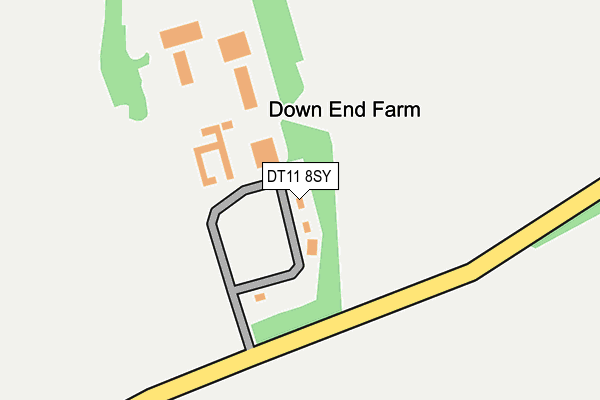
DT11 8SY is located in the Hill Forts & Upper Tarrants electoral ward, within the unitary authority of Dorset and the English Parliamentary constituency of North Dorset. The Sub Integrated Care Board (ICB) Location is NHS Dorset ICB - 11J and the police force is Dorset. This postcode has been in use since January 1980.


GetTheData
Source: OS OpenMap – Local (Ordnance Survey)
Source: OS VectorMap District (Ordnance Survey)
Licence: Open Government Licence (requires attribution)
| Easting | 387443 |
| Northing | 109460 |
| Latitude | 50.884484 |
| Longitude | -2.179870 |
GetTheData
Source: Open Postcode Geo
Licence: Open Government Licence
| Country | England |
| Postcode District | DT11 |
➜ See where DT11 is on a map | |
GetTheData
Source: Land Registry Price Paid Data
Licence: Open Government Licence
Elevation or altitude of DT11 8SY as distance above sea level:
| Metres | Feet | |
|---|---|---|
| Elevation | 130m | 427ft |
Elevation is measured from the approximate centre of the postcode, to the nearest point on an OS contour line from OS Terrain 50, which has contour spacing of ten vertical metres.
➜ How high above sea level am I? Find the elevation of your current position using your device's GPS.
GetTheData
Source: Open Postcode Elevation
Licence: Open Government Licence
| Ward | Hill Forts & Upper Tarrants |
| Constituency | North Dorset |
GetTheData
Source: ONS Postcode Database
Licence: Open Government Licence
| White Horse (Shaston Road) | Stourpaine | 1,254m |
| White Horse (Shaston Road) | Stourpaine | 1,270m |
| Little Nutford (A354) | Durweston | 1,305m |
| Little Nutford (A354) | Durweston | 1,309m |
| Manor France Farm (A354) | Durweston | 1,345m |
GetTheData
Source: NaPTAN
Licence: Open Government Licence
GetTheData
Source: ONS Postcode Database
Licence: Open Government Licence


➜ Get more ratings from the Food Standards Agency
GetTheData
Source: Food Standards Agency
Licence: FSA terms & conditions
| Last Collection | |||
|---|---|---|---|
| Location | Mon-Fri | Sat | Distance |
| Durweston P.o. | 16:00 | 09:45 | 1,695m |
| Sunrise Park | 17:45 | 11:00 | 1,885m |
| Sunrise Business Park | 17:45 | 1,899m | |
GetTheData
Source: Dracos
Licence: Creative Commons Attribution-ShareAlike
The below table lists the International Territorial Level (ITL) codes (formerly Nomenclature of Territorial Units for Statistics (NUTS) codes) and Local Administrative Units (LAU) codes for DT11 8SY:
| ITL 1 Code | Name |
|---|---|
| TLK | South West (England) |
| ITL 2 Code | Name |
| TLK2 | Dorset and Somerset |
| ITL 3 Code | Name |
| TLK25 | Dorset |
| LAU 1 Code | Name |
| E06000059 | Dorset |
GetTheData
Source: ONS Postcode Directory
Licence: Open Government Licence
The below table lists the Census Output Area (OA), Lower Layer Super Output Area (LSOA), and Middle Layer Super Output Area (MSOA) for DT11 8SY:
| Code | Name | |
|---|---|---|
| OA | E00103622 | |
| LSOA | E01020444 | North Dorset 005A |
| MSOA | E02004259 | North Dorset 005 |
GetTheData
Source: ONS Postcode Directory
Licence: Open Government Licence
| DT11 8SX | Bushes Road | 766m |
| DT11 8SZ | Bushes Road | 1079m |
| DT11 8PW | 1086m | |
| DT11 8TE | Orchard Close | 1157m |
| DT11 8TF | Bottom Road | 1161m |
| DT11 8TN | Hod View | 1189m |
| DT11 8TA | Shaston Road | 1200m |
| DT11 8SS | Church View | 1281m |
| DT11 8SU | Bushes Road | 1332m |
| DT11 8TG | South Holme | 1349m |
GetTheData
Source: Open Postcode Geo; Land Registry Price Paid Data
Licence: Open Government Licence