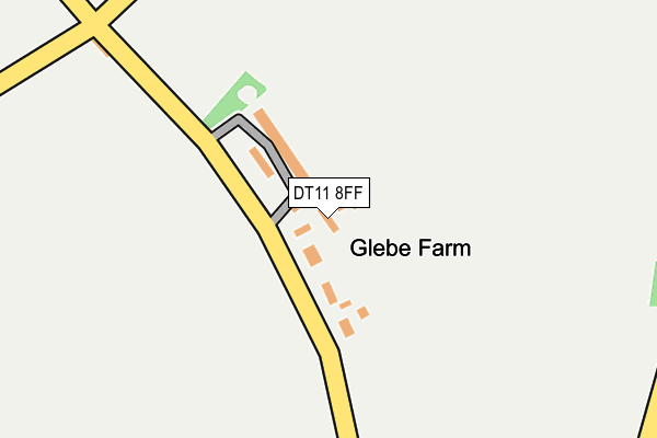
DT11 8FF is located in the Hill Forts & Upper Tarrants electoral ward, within the unitary authority of Dorset and the English Parliamentary constituency of North Dorset. The Sub Integrated Care Board (ICB) Location is NHS Dorset ICB - 11J and the police force is Dorset. This postcode has been in use since April 2017.


GetTheData
Source: OS OpenMap – Local (Ordnance Survey)
Source: OS VectorMap District (Ordnance Survey)
Licence: Open Government Licence (requires attribution)
| Easting | 395468 |
| Northing | 114593 |
| Latitude | 50.930762 |
| Longitude | -2.065854 |
GetTheData
Source: Open Postcode Geo
Licence: Open Government Licence
| Country | England |
| Postcode District | DT11 |
➜ See where DT11 is on a map | |
GetTheData
Source: Land Registry Price Paid Data
Licence: Open Government Licence
| Ward | Hill Forts & Upper Tarrants |
| Constituency | North Dorset |
GetTheData
Source: ONS Postcode Database
Licence: Open Government Licence
| Elm House | Farnham | 287m |
| Elm House | Farnham | 299m |
| Museum Hotel (Main Street) | Farnham | 666m |
| Museum Hotel (Main Street) | Farnham | 675m |
| Minchington Farm (Main Street) | Minchington | 755m |
GetTheData
Source: NaPTAN
Licence: Open Government Licence
GetTheData
Source: ONS Postcode Database
Licence: Open Government Licence


➜ Get more ratings from the Food Standards Agency
GetTheData
Source: Food Standards Agency
Licence: FSA terms & conditions
| Last Collection | |||
|---|---|---|---|
| Location | Mon-Fri | Sat | Distance |
| Bye Corner | 10:15 | 10:15 | 3,476m |
| Stubhampton | 09:30 | 09:30 | 3,830m |
| Tarrant Hinton | 11:15 | 11:15 | 3,866m |
GetTheData
Source: Dracos
Licence: Creative Commons Attribution-ShareAlike
The below table lists the International Territorial Level (ITL) codes (formerly Nomenclature of Territorial Units for Statistics (NUTS) codes) and Local Administrative Units (LAU) codes for DT11 8FF:
| ITL 1 Code | Name |
|---|---|
| TLK | South West (England) |
| ITL 2 Code | Name |
| TLK2 | Dorset and Somerset |
| ITL 3 Code | Name |
| TLK25 | Dorset |
| LAU 1 Code | Name |
| E06000059 | Dorset |
GetTheData
Source: ONS Postcode Directory
Licence: Open Government Licence
The below table lists the Census Output Area (OA), Lower Layer Super Output Area (LSOA), and Middle Layer Super Output Area (MSOA) for DT11 8FF:
| Code | Name | |
|---|---|---|
| OA | E00103597 | |
| LSOA | E01020442 | North Dorset 006A |
| MSOA | E02004260 | North Dorset 006 |
GetTheData
Source: ONS Postcode Directory
Licence: Open Government Licence
| DT11 8DD | 399m | |
| DT11 8DE | 696m | |
| DT11 8DQ | 1072m | |
| DT11 8DH | 1428m | |
| DT11 8BZ | 2147m | |
| DT11 8DN | 2198m | |
| BH21 5JG | 2508m | |
| SP5 5RT | 2563m | |
| DT11 8JS | 2697m | |
| SP5 5RR | 2766m |
GetTheData
Source: Open Postcode Geo; Land Registry Price Paid Data
Licence: Open Government Licence