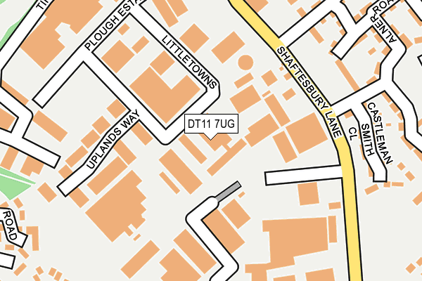
DT11 7UG lies on Blandford Heights in Blandford Forum. DT11 7UG is located in the Blandford electoral ward, within the unitary authority of Dorset and the English Parliamentary constituency of North Dorset. The Sub Integrated Care Board (ICB) Location is NHS Dorset ICB - 11J and the police force is Dorset. This postcode has been in use since October 1984.


GetTheData
Source: OS OpenMap – Local (Ordnance Survey)
Source: OS VectorMap District (Ordnance Survey)
Licence: Open Government Licence (requires attribution)
| Easting | 388958 |
| Northing | 107698 |
| Latitude | 50.868677 |
| Longitude | -2.158284 |
GetTheData
Source: Open Postcode Geo
Licence: Open Government Licence
| Street | Blandford Heights |
| Town/City | Blandford Forum |
| Country | England |
| Postcode District | DT11 |
➜ See where DT11 is on a map ➜ Where is Blandford Forum? | |
GetTheData
Source: Land Registry Price Paid Data
Licence: Open Government Licence
Elevation or altitude of DT11 7UG as distance above sea level:
| Metres | Feet | |
|---|---|---|
| Elevation | 80m | 262ft |
Elevation is measured from the approximate centre of the postcode, to the nearest point on an OS contour line from OS Terrain 50, which has contour spacing of ten vertical metres.
➜ How high above sea level am I? Find the elevation of your current position using your device's GPS.
GetTheData
Source: Open Postcode Elevation
Licence: Open Government Licence
| Ward | Blandford |
| Constituency | North Dorset |
GetTheData
Source: ONS Postcode Database
Licence: Open Government Licence
| Lady Baden Powell Way (Shaftesbury Lane) | Blandford Forum | 176m |
| Gurkha Road Bottom (Gurkha Road) | Blandford Forum | 190m |
| Industrial Estate | Blandford Forum | 278m |
| Industrial Estate | Blandford Forum | 288m |
| Hinton Close (Holland Way) | Blandford Forum | 407m |
GetTheData
Source: NaPTAN
Licence: Open Government Licence
Estimated total energy consumption in DT11 7UG by fuel type, 2015.
| Consumption (kWh) | 98,083 |
|---|---|
| Meter count | 6 |
| Mean (kWh/meter) | 16,347 |
| Median (kWh/meter) | 9,933 |
GetTheData
Source: Postcode level gas estimates: 2015 (experimental)
Source: Postcode level electricity estimates: 2015 (experimental)
Licence: Open Government Licence
GetTheData
Source: ONS Postcode Database
Licence: Open Government Licence


➜ Get more ratings from the Food Standards Agency
GetTheData
Source: Food Standards Agency
Licence: FSA terms & conditions
| Last Collection | |||
|---|---|---|---|
| Location | Mon-Fri | Sat | Distance |
| Blandford Heights Ind Est | 17:15 | 11:00 | 219m |
| Queens Road | 16:00 | 11:30 | 685m |
| Sunrise Park | 17:45 | 11:00 | 712m |
GetTheData
Source: Dracos
Licence: Creative Commons Attribution-ShareAlike
The below table lists the International Territorial Level (ITL) codes (formerly Nomenclature of Territorial Units for Statistics (NUTS) codes) and Local Administrative Units (LAU) codes for DT11 7UG:
| ITL 1 Code | Name |
|---|---|
| TLK | South West (England) |
| ITL 2 Code | Name |
| TLK2 | Dorset and Somerset |
| ITL 3 Code | Name |
| TLK25 | Dorset |
| LAU 1 Code | Name |
| E06000059 | Dorset |
GetTheData
Source: ONS Postcode Directory
Licence: Open Government Licence
The below table lists the Census Output Area (OA), Lower Layer Super Output Area (LSOA), and Middle Layer Super Output Area (MSOA) for DT11 7UG:
| Code | Name | |
|---|---|---|
| OA | E00171764 | |
| LSOA | E01020436 | North Dorset 007B |
| MSOA | E02004261 | North Dorset 007 |
GetTheData
Source: ONS Postcode Directory
Licence: Open Government Licence
| DT11 7TE | Blandford Heights | 147m |
| DT11 7UZ | Uplands Park | 178m |
| DT11 7XN | Castleman Smith Close | 246m |
| DT11 7TD | Clump Farm Industrial Estate | 290m |
| DT11 7YD | Cobham Road | 292m |
| DT11 7FJ | Alner Road | 299m |
| DT11 7RP | Liddington Crescent | 302m |
| DT11 7UN | Eastleaze Road | 339m |
| DT11 7XS | Hill Road | 341m |
| DT11 7UW | Jubilee Way | 354m |
GetTheData
Source: Open Postcode Geo; Land Registry Price Paid Data
Licence: Open Government Licence