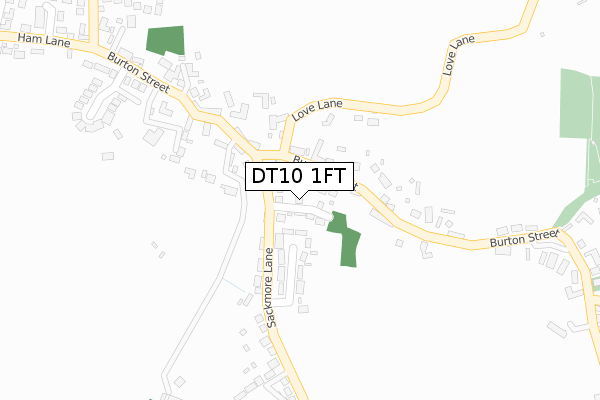
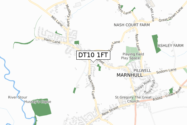
DT10 1FT is located in the Stalbridge & Marnhull electoral ward, within the unitary authority of Dorset and the English Parliamentary constituency of North Dorset. The Sub Integrated Care Board (ICB) Location is NHS Dorset ICB - 11J and the police force is Dorset. This postcode has been in use since November 2019.


GetTheData
Source: OS Open Zoomstack (Ordnance Survey)
Licence: Open Government Licence (requires attribution)
Attribution: Contains OS data © Crown copyright and database right 2025
Source: Open Postcode Geo
Licence: Open Government Licence (requires attribution)
Attribution: Contains OS data © Crown copyright and database right 2025; Contains Royal Mail data © Royal Mail copyright and database right 2025; Source: Office for National Statistics licensed under the Open Government Licence v.3.0
| Easting | 377610 |
| Northing | 119240 |
| Latitude | 50.972128 |
| Longitude | -2.320254 |
GetTheData
Source: Open Postcode Geo
Licence: Open Government Licence
| Country | England |
| Postcode District | DT10 |
➜ See where DT10 is on a map ➜ Where is Marnhull? | |
GetTheData
Source: Land Registry Price Paid Data
Licence: Open Government Licence
| Ward | Stalbridge & Marnhull |
| Constituency | North Dorset |
GetTheData
Source: ONS Postcode Database
Licence: Open Government Licence
2022 16 MAY £660,000 |
4, CHESTNUT CLOSE, MARNHULL, STURMINSTER NEWTON, DT10 1FT 2021 30 APR £510,000 |
5, CHESTNUT CLOSE, MARNHULL, STURMINSTER NEWTON, DT10 1FT 2020 14 DEC £550,000 |
2020 13 NOV £610,000 |
3, CHESTNUT CLOSE, MARNHULL, STURMINSTER NEWTON, DT10 1FT 2020 29 OCT £640,000 |
2, CHESTNUT CLOSE, MARNHULL, STURMINSTER NEWTON, DT10 1FT 2020 28 OCT £695,000 |
1, CHESTNUT CLOSE, MARNHULL, STURMINSTER NEWTON, DT10 1FT 2020 8 OCT £495,000 |
GetTheData
Source: HM Land Registry Price Paid Data
Licence: Contains HM Land Registry data © Crown copyright and database right 2025. This data is licensed under the Open Government Licence v3.0.
| Sackmore Lane Top (Sackmore Lane) | Hains | 93m |
| Sackmore Lane Top (Burton Street) | Hains | 98m |
| Sackmore Lane Top (Burton Street) | Hains | 108m |
| Post Office (Burton Street) | Marnhull | 234m |
| Post Office (Burton Street) | Marnhull | 251m |
GetTheData
Source: NaPTAN
Licence: Open Government Licence
GetTheData
Source: ONS Postcode Database
Licence: Open Government Licence


➜ Get more ratings from the Food Standards Agency
GetTheData
Source: Food Standards Agency
Licence: FSA terms & conditions
| Last Collection | |||
|---|---|---|---|
| Location | Mon-Fri | Sat | Distance |
| Todber | 12:15 | 10:30 | 2,555m |
| Little Kington | 16:30 | 08:15 | 3,772m |
| Dover Street | 16:15 | 10:15 | 3,854m |
GetTheData
Source: Dracos
Licence: Creative Commons Attribution-ShareAlike
The below table lists the International Territorial Level (ITL) codes (formerly Nomenclature of Territorial Units for Statistics (NUTS) codes) and Local Administrative Units (LAU) codes for DT10 1FT:
| ITL 1 Code | Name |
|---|---|
| TLK | South West (England) |
| ITL 2 Code | Name |
| TLK2 | Dorset and Somerset |
| ITL 3 Code | Name |
| TLK25 | Dorset |
| LAU 1 Code | Name |
| E06000059 | Dorset |
GetTheData
Source: ONS Postcode Directory
Licence: Open Government Licence
The below table lists the Census Output Area (OA), Lower Layer Super Output Area (LSOA), and Middle Layer Super Output Area (MSOA) for DT10 1FT:
| Code | Name | |
|---|---|---|
| OA | E00103641 | |
| LSOA | E01020449 | North Dorset 004C |
| MSOA | E02004258 | North Dorset 004 |
GetTheData
Source: ONS Postcode Directory
Licence: Open Government Licence
| DT10 1PW | Sackmore Green | 101m |
| DT10 1PP | Burton Street | 157m |
| DT10 1PN | Sackmore Lane | 166m |
| DT10 1PT | Love Lane | 180m |
| DT10 1PS | Burton Street | 196m |
| DT10 1PH | Burton Street | 256m |
| DT10 1PL | Sackmore Lane | 325m |
| DT10 1JL | Lovells Mead | 350m |
| DT10 1PR | Burtonhayes | 359m |
| DT10 1JJ | Burton Street | 376m |
GetTheData
Source: Open Postcode Geo; Land Registry Price Paid Data
Licence: Open Government Licence