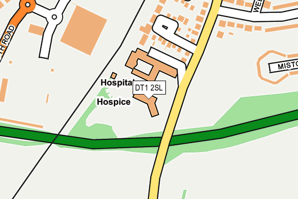
DT1 2SL is located in the Dorchester East electoral ward, within the unitary authority of Dorset and the English Parliamentary constituency of West Dorset. The Sub Integrated Care Board (ICB) Location is NHS Dorset ICB - 11J and the police force is Dorset. This postcode has been in use since May 1994.


GetTheData
Source: OS OpenMap – Local (Ordnance Survey)
Source: OS VectorMap District (Ordnance Survey)
Licence: Open Government Licence (requires attribution)
| Easting | 368873 |
| Northing | 89073 |
| Latitude | 50.700450 |
| Longitude | -2.442114 |
GetTheData
Source: Open Postcode Geo
Licence: Open Government Licence
| Country | England |
| Postcode District | DT1 |
➜ See where DT1 is on a map ➜ Where is Dorchester? | |
GetTheData
Source: Land Registry Price Paid Data
Licence: Open Government Licence
Elevation or altitude of DT1 2SL as distance above sea level:
| Metres | Feet | |
|---|---|---|
| Elevation | 70m | 230ft |
Elevation is measured from the approximate centre of the postcode, to the nearest point on an OS contour line from OS Terrain 50, which has contour spacing of ten vertical metres.
➜ How high above sea level am I? Find the elevation of your current position using your device's GPS.
GetTheData
Source: Open Postcode Elevation
Licence: Open Government Licence
| Ward | Dorchester East |
| Constituency | West Dorset |
GetTheData
Source: ONS Postcode Database
Licence: Open Government Licence
| P&r (Stadium Car Park) | Dorchester | 195m |
| Tesco Pick Up Point (Weymouth Road) | Dorchester | 238m |
| Tesco Stores (Weymouth Avenue) | Dorchester | 345m |
| Mellstock Avenue | Dorchester | 365m |
| Mellstock Avenue | Dorchester | 370m |
| Dorchester South Station | 1km |
| Dorchester West Station | 1.2km |
GetTheData
Source: NaPTAN
Licence: Open Government Licence
GetTheData
Source: ONS Postcode Database
Licence: Open Government Licence


➜ Get more ratings from the Food Standards Agency
GetTheData
Source: Food Standards Agency
Licence: FSA terms & conditions
| Last Collection | |||
|---|---|---|---|
| Location | Mon-Fri | Sat | Distance |
| Melstock Ave | 17:30 | 11:30 | 435m |
| Herrington Road | 17:00 | 11:30 | 550m |
| Winterborne Herringstone | 13:30 | 09:00 | 967m |
GetTheData
Source: Dracos
Licence: Creative Commons Attribution-ShareAlike
The below table lists the International Territorial Level (ITL) codes (formerly Nomenclature of Territorial Units for Statistics (NUTS) codes) and Local Administrative Units (LAU) codes for DT1 2SL:
| ITL 1 Code | Name |
|---|---|
| TLK | South West (England) |
| ITL 2 Code | Name |
| TLK2 | Dorset and Somerset |
| ITL 3 Code | Name |
| TLK25 | Dorset |
| LAU 1 Code | Name |
| E06000059 | Dorset |
GetTheData
Source: ONS Postcode Directory
Licence: Open Government Licence
The below table lists the Census Output Area (OA), Lower Layer Super Output Area (LSOA), and Middle Layer Super Output Area (MSOA) for DT1 2SL:
| Code | Name | |
|---|---|---|
| OA | E00104079 | |
| LSOA | E01020525 | West Dorset 010F |
| MSOA | E02004278 | West Dorset 010 |
GetTheData
Source: ONS Postcode Directory
Licence: Open Government Licence
| DT1 2JT | Durberville Close | 124m |
| DT1 2JS | Eldridge Close | 241m |
| DT1 2BT | Herringston Road | 263m |
| DT1 2EQ | Mistover Close | 295m |
| DT1 2BE | Mellstock Avenue | 320m |
| DT1 2BU | Farringdon Close | 342m |
| DT1 2BJ | Wellbridge Close | 355m |
| DT1 2TQ | Remus Close | 361m |
| DT1 2QY | Diana Close | 384m |
| DT1 2QJ | Celtic Crescent | 407m |
GetTheData
Source: Open Postcode Geo; Land Registry Price Paid Data
Licence: Open Government Licence