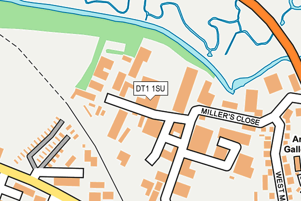
DT1 1SU is located in the Dorchester West electoral ward, within the unitary authority of Dorset and the English Parliamentary constituency of West Dorset. The Sub Integrated Care Board (ICB) Location is NHS Dorset ICB - 11J and the police force is Dorset. This postcode has been in use since December 2000.


GetTheData
Source: OS OpenMap – Local (Ordnance Survey)
Source: OS VectorMap District (Ordnance Survey)
Licence: Open Government Licence (requires attribution)
| Easting | 368551 |
| Northing | 91084 |
| Latitude | 50.718516 |
| Longitude | -2.446846 |
GetTheData
Source: Open Postcode Geo
Licence: Open Government Licence
| Country | England |
| Postcode District | DT1 |
➜ See where DT1 is on a map ➜ Where is Dorchester? | |
GetTheData
Source: Land Registry Price Paid Data
Licence: Open Government Licence
Elevation or altitude of DT1 1SU as distance above sea level:
| Metres | Feet | |
|---|---|---|
| Elevation | 70m | 230ft |
Elevation is measured from the approximate centre of the postcode, to the nearest point on an OS contour line from OS Terrain 50, which has contour spacing of ten vertical metres.
➜ How high above sea level am I? Find the elevation of your current position using your device's GPS.
GetTheData
Source: Open Postcode Elevation
Licence: Open Government Licence
| Ward | Dorchester West |
| Constituency | West Dorset |
GetTheData
Source: ONS Postcode Database
Licence: Open Government Licence
| Railway Triangle Industrial Estate (Poundbury Road) | Dorchester | 282m |
| Lidl Supermarket (The Grove) | Dorchester | 334m |
| Lidl Supermarket (The Grove) | Dorchester | 339m |
| Malta Close (Normandy Way) | Dorchester | 480m |
| Dorset County Hospital | Dorchester | 507m |
| Dorchester West Station | 0.9km |
| Dorchester South Station | 1.2km |
GetTheData
Source: NaPTAN
Licence: Open Government Licence
GetTheData
Source: ONS Postcode Database
Licence: Open Government Licence


➜ Get more ratings from the Food Standards Agency
GetTheData
Source: Food Standards Agency
Licence: FSA terms & conditions
| Last Collection | |||
|---|---|---|---|
| Location | Mon-Fri | Sat | Distance |
| Dorchester Delivery Office | 18:30 | 13:00 | 556m |
| High West Street | 17:30 | 11:30 | 593m |
| Celtic Crescent | 17:30 | 11:30 | 601m |
GetTheData
Source: Dracos
Licence: Creative Commons Attribution-ShareAlike
The below table lists the International Territorial Level (ITL) codes (formerly Nomenclature of Territorial Units for Statistics (NUTS) codes) and Local Administrative Units (LAU) codes for DT1 1SU:
| ITL 1 Code | Name |
|---|---|
| TLK | South West (England) |
| ITL 2 Code | Name |
| TLK2 | Dorset and Somerset |
| ITL 3 Code | Name |
| TLK25 | Dorset |
| LAU 1 Code | Name |
| E06000059 | Dorset |
GetTheData
Source: ONS Postcode Directory
Licence: Open Government Licence
The below table lists the Census Output Area (OA), Lower Layer Super Output Area (LSOA), and Middle Layer Super Output Area (MSOA) for DT1 1SU:
| Code | Name | |
|---|---|---|
| OA | E00104057 | |
| LSOA | E01032643 | West Dorset 009G |
| MSOA | E02004277 | West Dorset 009 |
GetTheData
Source: ONS Postcode Directory
Licence: Open Government Licence
| DT1 2PJ | Railway Triangle Industrial Estate | 198m |
| DT1 1SS | Millers Close | 199m |
| DT1 1SP | West Mills Road | 303m |
| DT1 1AH | Little Keep Gate | 304m |
| DT1 1SR | West Mills Road | 318m |
| DT1 2PF | Prospect Road | 336m |
| DT1 1XL | The Grove | 338m |
| DT1 2PG | Bridport Road | 342m |
| DT1 1XP | The Grove | 345m |
| DT1 2PN | Poundbury Road | 381m |
GetTheData
Source: Open Postcode Geo; Land Registry Price Paid Data
Licence: Open Government Licence