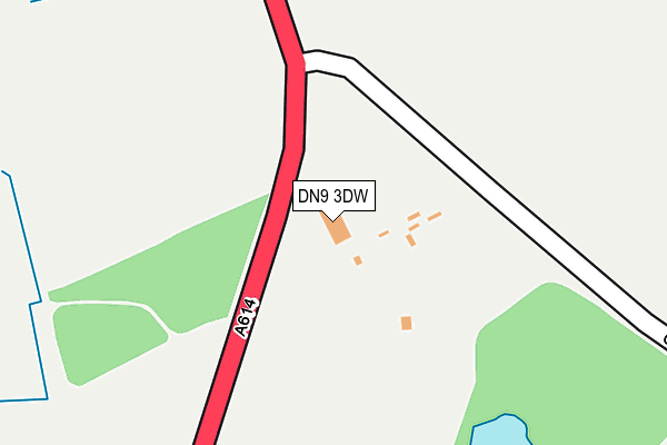
DN9 3DW is located in the Finningley electoral ward, within the metropolitan district of Doncaster and the English Parliamentary constituency of Don Valley. The Sub Integrated Care Board (ICB) Location is NHS South Yorkshire ICB - 02X and the police force is South Yorkshire. This postcode has been in use since January 1980.


GetTheData
Source: OS OpenMap – Local (Ordnance Survey)
Source: OS VectorMap District (Ordnance Survey)
Licence: Open Government Licence (requires attribution)
| Easting | 467765 |
| Northing | 398658 |
| Latitude | 53.480292 |
| Longitude | -0.980361 |
GetTheData
Source: Open Postcode Geo
Licence: Open Government Licence
| Country | England |
| Postcode District | DN9 |
➜ See where DN9 is on a map | |
GetTheData
Source: Land Registry Price Paid Data
Licence: Open Government Licence
Elevation or altitude of DN9 3DW as distance above sea level:
| Metres | Feet | |
|---|---|---|
| Elevation | 10m | 33ft |
Elevation is measured from the approximate centre of the postcode, to the nearest point on an OS contour line from OS Terrain 50, which has contour spacing of ten vertical metres.
➜ How high above sea level am I? Find the elevation of your current position using your device's GPS.
GetTheData
Source: Open Postcode Elevation
Licence: Open Government Licence
| Ward | Finningley |
| Constituency | Don Valley |
GetTheData
Source: ONS Postcode Database
Licence: Open Government Licence
| Bawtry Road (Wroot Road) | Finningley | 704m |
| Bawtry Road (Wroot Road) | Finningley | 713m |
| The Green (Doncaster Road) | Finningley | 774m |
| Elm Drive (Wroot Road) | Finningley | 789m |
| Lindley Road (Doncaster Road) | Finningley | 862m |
GetTheData
Source: NaPTAN
Licence: Open Government Licence
GetTheData
Source: ONS Postcode Database
Licence: Open Government Licence


➜ Get more ratings from the Food Standards Agency
GetTheData
Source: Food Standards Agency
Licence: FSA terms & conditions
| Last Collection | |||
|---|---|---|---|
| Location | Mon-Fri | Sat | Distance |
| Finningley P.o. | 16:45 | 10:00 | 1,034m |
| Blaxton Cross Roads | 17:15 | 10:00 | 1,842m |
| Summerfield Drive | 17:15 | 08:15 | 2,016m |
GetTheData
Source: Dracos
Licence: Creative Commons Attribution-ShareAlike
The below table lists the International Territorial Level (ITL) codes (formerly Nomenclature of Territorial Units for Statistics (NUTS) codes) and Local Administrative Units (LAU) codes for DN9 3DW:
| ITL 1 Code | Name |
|---|---|
| TLE | Yorkshire and The Humber |
| ITL 2 Code | Name |
| TLE3 | South Yorkshire |
| ITL 3 Code | Name |
| TLE31 | Barnsley, Doncaster and Rotherham |
| LAU 1 Code | Name |
| E08000017 | Doncaster |
GetTheData
Source: ONS Postcode Directory
Licence: Open Government Licence
The below table lists the Census Output Area (OA), Lower Layer Super Output Area (LSOA), and Middle Layer Super Output Area (MSOA) for DN9 3DW:
| Code | Name | |
|---|---|---|
| OA | E00038555 | |
| LSOA | E01007602 | Doncaster 026D |
| MSOA | E02001564 | Doncaster 026 |
GetTheData
Source: ONS Postcode Directory
Licence: Open Government Licence
| DN9 3PJ | Croft Court | 594m |
| DN9 3RA | Ashley Court | 645m |
| DN9 3GL | Madison Court | 659m |
| DN9 3EQ | Silver Birch Grove | 663m |
| DN9 3FB | Manor Farm Court | 667m |
| DN9 3EG | Elm Drive | 686m |
| DN9 3DP | Wroot Road | 711m |
| DN9 3BP | The Green | 718m |
| DN9 3DN | Wroot Road | 735m |
| DN9 3TA | Frobisher Grange | 745m |
GetTheData
Source: Open Postcode Geo; Land Registry Price Paid Data
Licence: Open Government Licence