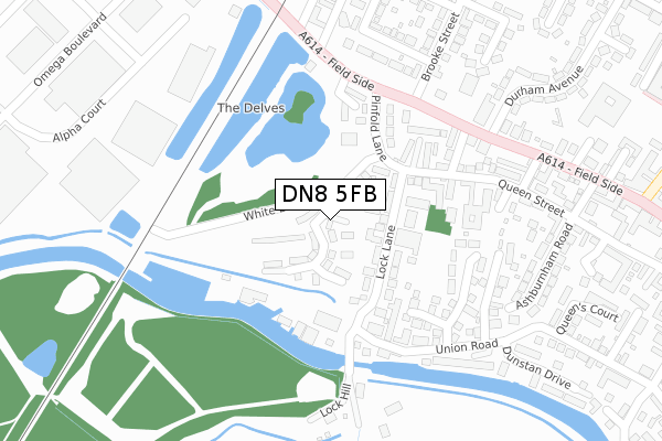
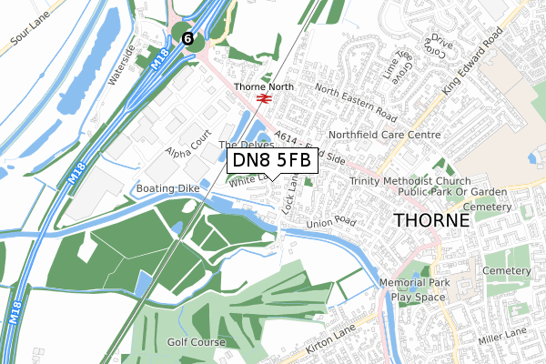
DN8 5FB is located in the Thorne & Moorends electoral ward, within the metropolitan district of Doncaster and the English Parliamentary constituency of Don Valley. The Sub Integrated Care Board (ICB) Location is NHS South Yorkshire ICB - 02X and the police force is South Yorkshire. This postcode has been in use since November 2019.


GetTheData
Source: OS Open Zoomstack (Ordnance Survey)
Licence: Open Government Licence (requires attribution)
Attribution: Contains OS data © Crown copyright and database right 2025
Source: Open Postcode Geo
Licence: Open Government Licence (requires attribution)
Attribution: Contains OS data © Crown copyright and database right 2025; Contains Royal Mail data © Royal Mail copyright and database right 2025; Source: Office for National Statistics licensed under the Open Government Licence v.3.0
| Easting | 468017 |
| Northing | 413367 |
| Latitude | 53.612468 |
| Longitude | -0.973376 |
GetTheData
Source: Open Postcode Geo
Licence: Open Government Licence
| Country | England |
| Postcode District | DN8 |
➜ See where DN8 is on a map ➜ Where is Thorne? | |
GetTheData
Source: Land Registry Price Paid Data
Licence: Open Government Licence
| Ward | Thorne & Moorends |
| Constituency | Don Valley |
GetTheData
Source: ONS Postcode Database
Licence: Open Government Licence
| Lakeside Mews (Field Side) | Thorne | 284m |
| Thorne North Station (Field Side) | Thorne | 301m |
| Thorne North Station (Selby Road) | Thorne | 342m |
| Foundry Lane (Field Side) | Thorne | 389m |
| Durham Avenue (Field Side) | Thorne | 426m |
| Thorne North Station | 0.4km |
| Thorne South Station | 1.6km |
| Hatfield & Stainforth Station | 4.2km |
GetTheData
Source: NaPTAN
Licence: Open Government Licence
GetTheData
Source: ONS Postcode Database
Licence: Open Government Licence


➜ Get more ratings from the Food Standards Agency
GetTheData
Source: Food Standards Agency
Licence: FSA terms & conditions
| Last Collection | |||
|---|---|---|---|
| Location | Mon-Fri | Sat | Distance |
| Brook Street | 17:00 | 10:00 | 373m |
| Omega Boulevard | 17:30 | 429m | |
| Thorne Post Office | 17:15 | 11:00 | 698m |
GetTheData
Source: Dracos
Licence: Creative Commons Attribution-ShareAlike
| Risk of DN8 5FB flooding from rivers and sea | Medium |
| ➜ DN8 5FB flood map | |
GetTheData
Source: Open Flood Risk by Postcode
Licence: Open Government Licence
The below table lists the International Territorial Level (ITL) codes (formerly Nomenclature of Territorial Units for Statistics (NUTS) codes) and Local Administrative Units (LAU) codes for DN8 5FB:
| ITL 1 Code | Name |
|---|---|
| TLE | Yorkshire and The Humber |
| ITL 2 Code | Name |
| TLE3 | South Yorkshire |
| ITL 3 Code | Name |
| TLE31 | Barnsley, Doncaster and Rotherham |
| LAU 1 Code | Name |
| E08000017 | Doncaster |
GetTheData
Source: ONS Postcode Directory
Licence: Open Government Licence
The below table lists the Census Output Area (OA), Lower Layer Super Output Area (LSOA), and Middle Layer Super Output Area (MSOA) for DN8 5FB:
| Code | Name | |
|---|---|---|
| OA | E00038680 | |
| LSOA | E01007640 | Doncaster 003E |
| MSOA | E02001541 | Doncaster 003 |
GetTheData
Source: ONS Postcode Directory
Licence: Open Government Licence
| DN8 5ET | Lock Lane | 167m |
| DN8 5EX | Pinfold Lane | 245m |
| DN8 5EP | Lock Hill | 270m |
| DN8 5UL | Windlass Close | 273m |
| DN8 4AA | Lakeside Mews | 276m |
| DN8 5AQ | Queen Street | 287m |
| DN8 5AH | Godfrey Road | 304m |
| DN8 5UN | Capstan Way | 316m |
| DN8 5AG | Rope Walk | 316m |
| DN8 4BD | Fieldside | 320m |
GetTheData
Source: Open Postcode Geo; Land Registry Price Paid Data
Licence: Open Government Licence