DN8 4FE maps, stats, and open data
DN8 4FE is located in the Thorne & Moorends electoral ward, within the metropolitan district of Doncaster and the English Parliamentary constituency of Don Valley. The Sub Integrated Care Board (ICB) Location is NHS South Yorkshire ICB - 02X and the police force is South Yorkshire. This postcode has been in use since July 2018.
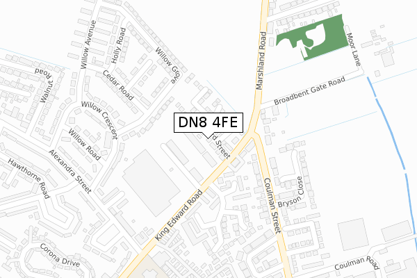
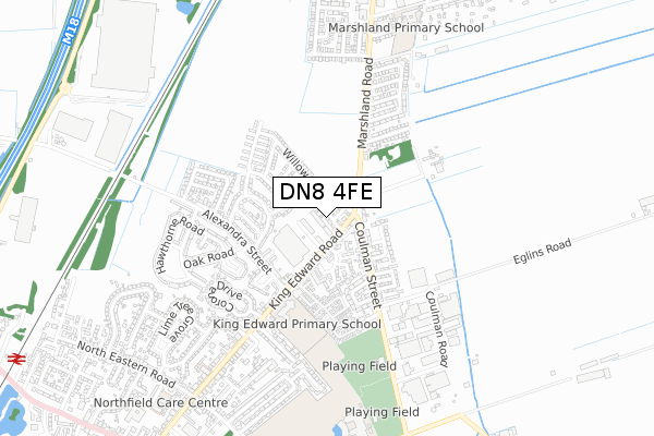
DN8 4FE maps


Licence: Open Government Licence (requires attribution)
Attribution: Contains OS data © Crown copyright and database right 2025
Source: Open Postcode Geo
Licence: Open Government Licence (requires attribution)
Attribution: Contains OS data © Crown copyright and database right 2025; Contains Royal Mail data © Royal Mail copyright and database right 2025; Source: Office for National Statistics licensed under the Open Government Licence v.3.0
DN8 4FE geodata
| Easting | 469250 |
| Northing | 414336 |
| Latitude | 53.621015 |
| Longitude | -0.954527 |
Where is DN8 4FE?
| Country | England |
| Postcode District | DN8 |
Politics
| Ward | Thorne & Moorends |
|---|---|
| Constituency | Don Valley |
House Prices
Sales of detached houses in DN8 4FE
2021 15 OCT £210,000 |
29, OXFORD STREET, THORNE, DONCASTER, DN8 4FE 2020 4 DEC £144,995 |
25, OXFORD STREET, THORNE, DONCASTER, DN8 4FE 2020 30 OCT £139,995 |
27, OXFORD STREET, THORNE, DONCASTER, DN8 4FE 2020 4 SEP £157,995 |
35, OXFORD STREET, THORNE, DONCASTER, DN8 4FE 2020 30 JUL £128,995 |
2019 20 DEC £169,995 |
Licence: Contains HM Land Registry data © Crown copyright and database right 2025. This data is licensed under the Open Government Licence v3.0.
Transport
Nearest bus stops to DN8 4FE
| Coulman Street (King Edward Road) | Thorne | 83m |
| Kings Court Road (King Edward Road) | Thorne | 97m |
| Cedar Road (Willow Grove) | Thorne | 147m |
| Cedar Road (Willow Grove) | Thorne | 162m |
| Alexandra Street (King Edward Road) | Thorne | 396m |
Nearest railway stations to DN8 4FE
| Thorne North Station | 1.3km |
| Thorne South Station | 2km |
| Hatfield & Stainforth Station | 5.8km |
Broadband
Broadband access in DN8 4FE (2020 data)
| Percentage of properties with Next Generation Access | 100.0% |
| Percentage of properties with Superfast Broadband | 100.0% |
| Percentage of properties with Ultrafast Broadband | 0.0% |
| Percentage of properties with Full Fibre Broadband | 0.0% |
Superfast Broadband is between 30Mbps and 300Mbps
Ultrafast Broadband is > 300Mbps
Broadband speed in DN8 4FE (2019 data)
Download
| Median download speed | 17.9Mbps |
| Average download speed | 29.2Mbps |
| Maximum download speed | 55.00Mbps |
Upload
| Median upload speed | 1.1Mbps |
| Average upload speed | 4.0Mbps |
| Maximum upload speed | 10.00Mbps |
Broadband limitations in DN8 4FE (2020 data)
| Percentage of properties unable to receive 2Mbps | 0.0% |
| Percentage of properties unable to receive 5Mbps | 0.0% |
| Percentage of properties unable to receive 10Mbps | 0.0% |
| Percentage of properties unable to receive 30Mbps | 0.0% |
Deprivation
87.8% of English postcodes are less deprived than DN8 4FE:Food Standards Agency
Three nearest food hygiene ratings to DN8 4FE (metres)


➜ Get more ratings from the Food Standards Agency
Nearest post box to DN8 4FE
| Last Collection | |||
|---|---|---|---|
| Location | Mon-Fri | Sat | Distance |
| Alexandrs Street | 16:45 | 10:00 | 340m |
| Northfield Post Office | 16:45 | 10:00 | 430m |
| Coulman Road | 16:30 | 08:00 | 698m |
Environment
| Risk of DN8 4FE flooding from rivers and sea | Medium |
DN8 4FE ITL and DN8 4FE LAU
The below table lists the International Territorial Level (ITL) codes (formerly Nomenclature of Territorial Units for Statistics (NUTS) codes) and Local Administrative Units (LAU) codes for DN8 4FE:
| ITL 1 Code | Name |
|---|---|
| TLE | Yorkshire and The Humber |
| ITL 2 Code | Name |
| TLE3 | South Yorkshire |
| ITL 3 Code | Name |
| TLE31 | Barnsley, Doncaster and Rotherham |
| LAU 1 Code | Name |
| E08000017 | Doncaster |
DN8 4FE census areas
The below table lists the Census Output Area (OA), Lower Layer Super Output Area (LSOA), and Middle Layer Super Output Area (MSOA) for DN8 4FE:
| Code | Name | |
|---|---|---|
| OA | E00038664 | |
| LSOA | E01007635 | Doncaster 001D |
| MSOA | E02001539 | Doncaster 001 |
Nearest postcodes to DN8 4FE
| DN8 4HX | The Poplars | 107m |
| DN8 4EQ | Willow Grove | 112m |
| DN8 4HU | King Edward Road | 145m |
| DN8 4LB | James Court | 151m |
| DN8 4RP | Marshland Road | 151m |
| DN8 4LA | Kings Court Road | 177m |
| DN8 4RR | Broadbent Gate Road | 182m |
| DN8 5JR | Coulman Street | 206m |
| DN8 4LE | Edward Court | 218m |
| DN8 4EG | Willow Crescent | 224m |