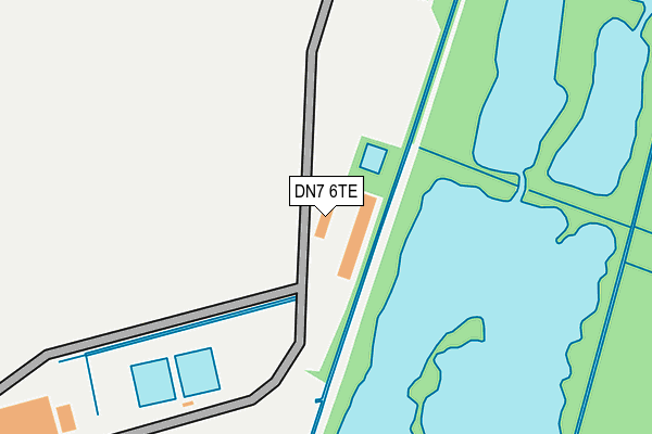
DN7 6TE is located in the Hatfield electoral ward, within the metropolitan district of Doncaster and the English Parliamentary constituency of Don Valley. The Sub Integrated Care Board (ICB) Location is NHS South Yorkshire ICB - 02X and the police force is South Yorkshire. This postcode has been in use since June 1999.


GetTheData
Source: OS OpenMap – Local (Ordnance Survey)
Source: OS VectorMap District (Ordnance Survey)
Licence: Open Government Licence (requires attribution)
| Easting | 468983 |
| Northing | 406375 |
| Latitude | 53.549486 |
| Longitude | -0.960315 |
GetTheData
Source: Open Postcode Geo
Licence: Open Government Licence
| Country | England |
| Postcode District | DN7 |
➜ See where DN7 is on a map | |
GetTheData
Source: Land Registry Price Paid Data
Licence: Open Government Licence
Elevation or altitude of DN7 6TE as distance above sea level:
| Metres | Feet | |
|---|---|---|
| Elevation | 10m | 33ft |
Elevation is measured from the approximate centre of the postcode, to the nearest point on an OS contour line from OS Terrain 50, which has contour spacing of ten vertical metres.
➜ How high above sea level am I? Find the elevation of your current position using your device's GPS.
GetTheData
Source: Open Postcode Elevation
Licence: Open Government Licence
| Ward | Hatfield |
| Constituency | Don Valley |
GetTheData
Source: ONS Postcode Database
Licence: Open Government Licence
| Moorland Prison (Prison Service Road) | Lindholme | 825m |
| Hampden Crescent (Lancaster Drive) | Lindholme | 1,030m |
| Huggin Carr Road (Bawtry Road) | Lindholme | 1,053m |
| Huggin Carr Road (Bawtry Road) | Lindholme | 1,073m |
| Redhouse Park (Bawtry Road) | Lindholme | 1,124m |
| Hatfield & Stainforth Station | 6km |
GetTheData
Source: NaPTAN
Licence: Open Government Licence
GetTheData
Source: ONS Postcode Database
Licence: Open Government Licence


➜ Get more ratings from the Food Standards Agency
GetTheData
Source: Food Standards Agency
Licence: FSA terms & conditions
| Last Collection | |||
|---|---|---|---|
| Location | Mon-Fri | Sat | Distance |
| Bawtry Road | 16:30 | 08:45 | 2,311m |
| Hatfield Woodhouse P.o. | 16:30 | 09:30 | 2,589m |
| East End | 16:00 | 07:45 | 3,059m |
GetTheData
Source: Dracos
Licence: Creative Commons Attribution-ShareAlike
| Risk of DN7 6TE flooding from rivers and sea | Medium |
| ➜ DN7 6TE flood map | |
GetTheData
Source: Open Flood Risk by Postcode
Licence: Open Government Licence
The below table lists the International Territorial Level (ITL) codes (formerly Nomenclature of Territorial Units for Statistics (NUTS) codes) and Local Administrative Units (LAU) codes for DN7 6TE:
| ITL 1 Code | Name |
|---|---|
| TLE | Yorkshire and The Humber |
| ITL 2 Code | Name |
| TLE3 | South Yorkshire |
| ITL 3 Code | Name |
| TLE31 | Barnsley, Doncaster and Rotherham |
| LAU 1 Code | Name |
| E08000017 | Doncaster |
GetTheData
Source: ONS Postcode Directory
Licence: Open Government Licence
The below table lists the Census Output Area (OA), Lower Layer Super Output Area (LSOA), and Middle Layer Super Output Area (MSOA) for DN7 6TE:
| Code | Name | |
|---|---|---|
| OA | E00172382 | |
| LSOA | E01007557 | Doncaster 008B |
| MSOA | E02001546 | Doncaster 008 |
GetTheData
Source: ONS Postcode Directory
Licence: Open Government Licence
| DN7 6DQ | Hampden Crescent | 971m |
| DN7 6DP | Moor Dike Road | 982m |
| DN7 6DG | Lancaster Drive | 992m |
| DN7 6DF | Gibson Road | 1063m |
| DN7 6DE | Blenheim Road | 1100m |
| DN7 6DD | Wellington Road | 1117m |
| DN7 6DB | Wellington Road | 1124m |
| DN7 6BZ | Cunningham Road | 1135m |
| DN7 6DJ | Lincoln Road | 1181m |
| DN7 6DA | Battle Close | 1195m |
GetTheData
Source: Open Postcode Geo; Land Registry Price Paid Data
Licence: Open Government Licence