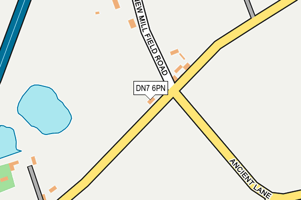
DN7 6PN is located in the Hatfield electoral ward, within the metropolitan district of Doncaster and the English Parliamentary constituency of Don Valley. The Sub Integrated Care Board (ICB) Location is NHS South Yorkshire ICB - 02X and the police force is South Yorkshire. This postcode has been in use since January 1980.


GetTheData
Source: OS OpenMap – Local (Ordnance Survey)
Source: OS VectorMap District (Ordnance Survey)
Licence: Open Government Licence (requires attribution)
| Easting | 466941 |
| Northing | 408449 |
| Latitude | 53.568409 |
| Longitude | -0.990690 |
GetTheData
Source: Open Postcode Geo
Licence: Open Government Licence
| Country | England |
| Postcode District | DN7 |
➜ See where DN7 is on a map ➜ Where is West End? | |
GetTheData
Source: Land Registry Price Paid Data
Licence: Open Government Licence
Elevation or altitude of DN7 6PN as distance above sea level:
| Metres | Feet | |
|---|---|---|
| Elevation | 10m | 33ft |
Elevation is measured from the approximate centre of the postcode, to the nearest point on an OS contour line from OS Terrain 50, which has contour spacing of ten vertical metres.
➜ How high above sea level am I? Find the elevation of your current position using your device's GPS.
GetTheData
Source: Open Postcode Elevation
Licence: Open Government Licence
| Ward | Hatfield |
| Constituency | Don Valley |
GetTheData
Source: ONS Postcode Database
Licence: Open Government Licence
| Mosscroft Lane (Cemetery Road) | Hatfield Woodhouse | 608m |
| Slay Pits Lane (Cemetery Road) | Hatfield Woodhouse | 632m |
| Dale Pit Road (Bawtry Road) | Hatfield Woodhouse | 672m |
| Churchill Avenue (Cemetery Road) | Hatfield Woodhouse | 686m |
| Dale Pit Road (Bawtry Road) | Hatfield Woodhouse | 688m |
| Hatfield & Stainforth Station | 3.1km |
| Thorne South Station | 4.5km |
GetTheData
Source: NaPTAN
Licence: Open Government Licence
GetTheData
Source: ONS Postcode Database
Licence: Open Government Licence


➜ Get more ratings from the Food Standards Agency
GetTheData
Source: Food Standards Agency
Licence: FSA terms & conditions
| Last Collection | |||
|---|---|---|---|
| Location | Mon-Fri | Sat | Distance |
| East End | 16:00 | 07:45 | 627m |
| Bawtry Road | 16:30 | 08:45 | 676m |
| Hatfield Woodhouse P.o. | 16:30 | 09:30 | 800m |
GetTheData
Source: Dracos
Licence: Creative Commons Attribution-ShareAlike
The below table lists the International Territorial Level (ITL) codes (formerly Nomenclature of Territorial Units for Statistics (NUTS) codes) and Local Administrative Units (LAU) codes for DN7 6PN:
| ITL 1 Code | Name |
|---|---|
| TLE | Yorkshire and The Humber |
| ITL 2 Code | Name |
| TLE3 | South Yorkshire |
| ITL 3 Code | Name |
| TLE31 | Barnsley, Doncaster and Rotherham |
| LAU 1 Code | Name |
| E08000017 | Doncaster |
GetTheData
Source: ONS Postcode Directory
Licence: Open Government Licence
The below table lists the Census Output Area (OA), Lower Layer Super Output Area (LSOA), and Middle Layer Super Output Area (MSOA) for DN7 6PN:
| Code | Name | |
|---|---|---|
| OA | E00038309 | |
| LSOA | E01007557 | Doncaster 008B |
| MSOA | E02001546 | Doncaster 008 |
GetTheData
Source: ONS Postcode Directory
Licence: Open Government Licence
| DN7 6PW | New Mill Field Road | 124m |
| DN7 6BD | Moss Croft Lane | 406m |
| DN7 6BN | Mosscroft Way | 415m |
| DN7 6PJ | Ancient Lane | 485m |
| DN7 6ND | Moss Croft Lane | 502m |
| DN7 6BQ | Mill Hill Road | 505m |
| DN7 6NA | Howville Avenue | 506m |
| DN7 6PL | Hale Hill Lane | 511m |
| DN7 6BG | Carr Side Lane | 561m |
| DN7 6LZ | Howville Road | 585m |
GetTheData
Source: Open Postcode Geo; Land Registry Price Paid Data
Licence: Open Government Licence