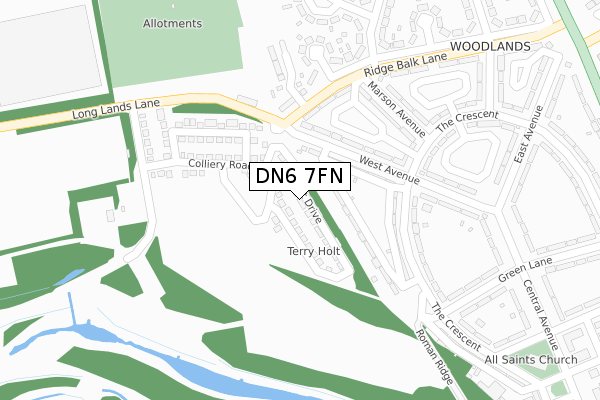
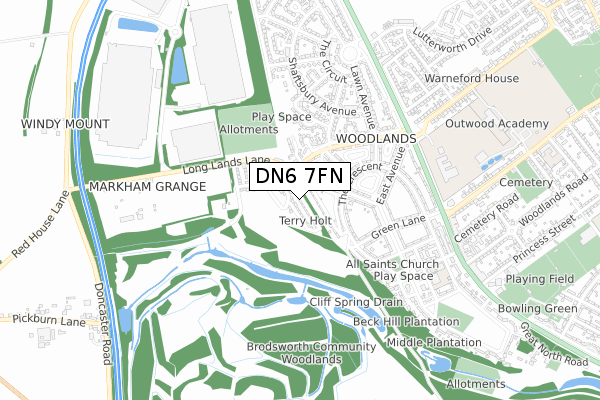
DN6 7FN is located in the Adwick le Street & Carcroft electoral ward, within the metropolitan district of Doncaster and the English Parliamentary constituency of Doncaster North. The Sub Integrated Care Board (ICB) Location is NHS South Yorkshire ICB - 02X and the police force is South Yorkshire. This postcode has been in use since September 2019.


GetTheData
Source: OS Open Zoomstack (Ordnance Survey)
Licence: Open Government Licence (requires attribution)
Attribution: Contains OS data © Crown copyright and database right 2025
Source: Open Postcode Geo
Licence: Open Government Licence (requires attribution)
Attribution: Contains OS data © Crown copyright and database right 2025; Contains Royal Mail data © Royal Mail copyright and database right 2025; Source: Office for National Statistics licensed under the Open Government Licence v.3.0
| Easting | 452767 |
| Northing | 407897 |
| Latitude | 53.565061 |
| Longitude | -1.204778 |
GetTheData
Source: Open Postcode Geo
Licence: Open Government Licence
| Country | England |
| Postcode District | DN6 |
➜ See where DN6 is on a map ➜ Where is Adwick le Street? | |
GetTheData
Source: Land Registry Price Paid Data
Licence: Open Government Licence
| Ward | Adwick Le Street & Carcroft |
| Constituency | Doncaster North |
GetTheData
Source: ONS Postcode Database
Licence: Open Government Licence
2, ANCIENT DRIVE, WOODLANDS, DONCASTER, DN6 7FN 2022 30 NOV £200,000 |
22, ANCIENT DRIVE, WOODLANDS, DONCASTER, DN6 7FN 2022 25 NOV £225,000 |
12, ANCIENT DRIVE, WOODLANDS, DONCASTER, DN6 7FN 2022 11 MAR £200,000 |
24, ANCIENT DRIVE, WOODLANDS, DONCASTER, DN6 7FN 2021 19 NOV £207,000 |
24, ANCIENT DRIVE, WOODLANDS, DONCASTER, DN6 7FN 2020 23 JUL £175,000 |
34, ANCIENT DRIVE, WOODLANDS, DONCASTER, DN6 7FN 2020 17 JUL £174,995 |
36, ANCIENT DRIVE, WOODLANDS, DONCASTER, DN6 7FN 2020 25 JUN £174,995 |
22, ANCIENT DRIVE, WOODLANDS, DONCASTER, DN6 7FN 2020 11 JUN £174,995 |
12, ANCIENT DRIVE, WOODLANDS, DONCASTER, DN6 7FN 2020 27 FEB £175,000 |
3, ANCIENT DRIVE, WOODLANDS, DONCASTER, DN6 7FN 2020 27 JAN £182,995 |
➜ Adwick le Street house prices
GetTheData
Source: HM Land Registry Price Paid Data
Licence: Contains HM Land Registry data © Crown copyright and database right 2025. This data is licensed under the Open Government Licence v3.0.
| West Avenue (The Crescent) | Woodlands | 174m |
| The Ridge (The Crescent) | Woodlands | 209m |
| Harold Avenue (The Crescent) | Woodlands | 327m |
| Osborne Avenue (Ridge Balk Lane) | Woodlands | 335m |
| The Crescent (Green Lane) | Woodlands | 350m |
| Adwick Station | 1.8km |
| Bentley (S Yorks) Station | 4.3km |
| Doncaster Station | 6.4km |
GetTheData
Source: NaPTAN
Licence: Open Government Licence
GetTheData
Source: ONS Postcode Database
Licence: Open Government Licence


➜ Get more ratings from the Food Standards Agency
GetTheData
Source: Food Standards Agency
Licence: FSA terms & conditions
| Last Collection | |||
|---|---|---|---|
| Location | Mon-Fri | Sat | Distance |
| Central Avenue | 17:15 | 09:00 | 325m |
| The Circuit | 17:15 | 08:30 | 625m |
| Woodlands Post Office | 17:15 | 11:30 | 725m |
GetTheData
Source: Dracos
Licence: Creative Commons Attribution-ShareAlike
The below table lists the International Territorial Level (ITL) codes (formerly Nomenclature of Territorial Units for Statistics (NUTS) codes) and Local Administrative Units (LAU) codes for DN6 7FN:
| ITL 1 Code | Name |
|---|---|
| TLE | Yorkshire and The Humber |
| ITL 2 Code | Name |
| TLE3 | South Yorkshire |
| ITL 3 Code | Name |
| TLE31 | Barnsley, Doncaster and Rotherham |
| LAU 1 Code | Name |
| E08000017 | Doncaster |
GetTheData
Source: ONS Postcode Directory
Licence: Open Government Licence
The below table lists the Census Output Area (OA), Lower Layer Super Output Area (LSOA), and Middle Layer Super Output Area (MSOA) for DN6 7FN:
| Code | Name | |
|---|---|---|
| OA | E00037842 | |
| LSOA | E01007466 | Doncaster 009C |
| MSOA | E02001547 | Doncaster 009 |
GetTheData
Source: ONS Postcode Directory
Licence: Open Government Licence
| DN6 7PF | The Ridge | 100m |
| DN6 7PA | West Avenue | 133m |
| DN6 7NR | Ridge Balk Lane | 171m |
| DN6 7PE | The Crescent | 200m |
| DN6 7NY | Marson Avenue | 206m |
| DN6 7PD | West Avenue | 239m |
| DN6 7NX | The Crescent | 274m |
| DN6 7NQ | Green Lane | 313m |
| DN6 7SX | Ridge Balk Lane | 320m |
| DN6 7NW | Central Avenue | 320m |
GetTheData
Source: Open Postcode Geo; Land Registry Price Paid Data
Licence: Open Government Licence