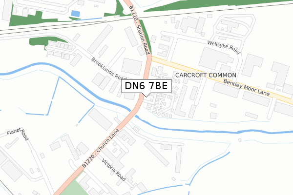
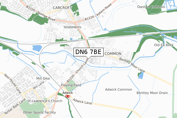
DN6 7BE is located in the Adwick le Street & Carcroft electoral ward, within the metropolitan district of Doncaster and the English Parliamentary constituency of Doncaster North. The Sub Integrated Care Board (ICB) Location is NHS South Yorkshire ICB - 02X and the police force is South Yorkshire. This postcode has been in use since October 2019.


GetTheData
Source: OS Open Zoomstack (Ordnance Survey)
Licence: Open Government Licence (requires attribution)
Attribution: Contains OS data © Crown copyright and database right 2025
Source: Open Postcode Geo
Licence: Open Government Licence (requires attribution)
Attribution: Contains OS data © Crown copyright and database right 2025; Contains Royal Mail data © Royal Mail copyright and database right 2025; Source: Office for National Statistics licensed under the Open Government Licence v.3.0
| Easting | 454739 |
| Northing | 409280 |
| Latitude | 53.577289 |
| Longitude | -1.174766 |
GetTheData
Source: Open Postcode Geo
Licence: Open Government Licence
| Country | England |
| Postcode District | DN6 |
➜ See where DN6 is on a map ➜ Where is Adwick le Street? | |
GetTheData
Source: Land Registry Price Paid Data
Licence: Open Government Licence
Elevation or altitude of DN6 7BE as distance above sea level:
| Metres | Feet | |
|---|---|---|
| Elevation | 10m | 33ft |
Elevation is measured from the approximate centre of the postcode, to the nearest point on an OS contour line from OS Terrain 50, which has contour spacing of ten vertical metres.
➜ How high above sea level am I? Find the elevation of your current position using your device's GPS.
GetTheData
Source: Open Postcode Elevation
Licence: Open Government Licence
| Ward | Adwick Le Street & Carcroft |
| Constituency | Doncaster North |
GetTheData
Source: ONS Postcode Database
Licence: Open Government Licence
| Brooklands Road (Station Road) | Adwick Le Street | 30m |
| Bentley Moor Lane (Station Road) | Adwick Le Street | 32m |
| Victoria Road (Church Lane) | Adwick Le Street | 387m |
| Victoria Road (Church Lane) | Adwick Le Street | 462m |
| Skellow Road (Owston Road) | Carcroft | 530m |
| Adwick Station | 0.7km |
| Bentley (S Yorks) Station | 4km |
GetTheData
Source: NaPTAN
Licence: Open Government Licence
GetTheData
Source: ONS Postcode Database
Licence: Open Government Licence


➜ Get more ratings from the Food Standards Agency
GetTheData
Source: Food Standards Agency
Licence: FSA terms & conditions
| Last Collection | |||
|---|---|---|---|
| Location | Mon-Fri | Sat | Distance |
| Brooklands Road | 17:00 | 09:30 | 70m |
| Carcroft Post Office | 17:00 | 10:45 | 745m |
| Adwick Post Office | 17:00 | 11:00 | 965m |
GetTheData
Source: Dracos
Licence: Creative Commons Attribution-ShareAlike
| Risk of DN6 7BE flooding from rivers and sea | Medium |
| ➜ DN6 7BE flood map | |
GetTheData
Source: Open Flood Risk by Postcode
Licence: Open Government Licence
The below table lists the International Territorial Level (ITL) codes (formerly Nomenclature of Territorial Units for Statistics (NUTS) codes) and Local Administrative Units (LAU) codes for DN6 7BE:
| ITL 1 Code | Name |
|---|---|
| TLE | Yorkshire and The Humber |
| ITL 2 Code | Name |
| TLE3 | South Yorkshire |
| ITL 3 Code | Name |
| TLE31 | Barnsley, Doncaster and Rotherham |
| LAU 1 Code | Name |
| E08000017 | Doncaster |
GetTheData
Source: ONS Postcode Directory
Licence: Open Government Licence
The below table lists the Census Output Area (OA), Lower Layer Super Output Area (LSOA), and Middle Layer Super Output Area (MSOA) for DN6 7BE:
| Code | Name | |
|---|---|---|
| OA | E00038035 | |
| LSOA | E01007504 | Doncaster 009F |
| MSOA | E02001547 | Doncaster 009 |
GetTheData
Source: ONS Postcode Directory
Licence: Open Government Licence
| DN6 7HH | James Road | 297m |
| DN6 8DE | Askern Road | 457m |
| DN6 8DB | Station Road | 458m |
| DN6 8DF | Askern Road | 493m |
| DN6 8HE | Skellow Road | 526m |
| DN6 8HD | Queens Road | 584m |
| DN6 8DL | Owston Road | 614m |
| DN6 8HQ | Skellow Road | 619m |
| DN6 8DA | Owston Road | 631m |
| DN6 8HB | Queens Road | 672m |
GetTheData
Source: Open Postcode Geo; Land Registry Price Paid Data
Licence: Open Government Licence