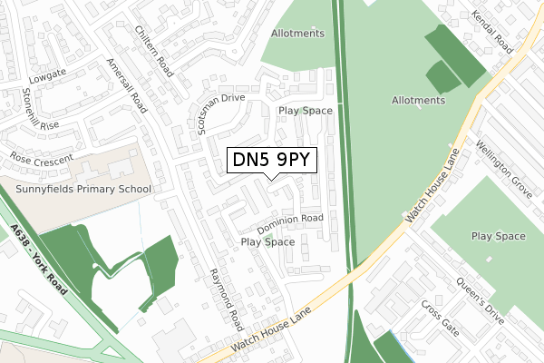
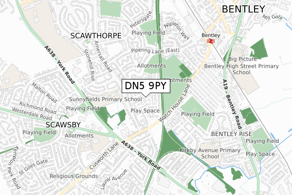
DN5 9PY is located in the Bentley electoral ward, within the metropolitan district of Doncaster and the English Parliamentary constituency of Doncaster North. The Sub Integrated Care Board (ICB) Location is NHS South Yorkshire ICB - 02X and the police force is South Yorkshire. This postcode has been in use since July 2018.


GetTheData
Source: OS Open Zoomstack (Ordnance Survey)
Licence: Open Government Licence (requires attribution)
Attribution: Contains OS data © Crown copyright and database right 2025
Source: Open Postcode Geo
Licence: Open Government Licence (requires attribution)
Attribution: Contains OS data © Crown copyright and database right 2025; Contains Royal Mail data © Royal Mail copyright and database right 2025; Source: Office for National Statistics licensed under the Open Government Licence v.3.0
| Easting | 455841 |
| Northing | 405080 |
| Latitude | 53.539426 |
| Longitude | -1.158873 |
GetTheData
Source: Open Postcode Geo
Licence: Open Government Licence
| Country | England |
| Postcode District | DN5 |
➜ See where DN5 is on a map ➜ Where is Bentley? | |
GetTheData
Source: Land Registry Price Paid Data
Licence: Open Government Licence
| Ward | Bentley |
| Constituency | Doncaster North |
GetTheData
Source: ONS Postcode Database
Licence: Open Government Licence
2023 13 DEC £260,000 |
2020 19 OCT £165,000 |
39, UNION DRIVE, DONCASTER, DN5 9PY 2020 25 SEP £184,999 |
9, UNION DRIVE, DONCASTER, DN5 9PY 2020 28 AUG £190,000 |
1, UNION DRIVE, DONCASTER, DN5 9PY 2020 29 MAY £194,999 |
3, UNION DRIVE, DONCASTER, DN5 9PY 2020 9 APR £225,999 |
5, UNION DRIVE, DONCASTER, DN5 9PY 2020 3 APR £219,999 |
7, UNION DRIVE, DONCASTER, DN5 9PY 2020 27 MAR £225,999 |
6, UNION DRIVE, DONCASTER, DN5 9PY 2020 28 FEB £192,999 |
8, UNION DRIVE, DONCASTER, DN5 9PY 2020 28 FEB £179,990 |
GetTheData
Source: HM Land Registry Price Paid Data
Licence: Contains HM Land Registry data © Crown copyright and database right 2025. This data is licensed under the Open Government Licence v3.0.
| Rose Crescent (Amersall Road) | Scawthorpe | 177m |
| Rose Crescent (Amersall Road) | Scawthorpe | 199m |
| Stonehill Rise (Amersall Road) | Scawthorpe | 316m |
| Rowan Garth (Queens Drive) | Bentley | 357m |
| Rowan Garth (Queens Drive) | Bentley | 359m |
| Bentley (S Yorks) Station | 0.7km |
| Doncaster Station | 2.3km |
| Adwick Station | 3.9km |
GetTheData
Source: NaPTAN
Licence: Open Government Licence
| Percentage of properties with Next Generation Access | 100.0% |
| Percentage of properties with Superfast Broadband | 100.0% |
| Percentage of properties with Ultrafast Broadband | 61.5% |
| Percentage of properties with Full Fibre Broadband | 0.0% |
Superfast Broadband is between 30Mbps and 300Mbps
Ultrafast Broadband is > 300Mbps
| Median download speed | 39.5Mbps |
| Average download speed | 57.0Mbps |
| Maximum download speed | 200.00Mbps |
| Median upload speed | 5.5Mbps |
| Average upload speed | 7.8Mbps |
| Maximum upload speed | 19.53Mbps |
| Percentage of properties unable to receive 2Mbps | 0.0% |
| Percentage of properties unable to receive 5Mbps | 0.0% |
| Percentage of properties unable to receive 10Mbps | 0.0% |
| Percentage of properties unable to receive 30Mbps | 0.0% |
GetTheData
Source: Ofcom
Licence: Ofcom Terms of Use (requires attribution)
GetTheData
Source: ONS Postcode Database
Licence: Open Government Licence


➜ Get more ratings from the Food Standards Agency
GetTheData
Source: Food Standards Agency
Licence: FSA terms & conditions
| Last Collection | |||
|---|---|---|---|
| Location | Mon-Fri | Sat | Distance |
| Watch House Lane | 17:15 | 11:15 | 274m |
| Queens Drive | 17:15 | 11:15 | 313m |
| Amersall Road | 17:15 | 11:15 | 327m |
GetTheData
Source: Dracos
Licence: Creative Commons Attribution-ShareAlike
The below table lists the International Territorial Level (ITL) codes (formerly Nomenclature of Territorial Units for Statistics (NUTS) codes) and Local Administrative Units (LAU) codes for DN5 9PY:
| ITL 1 Code | Name |
|---|---|
| TLE | Yorkshire and The Humber |
| ITL 2 Code | Name |
| TLE3 | South Yorkshire |
| ITL 3 Code | Name |
| TLE31 | Barnsley, Doncaster and Rotherham |
| LAU 1 Code | Name |
| E08000017 | Doncaster |
GetTheData
Source: ONS Postcode Directory
Licence: Open Government Licence
The below table lists the Census Output Area (OA), Lower Layer Super Output Area (LSOA), and Middle Layer Super Output Area (MSOA) for DN5 9PY:
| Code | Name | |
|---|---|---|
| OA | E00038079 | |
| LSOA | E01007512 | Doncaster 012A |
| MSOA | E02001550 | Doncaster 012 |
GetTheData
Source: ONS Postcode Directory
Licence: Open Government Licence
| DN5 9LJ | Stirling Lane | 52m |
| DN5 9JB | Scotsman Drive | 84m |
| DN5 9JA | Scotsman Drive | 108m |
| DN5 9LL | Butterscotch Walk | 189m |
| DN5 9LQ | Saxon Court | 207m |
| DN5 9PN | Amersall Road | 212m |
| DN5 9PP | Raymond Road | 212m |
| DN5 9PW | Amersall Road | 224m |
| DN5 9LH | Mallard Avenue | 242m |
| DN5 9LU | Watch House Lane | 261m |
GetTheData
Source: Open Postcode Geo; Land Registry Price Paid Data
Licence: Open Government Licence