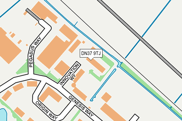
DN37 9TJ is located in the Wolds electoral ward, within the unitary authority of North East Lincolnshire and the English Parliamentary constituency of Cleethorpes. The Sub Integrated Care Board (ICB) Location is NHS Humber and North Yorkshire ICB - 03H and the police force is Humberside. This postcode has been in use since November 2005.


GetTheData
Source: OS OpenMap – Local (Ordnance Survey)
Source: OS VectorMap District (Ordnance Survey)
Licence: Open Government Licence (requires attribution)
| Easting | 523938 |
| Northing | 411598 |
| Latitude | 53.586349 |
| Longitude | -0.129194 |
GetTheData
Source: Open Postcode Geo
Licence: Open Government Licence
| Country | England |
| Postcode District | DN37 |
➜ See where DN37 is on a map ➜ Where is Grimsby? | |
GetTheData
Source: Land Registry Price Paid Data
Licence: Open Government Licence
Elevation or altitude of DN37 9TJ as distance above sea level:
| Metres | Feet | |
|---|---|---|
| Elevation | 10m | 33ft |
Elevation is measured from the approximate centre of the postcode, to the nearest point on an OS contour line from OS Terrain 50, which has contour spacing of ten vertical metres.
➜ How high above sea level am I? Find the elevation of your current position using your device's GPS.
GetTheData
Source: Open Postcode Elevation
Licence: Open Government Licence
| Ward | Wolds |
| Constituency | Cleethorpes |
GetTheData
Source: ONS Postcode Database
Licence: Open Government Licence
| Innovation Centre (Genesis Way) | Europarc | 149m |
| Pegasus Way (Genesis Way) | Europarc | 219m |
| Headland Foods (Lakeside) | Europarc | 386m |
| Lakeside | Europarc | 397m |
| Trigano House (Lakeside) | Europarc | 414m |
| Great Coates Station | 1.2km |
| Healing Station | 2.1km |
| Stallingborough Station | 3.6km |
GetTheData
Source: NaPTAN
Licence: Open Government Licence
GetTheData
Source: ONS Postcode Database
Licence: Open Government Licence


➜ Get more ratings from the Food Standards Agency
GetTheData
Source: Food Standards Agency
Licence: FSA terms & conditions
| Last Collection | |||
|---|---|---|---|
| Location | Mon-Fri | Sat | Distance |
| South Humberside Ind. Estate | 17:30 | 11:00 | 977m |
| Princess Road | 16:45 | 10:45 | 1,105m |
| Station Road | 16:00 | 11:15 | 1,494m |
GetTheData
Source: Dracos
Licence: Creative Commons Attribution-ShareAlike
| Risk of DN37 9TJ flooding from rivers and sea | Low |
| ➜ DN37 9TJ flood map | |
GetTheData
Source: Open Flood Risk by Postcode
Licence: Open Government Licence
The below table lists the International Territorial Level (ITL) codes (formerly Nomenclature of Territorial Units for Statistics (NUTS) codes) and Local Administrative Units (LAU) codes for DN37 9TJ:
| ITL 1 Code | Name |
|---|---|
| TLE | Yorkshire and The Humber |
| ITL 2 Code | Name |
| TLE1 | East Yorkshire and Northern Lincolnshire |
| ITL 3 Code | Name |
| TLE13 | North and North East Lincolnshire |
| LAU 1 Code | Name |
| E06000012 | North East Lincolnshire |
GetTheData
Source: ONS Postcode Directory
Licence: Open Government Licence
The below table lists the Census Output Area (OA), Lower Layer Super Output Area (LSOA), and Middle Layer Super Output Area (MSOA) for DN37 9TJ:
| Code | Name | |
|---|---|---|
| OA | E00066727 | |
| LSOA | E01013223 | North East Lincolnshire 007B |
| MSOA | E02002732 | North East Lincolnshire 007 |
GetTheData
Source: ONS Postcode Directory
Licence: Open Government Licence
| DN37 9TW | Lakeside | 510m |
| DN37 9NB | Woad Lane | 966m |
| DN37 9ND | Woad Lane | 970m |
| DN37 9FB | Navensby Close | 1036m |
| DN37 9FE | Ruskington Close | 1046m |
| DN37 9FF | Allington Drive | 1064m |
| DN37 9FD | Sibsey Court | 1064m |
| DN37 9NZ | Holme Farm Close | 1069m |
| DN37 9NE | Woad Lane | 1077m |
| DN31 2TB | 1100m |
GetTheData
Source: Open Postcode Geo; Land Registry Price Paid Data
Licence: Open Government Licence