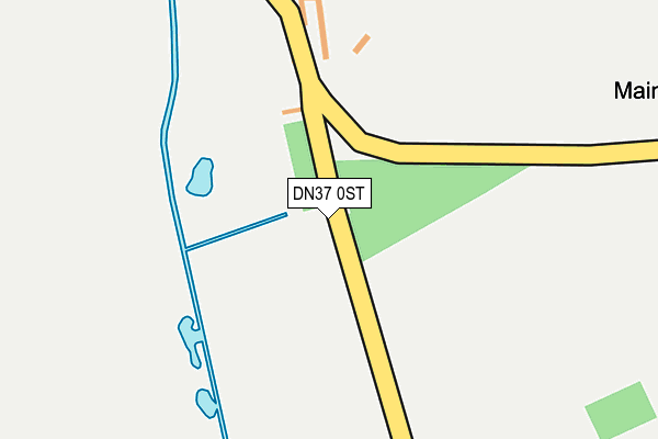
DN37 0ST is located in the Wold View electoral ward, within the local authority district of West Lindsey and the English Parliamentary constituency of Gainsborough. The Sub Integrated Care Board (ICB) Location is NHS Lincolnshire ICB - 71E and the police force is Lincolnshire. This postcode has been in use since January 1980.


GetTheData
Source: OS OpenMap – Local (Ordnance Survey)
Source: OS VectorMap District (Ordnance Survey)
Licence: Open Government Licence (requires attribution)
| Easting | 521084 |
| Northing | 397332 |
| Latitude | 53.458829 |
| Longitude | -0.177789 |
GetTheData
Source: Open Postcode Geo
Licence: Open Government Licence
| Country | England |
| Postcode District | DN37 |
➜ See where DN37 is on a map ➜ Where is Thorganby? | |
GetTheData
Source: Land Registry Price Paid Data
Licence: Open Government Licence
Elevation or altitude of DN37 0ST as distance above sea level:
| Metres | Feet | |
|---|---|---|
| Elevation | 50m | 164ft |
Elevation is measured from the approximate centre of the postcode, to the nearest point on an OS contour line from OS Terrain 50, which has contour spacing of ten vertical metres.
➜ How high above sea level am I? Find the elevation of your current position using your device's GPS.
GetTheData
Source: Open Postcode Elevation
Licence: Open Government Licence
| Ward | Wold View |
| Constituency | Gainsborough |
GetTheData
Source: ONS Postcode Database
Licence: Open Government Licence
| All Saints Church (Swallow Road) | Thorganby | 352m |
| All Saints Church (Swallow Road) | Thorganby | 358m |
| Demand Responsive Area | Thorganby | 388m |
| Demand Responsive Area | Swinhope | 1,267m |
| Kingsmead Caravan Park (Swinhope Road) | Swinhope | 1,450m |
GetTheData
Source: NaPTAN
Licence: Open Government Licence
GetTheData
Source: ONS Postcode Database
Licence: Open Government Licence

➜ Get more ratings from the Food Standards Agency
GetTheData
Source: Food Standards Agency
Licence: FSA terms & conditions
| Last Collection | |||
|---|---|---|---|
| Location | Mon-Fri | Sat | Distance |
| Thorganby | 16:00 | 08:00 | 341m |
| Croxby | 16:15 | 09:00 | 2,259m |
| Wold Newton | 16:00 | 09:45 | 3,319m |
GetTheData
Source: Dracos
Licence: Creative Commons Attribution-ShareAlike
The below table lists the International Territorial Level (ITL) codes (formerly Nomenclature of Territorial Units for Statistics (NUTS) codes) and Local Administrative Units (LAU) codes for DN37 0ST:
| ITL 1 Code | Name |
|---|---|
| TLF | East Midlands (England) |
| ITL 2 Code | Name |
| TLF3 | Lincolnshire |
| ITL 3 Code | Name |
| TLF30 | Lincolnshire CC |
| LAU 1 Code | Name |
| E07000142 | West Lindsey |
GetTheData
Source: ONS Postcode Directory
Licence: Open Government Licence
The below table lists the Census Output Area (OA), Lower Layer Super Output Area (LSOA), and Middle Layer Super Output Area (MSOA) for DN37 0ST:
| Code | Name | |
|---|---|---|
| OA | E00134211 | |
| LSOA | E01026415 | West Lindsey 003E |
| MSOA | E02005494 | West Lindsey 003 |
GetTheData
Source: ONS Postcode Directory
Licence: Open Government Licence
| LN8 6HT | 1044m | |
| LN8 6BS | 1165m | |
| LN8 6EZ | Salisbury Avenue | 1672m |
| LN8 6EY | Chichester Road | 1760m |
| LN8 6HD | Lancaster Road | 1777m |
| LN8 6EX | York Road | 1809m |
| LN8 6HB | Cambridge Crescent | 1838m |
| LN8 6HE | Sussex Close | 1926m |
| LN8 6HF | Brookenby Business Park | 1933m |
| DN37 0SW | Gunnerby Road | 2036m |
GetTheData
Source: Open Postcode Geo; Land Registry Price Paid Data
Licence: Open Government Licence