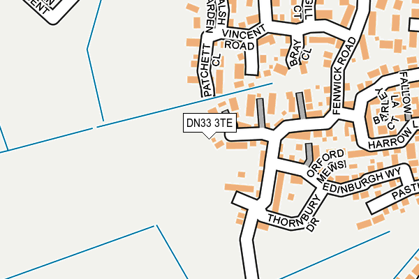
DN33 3TE is located in the Scartho electoral ward, within the unitary authority of North East Lincolnshire and the English Parliamentary constituency of Great Grimsby. The Sub Integrated Care Board (ICB) Location is NHS Humber and North Yorkshire ICB - 03H and the police force is Humberside. This postcode has been in use since August 2021.


GetTheData
Source: OS OpenMap – Local (Ordnance Survey)
Source: OS VectorMap District (Ordnance Survey)
Licence: Open Government Licence (requires attribution)
| Easting | 525606 |
| Northing | 406358 |
| Latitude | 53.538881 |
| Longitude | -0.106115 |
GetTheData
Source: Open Postcode Geo
Licence: Open Government Licence
| Country | England |
| Postcode District | DN33 |
➜ See where DN33 is on a map ➜ Where is Grimsby? | |
GetTheData
Source: Land Registry Price Paid Data
Licence: Open Government Licence
Elevation or altitude of DN33 3TE as distance above sea level:
| Metres | Feet | |
|---|---|---|
| Elevation | 20m | 66ft |
Elevation is measured from the approximate centre of the postcode, to the nearest point on an OS contour line from OS Terrain 50, which has contour spacing of ten vertical metres.
➜ How high above sea level am I? Find the elevation of your current position using your device's GPS.
GetTheData
Source: Open Postcode Elevation
Licence: Open Government Licence
| Ward | Scartho |
| Constituency | Great Grimsby |
GetTheData
Source: ONS Postcode Database
Licence: Open Government Licence
2025 24 JAN £230,000 |
8, RYEDALE WAY, SCARTHO TOP, GRIMSBY, DN33 3TE 2021 29 OCT £227,995 |
7, RYEDALE WAY, SCARTHO TOP, GRIMSBY, DN33 3TE 2021 30 SEP £241,995 |
9, RYEDALE WAY, SCARTHO TOP, GRIMSBY, DN33 3TE 2021 30 SEP £227,995 |
1, RYEDALE WAY, SCARTHO TOP, GRIMSBY, DN33 3TE 2021 17 SEP £239,995 |
2, RYEDALE WAY, SCARTHO TOP, GRIMSBY, DN33 3TE 2021 17 SEP £239,995 |
2021 10 SEP £227,995 |
5, RYEDALE WAY, SCARTHO TOP, GRIMSBY, DN33 3TE 2021 3 SEP £237,495 |
6, RYEDALE WAY, SCARTHO TOP, GRIMSBY, DN33 3TE 2021 3 SEP £239,995 |
4, RYEDALE WAY, SCARTHO TOP, GRIMSBY, DN33 3TE 2021 27 AUG £227,995 |
GetTheData
Source: HM Land Registry Price Paid Data
Licence: Contains HM Land Registry data © Crown copyright and database right 2025. This data is licensed under the Open Government Licence v3.0.
| Wren Crescent (Matthew Telford Park) | Scartho | 543m |
| Well Vale (Springfield Road) | Scartho | 641m |
| Well Vale (Springfield Road) | Scartho | 653m |
| Amcotts Road (Winchester Avenue) | Nunsthorpe | 679m |
| Amcotts Road (Winchester Avenue) | Nunsthorpe | 690m |
| Grimsby Town Station | 3km |
| Great Coates Station | 4.4km |
| Grimsby Docks Station | 4.4km |
GetTheData
Source: NaPTAN
Licence: Open Government Licence
GetTheData
Source: ONS Postcode Database
Licence: Open Government Licence


➜ Get more ratings from the Food Standards Agency
GetTheData
Source: Food Standards Agency
Licence: FSA terms & conditions
| Last Collection | |||
|---|---|---|---|
| Location | Mon-Fri | Sat | Distance |
| Scartho | 16:30 | 12:15 | 512m |
| Springfield Road | 17:00 | 11:00 | 668m |
| The Oval | 16:00 | 11:00 | 683m |
GetTheData
Source: Dracos
Licence: Creative Commons Attribution-ShareAlike
The below table lists the International Territorial Level (ITL) codes (formerly Nomenclature of Territorial Units for Statistics (NUTS) codes) and Local Administrative Units (LAU) codes for DN33 3TE:
| ITL 1 Code | Name |
|---|---|
| TLE | Yorkshire and The Humber |
| ITL 2 Code | Name |
| TLE1 | East Yorkshire and Northern Lincolnshire |
| ITL 3 Code | Name |
| TLE13 | North and North East Lincolnshire |
| LAU 1 Code | Name |
| E06000012 | North East Lincolnshire |
GetTheData
Source: ONS Postcode Directory
Licence: Open Government Licence
The below table lists the Census Output Area (OA), Lower Layer Super Output Area (LSOA), and Middle Layer Super Output Area (MSOA) for DN33 3TE:
| Code | Name | |
|---|---|---|
| OA | E00173595 | |
| LSOA | E01013190 | North East Lincolnshire 021B |
| MSOA | E02002746 | North East Lincolnshire 021 |
GetTheData
Source: ONS Postcode Directory
Licence: Open Government Licence
| DN33 3TD | Sandgate Close | 50m |
| DN33 3TJ | Amberley Close | 84m |
| DN33 3SJ | Fenwick Road | 122m |
| DN33 3TB | Berkeley Court | 142m |
| DN33 3SA | Patchett Close | 143m |
| DN33 3SD | Aldred Gardens | 161m |
| DN33 3TA | Fenwick Court | 164m |
| DN33 3TR | Thornbury Drive | 185m |
| DN33 3TH | Orford Mews | 190m |
| DN33 3TG | Edinburgh Way | 204m |
GetTheData
Source: Open Postcode Geo; Land Registry Price Paid Data
Licence: Open Government Licence