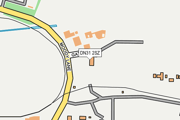
DN31 2SZ is located in the West Marsh electoral ward, within the unitary authority of North East Lincolnshire and the English Parliamentary constituency of Great Grimsby. The Sub Integrated Care Board (ICB) Location is NHS Humber and North Yorkshire ICB - 03H and the police force is Humberside. This postcode has been in use since September 1991.


GetTheData
Source: OS OpenMap – Local (Ordnance Survey)
Source: OS VectorMap District (Ordnance Survey)
Licence: Open Government Licence (requires attribution)
| Easting | 526328 |
| Northing | 410830 |
| Latitude | 53.578857 |
| Longitude | -0.093417 |
GetTheData
Source: Open Postcode Geo
Licence: Open Government Licence
| Country | England |
| Postcode District | DN31 |
➜ See where DN31 is on a map ➜ Where is Grimsby? | |
GetTheData
Source: Land Registry Price Paid Data
Licence: Open Government Licence
Elevation or altitude of DN31 2SZ as distance above sea level:
| Metres | Feet | |
|---|---|---|
| Elevation | 10m | 33ft |
Elevation is measured from the approximate centre of the postcode, to the nearest point on an OS contour line from OS Terrain 50, which has contour spacing of ten vertical metres.
➜ How high above sea level am I? Find the elevation of your current position using your device's GPS.
GetTheData
Source: Open Postcode Elevation
Licence: Open Government Licence
| Ward | West Marsh |
| Constituency | Great Grimsby |
GetTheData
Source: ONS Postcode Database
Licence: Open Government Licence
| Pyewipe Road | West Marsh | 592m |
| Pyewipe Road | West Marsh | 599m |
| Tioxide (Moody Lane) | Pyewipe | 755m |
| Tioxide (Moody Lane) | Pyewipe | 757m |
| Elsenham Road (Stortford Street) | West Marsh | 762m |
| Grimsby Docks Station | 1.3km |
| Grimsby Town Station | 1.8km |
| New Clee Station | 2.2km |
GetTheData
Source: NaPTAN
Licence: Open Government Licence
GetTheData
Source: ONS Postcode Database
Licence: Open Government Licence


➜ Get more ratings from the Food Standards Agency
GetTheData
Source: Food Standards Agency
Licence: FSA terms & conditions
| Last Collection | |||
|---|---|---|---|
| Location | Mon-Fri | Sat | Distance |
| Moody Lane | 17:30 | 10:00 | 307m |
| Gilby Road | 17:30 | 12:00 | 864m |
| Corporation Road | 18:30 | 12:00 | 888m |
GetTheData
Source: Dracos
Licence: Creative Commons Attribution-ShareAlike
| Risk of DN31 2SZ flooding from rivers and sea | Very Low |
| ➜ DN31 2SZ flood map | |
GetTheData
Source: Open Flood Risk by Postcode
Licence: Open Government Licence
The below table lists the International Territorial Level (ITL) codes (formerly Nomenclature of Territorial Units for Statistics (NUTS) codes) and Local Administrative Units (LAU) codes for DN31 2SZ:
| ITL 1 Code | Name |
|---|---|
| TLE | Yorkshire and The Humber |
| ITL 2 Code | Name |
| TLE1 | East Yorkshire and Northern Lincolnshire |
| ITL 3 Code | Name |
| TLE13 | North and North East Lincolnshire |
| LAU 1 Code | Name |
| E06000012 | North East Lincolnshire |
GetTheData
Source: ONS Postcode Directory
Licence: Open Government Licence
The below table lists the Census Output Area (OA), Lower Layer Super Output Area (LSOA), and Middle Layer Super Output Area (MSOA) for DN31 2SZ:
| Code | Name | |
|---|---|---|
| OA | E00066689 | |
| LSOA | E01013221 | North East Lincolnshire 003D |
| MSOA | E02002728 | North East Lincolnshire 003 |
GetTheData
Source: ONS Postcode Directory
Licence: Open Government Licence
| DN31 2SU | West Coates Road | 539m |
| DN31 2SG | Birchin Way | 641m |
| DN31 1SJ | Adam Smith Street | 643m |
| DN31 2QF | Armstrong Place East | 660m |
| DN31 1SQ | Charlton Street | 662m |
| DN31 2QD | Armstrong Street | 695m |
| DN31 2QP | Elsenham Road | 698m |
| DN31 2QR | Elsenham Road | 734m |
| DN31 2QQ | Armstrong Street | 734m |
| DN31 2QW | Pyewipe Bungalows | 752m |
GetTheData
Source: Open Postcode Geo; Land Registry Price Paid Data
Licence: Open Government Licence