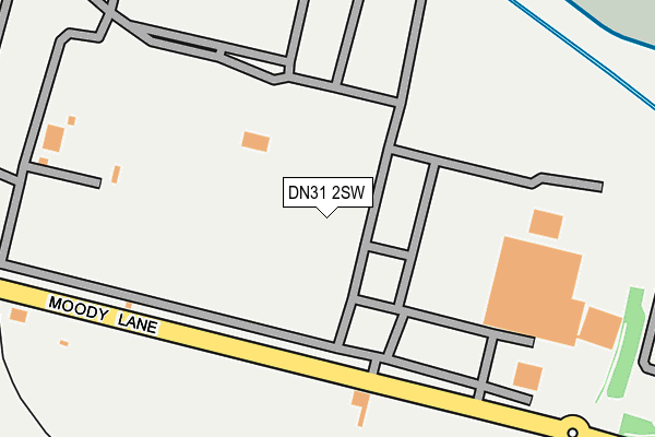
DN31 2SW is located in the Freshney electoral ward, within the unitary authority of North East Lincolnshire and the English Parliamentary constituency of Great Grimsby. The Sub Integrated Care Board (ICB) Location is NHS Humber and North Yorkshire ICB - 03H and the police force is Humberside. This postcode has been in use since January 1980.


GetTheData
Source: OS OpenMap – Local (Ordnance Survey)
Source: OS VectorMap District (Ordnance Survey)
Licence: Open Government Licence (requires attribution)
| Easting | 525651 |
| Northing | 411242 |
| Latitude | 53.582721 |
| Longitude | -0.103471 |
GetTheData
Source: Open Postcode Geo
Licence: Open Government Licence
| Country | England |
| Postcode District | DN31 |
➜ See where DN31 is on a map ➜ Where is Grimsby? | |
GetTheData
Source: Land Registry Price Paid Data
Licence: Open Government Licence
Elevation or altitude of DN31 2SW as distance above sea level:
| Metres | Feet | |
|---|---|---|
| Elevation | 10m | 33ft |
Elevation is measured from the approximate centre of the postcode, to the nearest point on an OS contour line from OS Terrain 50, which has contour spacing of ten vertical metres.
➜ How high above sea level am I? Find the elevation of your current position using your device's GPS.
GetTheData
Source: Open Postcode Elevation
Licence: Open Government Licence
| Ward | Freshney |
| Constituency | Great Grimsby |
GetTheData
Source: ONS Postcode Database
Licence: Open Government Licence
| Tioxide (Moody Lane) | Pyewipe | 127m |
| Tioxide (Moody Lane) | Pyewipe | 142m |
| Moody Lane | Pyewipe | 623m |
| Moody Lane | Pyewipe | 659m |
| Estate Road No 2 (Estate Road No 5) | Pyewipe | 826m |
| Great Coates Station | 1.9km |
| Grimsby Docks Station | 2.1km |
| Grimsby Town Station | 2.4km |
GetTheData
Source: NaPTAN
Licence: Open Government Licence
GetTheData
Source: ONS Postcode Database
Licence: Open Government Licence


➜ Get more ratings from the Food Standards Agency
GetTheData
Source: Food Standards Agency
Licence: FSA terms & conditions
| Last Collection | |||
|---|---|---|---|
| Location | Mon-Fri | Sat | Distance |
| Estate Road 2 Business Box | 17:30 | 787m | |
| South Humberside | 17:30 | 11:15 | 790m |
| Moody Lane | 17:30 | 10:00 | 849m |
GetTheData
Source: Dracos
Licence: Creative Commons Attribution-ShareAlike
| Risk of DN31 2SW flooding from rivers and sea | Low |
| ➜ DN31 2SW flood map | |
GetTheData
Source: Open Flood Risk by Postcode
Licence: Open Government Licence
The below table lists the International Territorial Level (ITL) codes (formerly Nomenclature of Territorial Units for Statistics (NUTS) codes) and Local Administrative Units (LAU) codes for DN31 2SW:
| ITL 1 Code | Name |
|---|---|
| TLE | Yorkshire and The Humber |
| ITL 2 Code | Name |
| TLE1 | East Yorkshire and Northern Lincolnshire |
| ITL 3 Code | Name |
| TLE13 | North and North East Lincolnshire |
| LAU 1 Code | Name |
| E06000012 | North East Lincolnshire |
GetTheData
Source: ONS Postcode Directory
Licence: Open Government Licence
The below table lists the Census Output Area (OA), Lower Layer Super Output Area (LSOA), and Middle Layer Super Output Area (MSOA) for DN31 2SW:
| Code | Name | |
|---|---|---|
| OA | E00066363 | |
| LSOA | E01013146 | North East Lincolnshire 004C |
| MSOA | E02002729 | North East Lincolnshire 004 |
GetTheData
Source: ONS Postcode Directory
Licence: Open Government Licence
| DN31 2FD | Europa Park | 502m |
| DN31 2UW | Venture Business Park | 568m |
| DN31 2SU | West Coates Road | 673m |
| DN31 2TX | Estate Road 5 | 782m |
| DN31 2TB | 825m | |
| DN31 2SG | Birchin Way | 873m |
| DN31 2QU | Clayden Street | 900m |
| DN31 2UA | Haven Gardens | 917m |
| DN31 2QS | Elsenham Road | 945m |
| DN31 2RJ | Cleveland Street | 957m |
GetTheData
Source: Open Postcode Geo; Land Registry Price Paid Data
Licence: Open Government Licence