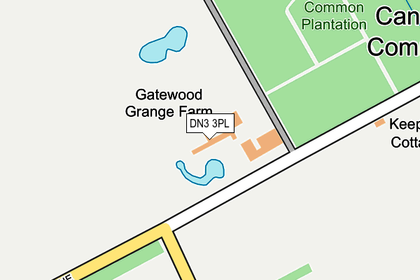
DN3 3PL is located in the Finningley electoral ward, within the metropolitan district of Doncaster and the English Parliamentary constituency of Don Valley. The Sub Integrated Care Board (ICB) Location is NHS South Yorkshire ICB - 02X and the police force is South Yorkshire. This postcode has been in use since January 1980.


GetTheData
Source: OS OpenMap – Local (Ordnance Survey)
Source: OS VectorMap District (Ordnance Survey)
Licence: Open Government Licence (requires attribution)
| Easting | 464195 |
| Northing | 402749 |
| Latitude | 53.517525 |
| Longitude | -1.033313 |
GetTheData
Source: Open Postcode Geo
Licence: Open Government Licence
| Country | England |
| Postcode District | DN3 |
➜ See where DN3 is on a map | |
GetTheData
Source: Land Registry Price Paid Data
Licence: Open Government Licence
Elevation or altitude of DN3 3PL as distance above sea level:
| Metres | Feet | |
|---|---|---|
| Elevation | 10m | 33ft |
Elevation is measured from the approximate centre of the postcode, to the nearest point on an OS contour line from OS Terrain 50, which has contour spacing of ten vertical metres.
➜ How high above sea level am I? Find the elevation of your current position using your device's GPS.
GetTheData
Source: Open Postcode Elevation
Licence: Open Government Licence
| Ward | Finningley |
| Constituency | Don Valley |
GetTheData
Source: ONS Postcode Database
Licence: Open Government Licence
| Whiphill Top Lane (Doncaster Road) | Branton | 1,050m |
| Glen Road (Doncaster Road) | Branton | 1,070m |
| Valley Drive (Moor Gap) | Branton | 1,122m |
| Badgers Holt (Moor Gap) | Branton | 1,167m |
| Spring Gardens (Nutwell Lane) | Cantley | 1,222m |
GetTheData
Source: NaPTAN
Licence: Open Government Licence
| Percentage of properties with Next Generation Access | 100.0% |
| Percentage of properties with Superfast Broadband | 66.7% |
| Percentage of properties with Ultrafast Broadband | 0.0% |
| Percentage of properties with Full Fibre Broadband | 0.0% |
Superfast Broadband is between 30Mbps and 300Mbps
Ultrafast Broadband is > 300Mbps
| Percentage of properties unable to receive 2Mbps | 0.0% |
| Percentage of properties unable to receive 5Mbps | 33.3% |
| Percentage of properties unable to receive 10Mbps | 33.3% |
| Percentage of properties unable to receive 30Mbps | 33.3% |
GetTheData
Source: Ofcom
Licence: Ofcom Terms of Use (requires attribution)
GetTheData
Source: ONS Postcode Database
Licence: Open Government Licence


➜ Get more ratings from the Food Standards Agency
GetTheData
Source: Food Standards Agency
Licence: FSA terms & conditions
| Last Collection | |||
|---|---|---|---|
| Location | Mon-Fri | Sat | Distance |
| Milton Road | 16:15 | 09:30 | 766m |
| Branton Post Office | 16:15 | 11:30 | 1,062m |
| Fairholme View | 16:45 | 08:00 | 1,343m |
GetTheData
Source: Dracos
Licence: Creative Commons Attribution-ShareAlike
The below table lists the International Territorial Level (ITL) codes (formerly Nomenclature of Territorial Units for Statistics (NUTS) codes) and Local Administrative Units (LAU) codes for DN3 3PL:
| ITL 1 Code | Name |
|---|---|
| TLE | Yorkshire and The Humber |
| ITL 2 Code | Name |
| TLE3 | South Yorkshire |
| ITL 3 Code | Name |
| TLE31 | Barnsley, Doncaster and Rotherham |
| LAU 1 Code | Name |
| E08000017 | Doncaster |
GetTheData
Source: ONS Postcode Directory
Licence: Open Government Licence
The below table lists the Census Output Area (OA), Lower Layer Super Output Area (LSOA), and Middle Layer Super Output Area (MSOA) for DN3 3PL:
| Code | Name | |
|---|---|---|
| OA | E00038550 | |
| LSOA | E01007603 | Doncaster 026E |
| MSOA | E02001564 | Doncaster 026 |
GetTheData
Source: ONS Postcode Directory
Licence: Open Government Licence
| DN3 3PJ | Gatewood Lane | 326m |
| DN3 3UL | Bracken Close | 548m |
| DN3 3PQ | Whiphill Top Lane | 548m |
| DN3 3PZ | Beech Drive | 622m |
| DN3 3PF | Kilham Lane | 631m |
| DN3 3QD | Oak Tree Road | 661m |
| DN3 3NY | Kingston Close | 664m |
| DN3 3PE | Wood View | 666m |
| DN3 3PD | Whiphill Top Lane | 694m |
| DN3 3QB | Oak Tree Road | 737m |
GetTheData
Source: Open Postcode Geo; Land Registry Price Paid Data
Licence: Open Government Licence