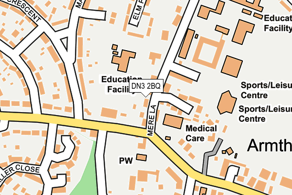
DN3 2BQ is located in the Armthorpe electoral ward, within the metropolitan district of Doncaster and the English Parliamentary constituency of Doncaster Central. The Sub Integrated Care Board (ICB) Location is NHS South Yorkshire ICB - 02X and the police force is South Yorkshire. This postcode has been in use since March 2017.


GetTheData
Source: OS OpenMap – Local (Ordnance Survey)
Source: OS VectorMap District (Ordnance Survey)
Licence: Open Government Licence (requires attribution)
| Easting | 462206 |
| Northing | 405007 |
| Latitude | 53.538057 |
| Longitude | -1.062859 |
GetTheData
Source: Open Postcode Geo
Licence: Open Government Licence
| Country | England |
| Postcode District | DN3 |
➜ See where DN3 is on a map ➜ Where is Armthorpe? | |
GetTheData
Source: Land Registry Price Paid Data
Licence: Open Government Licence
| Ward | Armthorpe |
| Constituency | Doncaster Central |
GetTheData
Source: ONS Postcode Database
Licence: Open Government Licence
| Glebe Farm Close (Mere Lane) | Armthorpe | 43m |
| Mansfield Crescent (Doncaster Road) | Armthorpe | 92m |
| Barton Lane (Church Street) | Armthorpe | 119m |
| Mere Lane (Church Street) | Armthorpe | 126m |
| The Practice (Mere Lane) | Armthorpe | 186m |
| Kirk Sandall Station | 3km |
GetTheData
Source: NaPTAN
Licence: Open Government Licence
| Percentage of properties with Next Generation Access | 100.0% |
| Percentage of properties with Superfast Broadband | 100.0% |
| Percentage of properties with Ultrafast Broadband | 0.0% |
| Percentage of properties with Full Fibre Broadband | 0.0% |
Superfast Broadband is between 30Mbps and 300Mbps
Ultrafast Broadband is > 300Mbps
| Median download speed | 40.0Mbps |
| Average download speed | 52.4Mbps |
| Maximum download speed | 79.98Mbps |
| Median upload speed | 10.0Mbps |
| Average upload speed | 13.3Mbps |
| Maximum upload speed | 20.00Mbps |
| Percentage of properties unable to receive 2Mbps | 0.0% |
| Percentage of properties unable to receive 5Mbps | 0.0% |
| Percentage of properties unable to receive 10Mbps | 0.0% |
| Percentage of properties unable to receive 30Mbps | 0.0% |
GetTheData
Source: Ofcom
Licence: Ofcom Terms of Use (requires attribution)
GetTheData
Source: ONS Postcode Database
Licence: Open Government Licence


➜ Get more ratings from the Food Standards Agency
GetTheData
Source: Food Standards Agency
Licence: FSA terms & conditions
| Last Collection | |||
|---|---|---|---|
| Location | Mon-Fri | Sat | Distance |
| Armthorpe Post Office | 17:00 | 12:15 | 195m |
| Briar Road | 17:00 | 10:00 | 424m |
| Doncaster Road | 17:00 | 09:00 | 441m |
GetTheData
Source: Dracos
Licence: Creative Commons Attribution-ShareAlike
The below table lists the International Territorial Level (ITL) codes (formerly Nomenclature of Territorial Units for Statistics (NUTS) codes) and Local Administrative Units (LAU) codes for DN3 2BQ:
| ITL 1 Code | Name |
|---|---|
| TLE | Yorkshire and The Humber |
| ITL 2 Code | Name |
| TLE3 | South Yorkshire |
| ITL 3 Code | Name |
| TLE31 | Barnsley, Doncaster and Rotherham |
| LAU 1 Code | Name |
| E08000017 | Doncaster |
GetTheData
Source: ONS Postcode Directory
Licence: Open Government Licence
The below table lists the Census Output Area (OA), Lower Layer Super Output Area (LSOA), and Middle Layer Super Output Area (MSOA) for DN3 2BQ:
| Code | Name | |
|---|---|---|
| OA | E00037884 | |
| LSOA | E01007478 | Doncaster 011D |
| MSOA | E02001549 | Doncaster 011 |
GetTheData
Source: ONS Postcode Directory
Licence: Open Government Licence
| DN3 2DD | Glebe Farm Close | 78m |
| DN3 2BG | Mere Lane | 81m |
| DN3 3AN | Church Street | 152m |
| DN3 2BY | Doncaster Road | 166m |
| DN3 2DB | Mere Lane | 198m |
| DN3 2DE | Elm Place | 224m |
| DN3 3AL | Church Street | 243m |
| DN3 2AZ | Markham Avenue | 250m |
| DN3 2AB | Mansfield Crescent | 252m |
| DN3 3AB | Barton Lane | 252m |
GetTheData
Source: Open Postcode Geo; Land Registry Price Paid Data
Licence: Open Government Licence