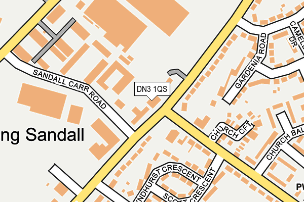
DN3 1QS is located in the Edenthorpe & Kirk Sandall electoral ward, within the metropolitan district of Doncaster and the English Parliamentary constituency of Doncaster Central. The Sub Integrated Care Board (ICB) Location is NHS South Yorkshire ICB - 02X and the police force is South Yorkshire. This postcode has been in use since May 2017.


GetTheData
Source: OS OpenMap – Local (Ordnance Survey)
Source: OS VectorMap District (Ordnance Survey)
Licence: Open Government Licence (requires attribution)
| Easting | 461302 |
| Northing | 407234 |
| Latitude | 53.558177 |
| Longitude | -1.076062 |
GetTheData
Source: Open Postcode Geo
Licence: Open Government Licence
| Country | England |
| Postcode District | DN3 |
➜ See where DN3 is on a map ➜ Where is Kirk Sandall? | |
GetTheData
Source: Land Registry Price Paid Data
Licence: Open Government Licence
| Ward | Edenthorpe & Kirk Sandall |
| Constituency | Doncaster Central |
GetTheData
Source: ONS Postcode Database
Licence: Open Government Licence
| Doncaster Road (Church Balk) | Kirk Sandall | 83m |
| Holly Bush Lane (Church Balk) | Kirk Sandall | 105m |
| Graham Road (Doncaster Road) | Kirk Sandall | 133m |
| Graham Road (Doncaster Road) | Kirk Sandall | 167m |
| Lynton Drive (Doncaster Road) | Kirk Sandall | 178m |
| Kirk Sandall Station | 0.6km |
| Hatfield & Stainforth Station | 4.9km |
| Bentley (S Yorks) Station | 5.2km |
GetTheData
Source: NaPTAN
Licence: Open Government Licence
GetTheData
Source: ONS Postcode Database
Licence: Open Government Licence


➜ Get more ratings from the Food Standards Agency
GetTheData
Source: Food Standards Agency
Licence: FSA terms & conditions
| Last Collection | |||
|---|---|---|---|
| Location | Mon-Fri | Sat | Distance |
| Sunnyside | 16:00 | 09:00 | 170m |
| Kirk Sandall Industrial Estate | 18:15 | 294m | |
| Graham Road | 16:15 | 11:00 | 295m |
GetTheData
Source: Dracos
Licence: Creative Commons Attribution-ShareAlike
| Risk of DN3 1QS flooding from rivers and sea | Low |
| ➜ DN3 1QS flood map | |
GetTheData
Source: Open Flood Risk by Postcode
Licence: Open Government Licence
The below table lists the International Territorial Level (ITL) codes (formerly Nomenclature of Territorial Units for Statistics (NUTS) codes) and Local Administrative Units (LAU) codes for DN3 1QS:
| ITL 1 Code | Name |
|---|---|
| TLE | Yorkshire and The Humber |
| ITL 2 Code | Name |
| TLE3 | South Yorkshire |
| ITL 3 Code | Name |
| TLE31 | Barnsley, Doncaster and Rotherham |
| LAU 1 Code | Name |
| E08000017 | Doncaster |
GetTheData
Source: ONS Postcode Directory
Licence: Open Government Licence
The below table lists the Census Output Area (OA), Lower Layer Super Output Area (LSOA), and Middle Layer Super Output Area (MSOA) for DN3 1QS:
| Code | Name | |
|---|---|---|
| OA | E00038617 | |
| LSOA | E01007624 | Doncaster 007D |
| MSOA | E02001545 | Doncaster 007 |
GetTheData
Source: ONS Postcode Directory
Licence: Open Government Licence
| DN3 1HR | Doncaster Road | 118m |
| DN3 2PU | Lyndhurst Crescent | 136m |
| DN3 2PZ | Doncaster Road | 137m |
| DN3 2PX | Lyndhurst Crescent | 161m |
| DN3 2PA | Church Croft | 175m |
| DN3 1HZ | Gardenia Road | 176m |
| DN3 2PS | Scott Crescent | 204m |
| DN3 2PY | Lyndhurst Crescent | 210m |
| DN3 2PR | Church Balk | 229m |
| DN3 2QB | Sunnyside | 236m |
GetTheData
Source: Open Postcode Geo; Land Registry Price Paid Data
Licence: Open Government Licence