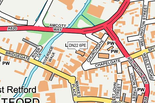
DN22 6PE is located in the East Retford West electoral ward, within the local authority district of Bassetlaw and the English Parliamentary constituency of Bassetlaw. The Sub Integrated Care Board (ICB) Location is NHS Nottingham and Nottinghamshire ICB - 02Q and the police force is Nottinghamshire. This postcode has been in use since January 1980.


GetTheData
Source: OS OpenMap – Local (Ordnance Survey)
Source: OS VectorMap District (Ordnance Survey)
Licence: Open Government Licence (requires attribution)
| Easting | 470548 |
| Northing | 381340 |
| Latitude | 53.324290 |
| Longitude | -0.942299 |
GetTheData
Source: Open Postcode Geo
Licence: Open Government Licence
| Country | England |
| Postcode District | DN22 |
➜ See where DN22 is on a map ➜ Where is Retford? | |
GetTheData
Source: Land Registry Price Paid Data
Licence: Open Government Licence
Elevation or altitude of DN22 6PE as distance above sea level:
| Metres | Feet | |
|---|---|---|
| Elevation | 20m | 66ft |
Elevation is measured from the approximate centre of the postcode, to the nearest point on an OS contour line from OS Terrain 50, which has contour spacing of ten vertical metres.
➜ How high above sea level am I? Find the elevation of your current position using your device's GPS.
GetTheData
Source: Open Postcode Elevation
Licence: Open Government Licence
| Ward | East Retford West |
| Constituency | Bassetlaw |
GetTheData
Source: ONS Postcode Database
Licence: Open Government Licence
| The Square (Market Place) | Retford | 137m |
| The Square (Market Place) | Retford | 154m |
| Bridgegate | Retford | 269m |
| Bridgegate | Retford | 299m |
| Lime Tree Avenue (Hospital Road) | Retford | 438m |
| Retford Station | 1.1km |
| Retford Low Level Station | 1.1km |
GetTheData
Source: NaPTAN
Licence: Open Government Licence
GetTheData
Source: ONS Postcode Database
Licence: Open Government Licence


➜ Get more ratings from the Food Standards Agency
GetTheData
Source: Food Standards Agency
Licence: FSA terms & conditions
| Last Collection | |||
|---|---|---|---|
| Location | Mon-Fri | Sat | Distance |
| Cannon Square | 17:30 | 11:00 | 46m |
| Market Place | 17:30 | 11:00 | 150m |
| Morrisons | 18:15 | 11:30 | 185m |
GetTheData
Source: Dracos
Licence: Creative Commons Attribution-ShareAlike
The below table lists the International Territorial Level (ITL) codes (formerly Nomenclature of Territorial Units for Statistics (NUTS) codes) and Local Administrative Units (LAU) codes for DN22 6PE:
| ITL 1 Code | Name |
|---|---|
| TLF | East Midlands (England) |
| ITL 2 Code | Name |
| TLF1 | Derbyshire and Nottinghamshire |
| ITL 3 Code | Name |
| TLF15 | North Nottinghamshire |
| LAU 1 Code | Name |
| E07000171 | Bassetlaw |
GetTheData
Source: ONS Postcode Directory
Licence: Open Government Licence
The below table lists the Census Output Area (OA), Lower Layer Super Output Area (LSOA), and Middle Layer Super Output Area (MSOA) for DN22 6PE:
| Code | Name | |
|---|---|---|
| OA | E00142771 | |
| LSOA | E01028020 | Bassetlaw 010D |
| MSOA | E02005844 | Bassetlaw 010 |
GetTheData
Source: ONS Postcode Directory
Licence: Open Government Licence
| DN22 6PH | Churchgate | 33m |
| DN22 6PA | Churchgate | 47m |
| DN22 6BH | Bridgegate Place | 82m |
| DN22 6AL | Bridgegate | 92m |
| DN22 6DW | The Square | 97m |
| DN22 6AA | Bridgegate | 107m |
| DN22 6PQ | Churchgate | 113m |
| DN22 6DR | Market Place | 115m |
| DN22 6AE | Bridgegate | 134m |
| DN22 6PJ | Chapelgate | 134m |
GetTheData
Source: Open Postcode Geo; Land Registry Price Paid Data
Licence: Open Government Licence