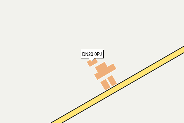
DN20 0PJ is located in the Brigg & Wolds electoral ward, within the unitary authority of North Lincolnshire and the English Parliamentary constituency of Brigg and Goole. The Sub Integrated Care Board (ICB) Location is NHS Humber and North Yorkshire ICB - 03K and the police force is Humberside. This postcode has been in use since March 2009.


GetTheData
Source: OS OpenMap – Local (Ordnance Survey)
Source: OS VectorMap District (Ordnance Survey)
Licence: Open Government Licence (requires attribution)
| Easting | 501497 |
| Northing | 416482 |
| Latitude | 53.635028 |
| Longitude | -0.466460 |
GetTheData
Source: Open Postcode Geo
Licence: Open Government Licence
| Country | England |
| Postcode District | DN20 |
➜ See where DN20 is on a map | |
GetTheData
Source: Land Registry Price Paid Data
Licence: Open Government Licence
Elevation or altitude of DN20 0PJ as distance above sea level:
| Metres | Feet | |
|---|---|---|
| Elevation | 80m | 262ft |
Elevation is measured from the approximate centre of the postcode, to the nearest point on an OS contour line from OS Terrain 50, which has contour spacing of ten vertical metres.
➜ How high above sea level am I? Find the elevation of your current position using your device's GPS.
GetTheData
Source: Open Postcode Elevation
Licence: Open Government Licence
| Ward | Brigg & Wolds |
| Constituency | Brigg And Goole |
GetTheData
Source: ONS Postcode Database
Licence: Open Government Licence
| Carr Lane (Main Street) | Bonby | 1,594m |
| Church Street (Main Street) | Bonby | 1,622m |
| Guildway Close (Main Street) | Bonby | 1,633m |
| Sheepdyke Lane (Main Street) | Bonby | 1,639m |
| Demand Responsive Area | Bonby | 1,749m |
GetTheData
Source: NaPTAN
Licence: Open Government Licence
GetTheData
Source: ONS Postcode Database
Licence: Open Government Licence


➜ Get more ratings from the Food Standards Agency
GetTheData
Source: Food Standards Agency
Licence: FSA terms & conditions
| Last Collection | |||
|---|---|---|---|
| Location | Mon-Fri | Sat | Distance |
| Bonby P.o. | 16:30 | 11:00 | 1,652m |
| Saxby All Saints | 16:30 | 10:30 | 2,441m |
| Worlaby Post Office | 16:30 | 11:00 | 2,687m |
GetTheData
Source: Dracos
Licence: Creative Commons Attribution-ShareAlike
The below table lists the International Territorial Level (ITL) codes (formerly Nomenclature of Territorial Units for Statistics (NUTS) codes) and Local Administrative Units (LAU) codes for DN20 0PJ:
| ITL 1 Code | Name |
|---|---|
| TLE | Yorkshire and The Humber |
| ITL 2 Code | Name |
| TLE1 | East Yorkshire and Northern Lincolnshire |
| ITL 3 Code | Name |
| TLE13 | North and North East Lincolnshire |
| LAU 1 Code | Name |
| E06000013 | North Lincolnshire |
GetTheData
Source: ONS Postcode Directory
Licence: Open Government Licence
The below table lists the Census Output Area (OA), Lower Layer Super Output Area (LSOA), and Middle Layer Super Output Area (MSOA) for DN20 0PJ:
| Code | Name | |
|---|---|---|
| OA | E00066956 | |
| LSOA | E01013267 | North Lincolnshire 011A |
| MSOA | E02002759 | North Lincolnshire 011 |
GetTheData
Source: ONS Postcode Directory
Licence: Open Government Licence
| DN18 6EJ | Brigg Road | 1349m |
| DN20 0PS | Church Lane | 1431m |
| DN20 0QP | Hall Meadow | 1482m |
| DN20 0PQ | Church Close | 1512m |
| DN20 0PR | Sheep Dyke Lane | 1568m |
| DN20 0PU | St Andrews Place | 1581m |
| DN20 0PN | Freemans Lane | 1611m |
| DN20 0PY | Main Street | 1622m |
| DN20 0PW | Main Street | 1630m |
| DN20 0QT | Guildway Close | 1660m |
GetTheData
Source: Open Postcode Geo; Land Registry Price Paid Data
Licence: Open Government Licence