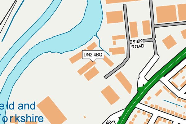
DN2 4BQ is located in the Wheatley Hills & Intake electoral ward, within the metropolitan district of Doncaster and the English Parliamentary constituency of Doncaster Central. The Sub Integrated Care Board (ICB) Location is NHS South Yorkshire ICB - 02X and the police force is South Yorkshire. This postcode has been in use since July 2017.


GetTheData
Source: OS OpenMap – Local (Ordnance Survey)
Source: OS VectorMap District (Ordnance Survey)
Licence: Open Government Licence (requires attribution)
| Easting | 458241 |
| Northing | 404919 |
| Latitude | 53.537720 |
| Longitude | -1.122693 |
GetTheData
Source: Open Postcode Geo
Licence: Open Government Licence
| Country | England |
| Postcode District | DN2 |
➜ See where DN2 is on a map ➜ Where is Doncaster? | |
GetTheData
Source: Land Registry Price Paid Data
Licence: Open Government Licence
| Ward | Wheatley Hills & Intake |
| Constituency | Doncaster Central |
GetTheData
Source: ONS Postcode Database
Licence: Open Government Licence
| Oversley Road (Beckett Road) | Wheatley | 552m |
| Oversley Road (Beckett Road) | Wheatley | 586m |
| Wentworth Road (Beckett Road) | Wheatley | 610m |
| Wentworth Road (Beckett Road) | Wheatley | 630m |
| Canterbury Road (Beckett Road) | Wheatley | 665m |
| Bentley (S Yorks) Station | 2km |
| Doncaster Station | 2.1km |
| Kirk Sandall Station | 4.3km |
GetTheData
Source: NaPTAN
Licence: Open Government Licence
| Median download speed | 76.4Mbps |
| Average download speed | 50.5Mbps |
| Maximum download speed | 80.00Mbps |
| Median upload speed | 18.2Mbps |
| Average upload speed | 11.8Mbps |
| Maximum upload speed | 20.00Mbps |
GetTheData
Source: Ofcom
Licence: Ofcom Terms of Use (requires attribution)
GetTheData
Source: ONS Postcode Database
Licence: Open Government Licence


➜ Get more ratings from the Food Standards Agency
GetTheData
Source: Food Standards Agency
Licence: FSA terms & conditions
| Last Collection | |||
|---|---|---|---|
| Location | Mon-Fri | Sat | Distance |
| Parkside Post Office | 17:30 | 11:30 | 618m |
| Wentworth Road | 17:30 | 11:30 | 625m |
| Cranbrook Road | 18:15 | 11:15 | 688m |
GetTheData
Source: Dracos
Licence: Creative Commons Attribution-ShareAlike
| Risk of DN2 4BQ flooding from rivers and sea | Very Low |
| ➜ DN2 4BQ flood map | |
GetTheData
Source: Open Flood Risk by Postcode
Licence: Open Government Licence
The below table lists the International Territorial Level (ITL) codes (formerly Nomenclature of Territorial Units for Statistics (NUTS) codes) and Local Administrative Units (LAU) codes for DN2 4BQ:
| ITL 1 Code | Name |
|---|---|
| TLE | Yorkshire and The Humber |
| ITL 2 Code | Name |
| TLE3 | South Yorkshire |
| ITL 3 Code | Name |
| TLE31 | Barnsley, Doncaster and Rotherham |
| LAU 1 Code | Name |
| E08000017 | Doncaster |
GetTheData
Source: ONS Postcode Directory
Licence: Open Government Licence
The below table lists the Census Output Area (OA), Lower Layer Super Output Area (LSOA), and Middle Layer Super Output Area (MSOA) for DN2 4BQ:
| Code | Name | |
|---|---|---|
| OA | E00038761 | |
| LSOA | E01007652 | Doncaster 015D |
| MSOA | E02001553 | Doncaster 015 |
GetTheData
Source: ONS Postcode Directory
Licence: Open Government Licence
| DN2 4ES | Harrowden Road | 232m |
| DN2 4ET | Liverpool Avenue | 261m |
| DN2 4LZ | Wheatley Hall Road | 276m |
| DN2 4LY | Wheatley Hall Road | 282m |
| DN2 4ER | Harrowden Road | 286m |
| DN2 4DL | Drake Road | 298m |
| DN2 4DN | Drake Road | 317m |
| DN2 4EU | Lichfield Road | 328m |
| DN2 4DW | Hardy Road | 352m |
| DN2 4LP | Wheatley Hall Road | 366m |
GetTheData
Source: Open Postcode Geo; Land Registry Price Paid Data
Licence: Open Government Licence