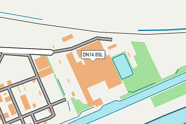
DN14 8SL is located in the Snaith, Airmyn, Rawcliffe and Marshland electoral ward, within the unitary authority of East Riding of Yorkshire and the English Parliamentary constituency of Brigg and Goole. The Sub Integrated Care Board (ICB) Location is NHS Humber and North Yorkshire ICB - 02Y and the police force is Humberside. This postcode has been in use since January 1980.


GetTheData
Source: OS OpenMap – Local (Ordnance Survey)
Source: OS VectorMap District (Ordnance Survey)
Licence: Open Government Licence (requires attribution)
| Easting | 470444 |
| Northing | 421493 |
| Latitude | 53.685153 |
| Longitude | -0.934854 |
GetTheData
Source: Open Postcode Geo
Licence: Open Government Licence
| Country | England |
| Postcode District | DN14 |
➜ See where DN14 is on a map ➜ Where is Rawcliffe Bridge? | |
GetTheData
Source: Land Registry Price Paid Data
Licence: Open Government Licence
Elevation or altitude of DN14 8SL as distance above sea level:
| Metres | Feet | |
|---|---|---|
| Elevation | 10m | 33ft |
Elevation is measured from the approximate centre of the postcode, to the nearest point on an OS contour line from OS Terrain 50, which has contour spacing of ten vertical metres.
➜ How high above sea level am I? Find the elevation of your current position using your device's GPS.
GetTheData
Source: Open Postcode Elevation
Licence: Open Government Licence
| Ward | Snaith, Airmyn, Rawcliffe And Marshland |
| Constituency | Brigg And Goole |
GetTheData
Source: ONS Postcode Database
Licence: Open Government Licence
| Rawcliffe Bridge Lane (Bridge Lane) | Rawcliffe Bridge | 532m |
| Rawcliffe Moor Road (Moor Road) | Rawcliffe Bridge | 612m |
| Rawcliffe Bridge Lane (Bridge Lane) | Rawcliffe Bridge | 625m |
| Rawcliffe Bridge Lane (Bridge Lane) | Rawcliffe Bridge | 659m |
| Rawcliffe Bridge Lane (Bridge Lane) | Rawcliffe Bridge | 981m |
| Rawcliffe Station | 1.8km |
| Goole Station | 4.6km |
GetTheData
Source: NaPTAN
Licence: Open Government Licence
GetTheData
Source: ONS Postcode Database
Licence: Open Government Licence

➜ Get more ratings from the Food Standards Agency
GetTheData
Source: Food Standards Agency
Licence: FSA terms & conditions
| Last Collection | |||
|---|---|---|---|
| Location | Mon-Fri | Sat | Distance |
| Paper Mill Road | 17:15 | 09:15 | 560m |
| Rawcliffe Bridge P.o. | 17:15 | 09:00 | 798m |
| Charter Avenue | 16:30 | 09:15 | 1,972m |
GetTheData
Source: Dracos
Licence: Creative Commons Attribution-ShareAlike
The below table lists the International Territorial Level (ITL) codes (formerly Nomenclature of Territorial Units for Statistics (NUTS) codes) and Local Administrative Units (LAU) codes for DN14 8SL:
| ITL 1 Code | Name |
|---|---|
| TLE | Yorkshire and The Humber |
| ITL 2 Code | Name |
| TLE1 | East Yorkshire and Northern Lincolnshire |
| ITL 3 Code | Name |
| TLE12 | East Riding of Yorkshire |
| LAU 1 Code | Name |
| E06000011 | East Riding of Yorkshire |
GetTheData
Source: ONS Postcode Directory
Licence: Open Government Licence
The below table lists the Census Output Area (OA), Lower Layer Super Output Area (LSOA), and Middle Layer Super Output Area (MSOA) for DN14 8SL:
| Code | Name | |
|---|---|---|
| OA | E00065972 | |
| LSOA | E01013074 | East Riding of Yorkshire 040E |
| MSOA | E02002723 | East Riding of Yorkshire 040 |
GetTheData
Source: ONS Postcode Directory
Licence: Open Government Licence
| DN14 8SN | Paper Mill Road | 388m |
| DN14 8SJ | Paper Mill Road | 427m |
| DN14 8PS | New Cottages | 591m |
| DN14 8RY | Bridge Hill Close | 602m |
| DN14 8PL | Bridge Terrace | 619m |
| DN14 8PQ | Station Road | 674m |
| DN14 8PF | Tornville Crescent | 800m |
| DN14 8PG | Harvest Way | 816m |
| DN14 8NH | Bridge Lane | 816m |
| DN14 8PE | Gossips Wood Road | 841m |
GetTheData
Source: Open Postcode Geo; Land Registry Price Paid Data
Licence: Open Government Licence