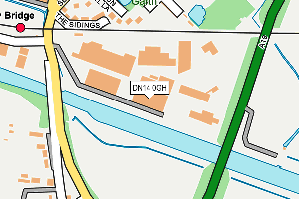
DN14 0GH is located in the Osgoldcross electoral ward, within the unitary authority of North Yorkshire and the English Parliamentary constituency of Selby and Ainsty. The Sub Integrated Care Board (ICB) Location is NHS Humber and North Yorkshire ICB - 03Q and the police force is North Yorkshire. This postcode has been in use since December 1996.


GetTheData
Source: OS OpenMap – Local (Ordnance Survey)
Source: OS VectorMap District (Ordnance Survey)
Licence: Open Government Licence (requires attribution)
| Easting | 455879 |
| Northing | 422706 |
| Latitude | 53.697831 |
| Longitude | -1.155145 |
GetTheData
Source: Open Postcode Geo
Licence: Open Government Licence
| Country | England |
| Postcode District | DN14 |
➜ See where DN14 is on a map ➜ Where is Eggborough? | |
GetTheData
Source: Land Registry Price Paid Data
Licence: Open Government Licence
Elevation or altitude of DN14 0GH as distance above sea level:
| Metres | Feet | |
|---|---|---|
| Elevation | 10m | 33ft |
Elevation is measured from the approximate centre of the postcode, to the nearest point on an OS contour line from OS Terrain 50, which has contour spacing of ten vertical metres.
➜ How high above sea level am I? Find the elevation of your current position using your device's GPS.
GetTheData
Source: Open Postcode Elevation
Licence: Open Government Licence
| Ward | Osgoldcross |
| Constituency | Selby And Ainsty |
GetTheData
Source: ONS Postcode Database
Licence: Open Government Licence
| Templar Close (Low Eggborough Rd) | Whitley Bridge | 219m |
| Templar Close (Low Eggborough Rd) | Whitley Bridge | 231m |
| Cannon Hall Lane (Selby Road) | Whitley Bridge | 268m |
| Jolly Miller (Selby Road) | Whitley Bridge | 276m |
| Graysfield (Selby Road) | Eggborough | 520m |
| Whitley Bridge Station | 0.3km |
| Hensall Station | 2.7km |
GetTheData
Source: NaPTAN
Licence: Open Government Licence
GetTheData
Source: ONS Postcode Database
Licence: Open Government Licence


➜ Get more ratings from the Food Standards Agency
GetTheData
Source: Food Standards Agency
Licence: FSA terms & conditions
| Last Collection | |||
|---|---|---|---|
| Location | Mon-Fri | Sat | Distance |
| Whitley Bridge | 16:45 | 11:00 | 268m |
| Eggborough Post Office | 16:45 | 11:00 | 729m |
| Whitley | 16:00 | 08:00 | 849m |
GetTheData
Source: Dracos
Licence: Creative Commons Attribution-ShareAlike
The below table lists the International Territorial Level (ITL) codes (formerly Nomenclature of Territorial Units for Statistics (NUTS) codes) and Local Administrative Units (LAU) codes for DN14 0GH:
| ITL 1 Code | Name |
|---|---|
| TLE | Yorkshire and The Humber |
| ITL 2 Code | Name |
| TLE2 | North Yorkshire |
| ITL 3 Code | Name |
| TLE22 | North Yorkshire CC |
| LAU 1 Code | Name |
| E07000169 | Selby |
GetTheData
Source: ONS Postcode Directory
Licence: Open Government Licence
The below table lists the Census Output Area (OA), Lower Layer Super Output Area (LSOA), and Middle Layer Super Output Area (MSOA) for DN14 0GH:
| Code | Name | |
|---|---|---|
| OA | E00142080 | |
| LSOA | E01027890 | Selby 010B |
| MSOA | E02005818 | Selby 010 |
GetTheData
Source: ONS Postcode Directory
Licence: Open Government Licence
| DN14 0LE | The Willows | 162m |
| DN14 0LF | Croysdale Terrace | 185m |
| DN14 0US | Cannon Hall Lane | 203m |
| DN14 0UA | Willowdene Garth | 270m |
| DN14 0HJ | Templar Close | 277m |
| DN14 0LD | Selby Road | 325m |
| DN14 0HL | Bernard Villas | 338m |
| DN14 0HN | Milestone Croft | 343m |
| DN14 0HH | The Maltings Industrial Estate | 354m |
| DN14 0LG | Carlton Close | 385m |
GetTheData
Source: Open Postcode Geo; Land Registry Price Paid Data
Licence: Open Government Licence