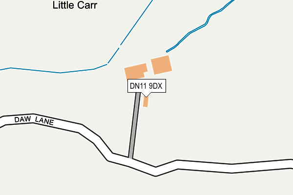
DN11 9DX is located in the Tickhill & Wadsworth electoral ward, within the metropolitan district of Doncaster and the English Parliamentary constituency of Don Valley. The Sub Integrated Care Board (ICB) Location is NHS South Yorkshire ICB - 02X and the police force is South Yorkshire. This postcode has been in use since January 1980.


GetTheData
Source: OS OpenMap – Local (Ordnance Survey)
Source: OS VectorMap District (Ordnance Survey)
Licence: Open Government Licence (requires attribution)
| Easting | 457945 |
| Northing | 397832 |
| Latitude | 53.474059 |
| Longitude | -1.128465 |
GetTheData
Source: Open Postcode Geo
Licence: Open Government Licence
| Country | England |
| Postcode District | DN11 |
➜ See where DN11 is on a map | |
GetTheData
Source: Land Registry Price Paid Data
Licence: Open Government Licence
Elevation or altitude of DN11 9DX as distance above sea level:
| Metres | Feet | |
|---|---|---|
| Elevation | 10m | 33ft |
Elevation is measured from the approximate centre of the postcode, to the nearest point on an OS contour line from OS Terrain 50, which has contour spacing of ten vertical metres.
➜ How high above sea level am I? Find the elevation of your current position using your device's GPS.
GetTheData
Source: Open Postcode Elevation
Licence: Open Government Licence
| Ward | Tickhill & Wadsworth |
| Constituency | Don Valley |
GetTheData
Source: ONS Postcode Database
Licence: Open Government Licence
| Rockcliffe Drive (Wadworth Hill) | Wadworth | 1,039m |
| Rockcliffe Drive (Wadworth Hill) | Wadworth | 1,059m |
| Skipwith Close (Bubup Hill) | Loversall | 1,063m |
| Bubup Hill (Wadworth Hill) | Loversall | 1,183m |
| Ratten Row (Main Street) | Wadworth | 1,190m |
GetTheData
Source: NaPTAN
Licence: Open Government Licence
GetTheData
Source: ONS Postcode Database
Licence: Open Government Licence


➜ Get more ratings from the Food Standards Agency
GetTheData
Source: Food Standards Agency
Licence: FSA terms & conditions
| Last Collection | |||
|---|---|---|---|
| Location | Mon-Fri | Sat | Distance |
| Loversall | 16:15 | 08:45 | 1,156m |
| Wadworth Post Office | 16:15 | 10:45 | 1,221m |
| Tesco Store | 17:30 | 11:30 | 2,003m |
GetTheData
Source: Dracos
Licence: Creative Commons Attribution-ShareAlike
The below table lists the International Territorial Level (ITL) codes (formerly Nomenclature of Territorial Units for Statistics (NUTS) codes) and Local Administrative Units (LAU) codes for DN11 9DX:
| ITL 1 Code | Name |
|---|---|
| TLE | Yorkshire and The Humber |
| ITL 2 Code | Name |
| TLE3 | South Yorkshire |
| ITL 3 Code | Name |
| TLE31 | Barnsley, Doncaster and Rotherham |
| LAU 1 Code | Name |
| E08000017 | Doncaster |
GetTheData
Source: ONS Postcode Directory
Licence: Open Government Licence
The below table lists the Census Output Area (OA), Lower Layer Super Output Area (LSOA), and Middle Layer Super Output Area (MSOA) for DN11 9DX:
| Code | Name | |
|---|---|---|
| OA | E00038608 | |
| LSOA | E01007611 | Doncaster 039A |
| MSOA | E02001577 | Doncaster 039 |
GetTheData
Source: ONS Postcode Directory
Licence: Open Government Licence
| DN11 9DA | Rakes Lane | 810m |
| DN11 9DB | Bubup Hill | 952m |
| DN11 9AT | New Road | 997m |
| DN11 9DD | 1024m | |
| DN11 9BE | Pear Tree Mews | 1048m |
| DN11 9AS | Carr Lane | 1074m |
| DN11 9TB | Beancroft Close | 1076m |
| DN11 9AL | Osberton Street | 1081m |
| DN11 9DE | Hut Yard | 1085m |
| DN11 9BJ | Ratten Row | 1093m |
GetTheData
Source: Open Postcode Geo; Land Registry Price Paid Data
Licence: Open Government Licence