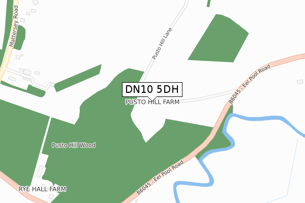
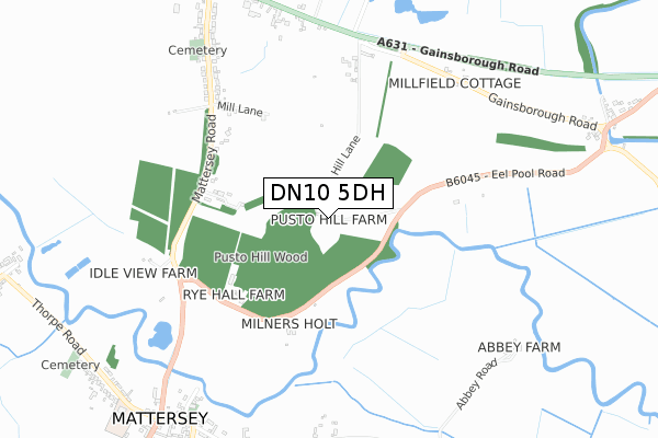
DN10 5DH is located in the Everton electoral ward, within the local authority district of Bassetlaw and the English Parliamentary constituency of Bassetlaw. The Sub Integrated Care Board (ICB) Location is NHS Nottingham and Nottinghamshire ICB - 02Q and the police force is Nottinghamshire. This postcode has been in use since February 2019.


GetTheData
Source: OS Open Zoomstack (Ordnance Survey)
Licence: Open Government Licence (requires attribution)
Attribution: Contains OS data © Crown copyright and database right 2025
Source: Open Postcode Geo
Licence: Open Government Licence (requires attribution)
Attribution: Contains OS data © Crown copyright and database right 2025; Contains Royal Mail data © Royal Mail copyright and database right 2025; Source: Office for National Statistics licensed under the Open Government Licence v.3.0
| Easting | 469583 |
| Northing | 390095 |
| Latitude | 53.403120 |
| Longitude | -0.954862 |
GetTheData
Source: Open Postcode Geo
Licence: Open Government Licence
| Country | England |
| Postcode District | DN10 |
➜ See where DN10 is on a map | |
GetTheData
Source: Land Registry Price Paid Data
Licence: Open Government Licence
| Ward | Everton |
| Constituency | Bassetlaw |
GetTheData
Source: ONS Postcode Database
Licence: Open Government Licence
| Mattersey Road | Mattersey | 955m |
| Mattersey Road | Mattersey | 963m |
| Sun Inn (Mattersey Road) | Everton | 989m |
| Sun Inn (Gainsborough Road) | Everton | 991m |
| Sun Inn (Mattersey Road) | Everton | 997m |
GetTheData
Source: NaPTAN
Licence: Open Government Licence
| Percentage of properties with Next Generation Access | 100.0% |
| Percentage of properties with Superfast Broadband | 100.0% |
| Percentage of properties with Ultrafast Broadband | 0.0% |
| Percentage of properties with Full Fibre Broadband | 0.0% |
Superfast Broadband is between 30Mbps and 300Mbps
Ultrafast Broadband is > 300Mbps
| Percentage of properties unable to receive 2Mbps | 0.0% |
| Percentage of properties unable to receive 5Mbps | 0.0% |
| Percentage of properties unable to receive 10Mbps | 0.0% |
| Percentage of properties unable to receive 30Mbps | 0.0% |
GetTheData
Source: Ofcom
Licence: Ofcom Terms of Use (requires attribution)
GetTheData
Source: ONS Postcode Database
Licence: Open Government Licence


➜ Get more ratings from the Food Standards Agency
GetTheData
Source: Food Standards Agency
Licence: FSA terms & conditions
| Last Collection | |||
|---|---|---|---|
| Location | Mon-Fri | Sat | Distance |
| Mattersey P.o. | 17:15 | 11:00 | 958m |
| Everton Post Office | 17:30 | 11:00 | 1,009m |
| Old Gainsborough Road | 17:00 | 11:00 | 1,051m |
GetTheData
Source: Dracos
Licence: Creative Commons Attribution-ShareAlike
The below table lists the International Territorial Level (ITL) codes (formerly Nomenclature of Territorial Units for Statistics (NUTS) codes) and Local Administrative Units (LAU) codes for DN10 5DH:
| ITL 1 Code | Name |
|---|---|
| TLF | East Midlands (England) |
| ITL 2 Code | Name |
| TLF1 | Derbyshire and Nottinghamshire |
| ITL 3 Code | Name |
| TLF15 | North Nottinghamshire |
| LAU 1 Code | Name |
| E07000171 | Bassetlaw |
GetTheData
Source: ONS Postcode Directory
Licence: Open Government Licence
The below table lists the Census Output Area (OA), Lower Layer Super Output Area (LSOA), and Middle Layer Super Output Area (MSOA) for DN10 5DH:
| Code | Name | |
|---|---|---|
| OA | E00142778 | |
| LSOA | E01028023 | Bassetlaw 003A |
| MSOA | E02005837 | Bassetlaw 003 |
GetTheData
Source: ONS Postcode Directory
Licence: Open Government Licence
| DN10 5DP | Mattersey Road | 502m |
| DN10 5DG | Mill Lane | 554m |
| DN10 5DE | Old Gainsborough Road | 723m |
| DN10 5BN | Mattersey Road | 766m |
| DN10 5BW | Gainsborough Road | 825m |
| DN10 5HN | Abbey Road | 833m |
| DN10 5DU | Church Lane | 878m |
| DN10 5DX | Abbey Road | 907m |
| DN10 5DS | Everton Road | 950m |
| DN10 5DT | Main Street | 988m |
GetTheData
Source: Open Postcode Geo; Land Registry Price Paid Data
Licence: Open Government Licence